Category:London photographs taken on 2007-01-21
Appearance
Ceremonial counties of England: Greater London ·
City-counties:
Former historic counties:
Other former counties:
City-counties:
Former historic counties:
Other former counties:
| Photographs of the previous week | · | Photographs of the previous day | ← | 21 January 2007 | → | Photographs of the next day | · | Photographs of the next week |
| Photographs of the previous year | · | Photographs of the previous month | ← | → | Photographs of the next month | · | Photographs of the next year |
| 14 | · | 15 | · | 16 | · | 17 | · | 18 | · | 19 | · | 20 | · | 21 | · | 22 | · | 23 | · | 24 | · | 25 | · | 26 | · | 27 | · | 28 |
Files or subcategories can be added here using a direct categorization tag. Image files can be categorized here also automatically using {{Taken on}} template.
Subcategories
This category has only the following subcategory.
Media in category "London photographs taken on 2007-01-21"
The following 36 files are in this category, out of 36 total.
-
A regular 'FREE HUGS' dispenser, Speaker's Corner, Hyde Park, London.jpg 1,024 × 769; 738 KB
-
Blackwall tunnel southern portal.jpg 640 × 480; 45 KB
-
Clays Lane industrial estate - geograph.org.uk - 335640.jpg 640 × 480; 86 KB
-
East London Bus garage, Waterden Lane - geograph.org.uk - 336019.jpg 640 × 323; 125 KB
-
Flask Walk - geograph.org.uk - 320998.jpg 640 × 480; 102 KB
-
Grand Union Canal in Uxbridge - geograph.org.uk - 317504.jpg 640 × 480; 114 KB
-
Harlesden High Street NW10 - geograph.org.uk - 317628.jpg 640 × 480; 112 KB
-
Harlesden High Street NW10 - geograph.org.uk - 317643.jpg 640 × 480; 100 KB
-
Harlesden High Street NW10 - geograph.org.uk - 317649.jpg 640 × 480; 106 KB
-
Harlesden High Street NW10 - geograph.org.uk - 317652.jpg 640 × 480; 96 KB
-
Harlesden Mural - geograph.org.uk - 317672.jpg 640 × 480; 118 KB
-
Harlesden Mural - geograph.org.uk - 317680.jpg 640 × 480; 98 KB
-
Harlesden Mural - geograph.org.uk - 317689.jpg 640 × 480; 106 KB
-
Harlesden Recycling - geograph.org.uk - 317697.jpg 640 × 426; 69 KB
-
Norton Folgate almshouses in Puma Court - geograph.org.uk - 320491.jpg 640 × 480; 126 KB
-
Number 17 Princelet Street - geograph.org.uk - 320391.jpg 480 × 640; 109 KB
-
Number 4 Princelet Street - geograph.org.uk - 321625.jpg 640 × 480; 120 KB
-
Nuts and coffee in Spitalfields - geograph.org.uk - 320607.jpg 532 × 640; 114 KB
-
Park Royal Station - geograph.org.uk - 318529.jpg 640 × 480; 101 KB
-
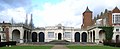
Ruins of Holland House.jpg 3,263 × 1,342; 488 KB
-
Saints and sinners in Spitalfields - geograph.org.uk - 320634.jpg 480 × 640; 99 KB
-
Signs of the times in Fournier Street - geograph.org.uk - 321760.jpg 640 × 406; 66 KB
-
Spitalfields Market Horner Buildings - geograph.org.uk - 320580.jpg 640 × 480; 116 KB
-
Sudbury Town Station - geograph.org.uk - 318554.jpg 640 × 480; 85 KB
-
Sunday morning, Brick Lane - geograph.org.uk - 320366.jpg 640 × 519; 122 KB
-
The Elm Tree NW10 - geograph.org.uk - 317659.jpg 640 × 480; 97 KB
-
The Great London Mosque in Brick Lane - geograph.org.uk - 320559.jpg 480 × 640; 102 KB
-
The last Jewish shop in Brick Lane - geograph.org.uk - 320376.jpg 480 × 640; 119 KB
-
The noted house for paper bags - geograph.org.uk - 320618.jpg 640 × 512; 101 KB
-
The school in Brick Lane - geograph.org.uk - 320480.jpg 640 × 480; 117 KB
-
Woodseer, formerly Pelham, Street - geograph.org.uk - 320384.jpg 640 × 492; 112 KB
