Category:Loralai District
Jump to navigation
Jump to search
district of Balochistan, Pakistan  | |||||
| Upload media | |||||
| Instance of | |||||
|---|---|---|---|---|---|
| Location | Zhob Division, Balochistan, Pakistan | ||||
| Capital |
| ||||
| Area |
| ||||
 | |||||
Loralai District (Urdu:ضلع لورالائی) is a unit part of Pakistan. It is divided into 3 tehsils.
Subcategories
This category has the following 6 subcategories, out of 6 total.
- Loralai District maps (3 F)
C
- Chinjan, Loralai (12 F)
M
- Mughal Qila, Loralai (7 F)
P
- Prehistoric mound, Loralai (3 F)
R
- Rana Ghundai, Loralai (13 F)
S
- Surjangal, Loralai (4 F)
Media in category "Loralai District"
The following 8 files are in this category, out of 8 total.
-
 Farmer in Pakistan.jpg 1,759 × 2,347; 1.54 MB
-
 JZK.jpg 1,277 × 548; 153 KB
-
 Khardazai, Loralai.jpg 4,000 × 3,000; 4.79 MB
-
 Loralai city.jpg 1,000 × 750; 450 KB
-
 N70, Quetta - Multan Highway.jpg 1,080 × 608; 252 KB
-
 Shams azad.jpg 4,896 × 3,672; 5.14 MB
-
 Shoaib rehman.jpg 4,896 × 3,672; 3.94 MB
-
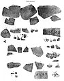 Tor Dherai inscribed potsherds of Yolamira.jpg 1,346 × 1,708; 1.1 MB


