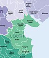
Category:Louth, County Louth
Перейти к навигации
Перейти к поиску
English: Louth Village lies in the heart of County Louth, Ireland, roughly 8 km south-west of the town of Dundalk.
human settlement  | |||||
| Медиафайл | |||||
| Это частный случай понятия | |||||
|---|---|---|---|---|---|
| Местонахождение | Лаут, Ленстер, Ирландия | ||||
| Высота над уровнем моря |
| ||||
 | |||||
Подкатегории
В этой категории отображается 2 подкатегории из имеющихся 2.
M
- St. Mary's Priory, Louth (5 Ф)
S
- St. Mochta's House (2 Ф)
Файлы в категории «Louth, County Louth»
Показано 73 файла из 73, находящихся в данной категории.
-
-
 Ardee Municipal.District.png 764 × 681; 141 КБ
-
 Bend in the L1170 - geograph.org.uk - 5084614.jpg 2669 × 1998; 3,36 МБ
-
 Beyond the glass ceiling at Townley Hall Georgian mansion.jpg 3216 × 2136; 3,24 МБ
-
 BOYNE Battle Site - panoramio - Pastor Sam.jpg 1600 × 1200; 575 КБ
-
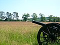 BOYNE Battle Site - panoramio.jpg 1600 × 1200; 874 КБ
-
 BOYNE River-site of Battle - panoramio.jpg 1600 × 1200; 1018 КБ
-
 BOYNE Valley Oldbridge House-Visitors Centre. - panoramio.jpg 1329 × 872; 269 КБ
-
 BOYNE visitors Centre - panoramio.jpg 1600 × 1200; 845 КБ
-
 BOYNE Visitors Centre- Oldbridge House - panoramio.jpg 808 × 468; 177 КБ
-
 Castle Roche Louth.jpg 12 500 × 8500; 69,23 МБ
-
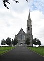 Church of the Immaculate Conception, Louth Village - geograph.org.uk - 5080018.jpg 1907 × 2598; 1,97 МБ
-
 Cottage at the southern end of Commons Road, Solmas - geograph.org.uk - 5079486.jpg 4000 × 3000; 4,51 МБ
-
County Louth, Ireland- Check in with Vice President Biden.webm 3 м 6 с, 1920 × 1080; 69,47 МБ
-
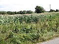
 Cropland on the south side of the L1170 - geograph.org.uk - 5084620.jpg 4000 × 3000; 4,69 МБ
-
 Detached houses facing the L1170 at Ballyland - geograph.org.uk - 5084603.jpg 3000 × 4000; 3,7 МБ
-
 Disused homestead on Green Lane - geograph.org.uk - 5080997.jpg 4000 × 3000; 4,43 МБ
-
 Draghanstown sunset. (Unsplash).jpg 6720 × 4480; 19,2 МБ
-
 Drumlins south-southeast of Ardpatrick - geograph.org.uk - 5082126.jpg 1998 × 2669; 3,58 МБ
-
 Dundalk Municipal.District.png 842 × 587; 445 КБ
-
 Eamo's Bar An Coimín, Louth Village - geograph.org.uk - 5080266.jpg 3780 × 1998; 3,79 МБ
-
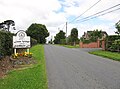 Entering Louth Village along the L1170 - geograph.org.uk - 5072025.jpg 3948 × 2930; 5,51 МБ
-
 Farm buildings on Green Road, Louth Village - geograph.org.uk - 5079530.jpg 1780 × 1333; 1,53 МБ
-
 Farm outbuildings on the R171 - geograph.org.uk - 5080414.jpg 2856 × 1995; 2,47 МБ
-
 Ferran Drive, Louth Village - geograph.org.uk - 5080261.jpg 3155 × 1998; 4,63 МБ
-
 Fields of grain crops in a drumlin landscape - geograph.org.uk - 5079520.jpg 2669 × 1998; 2,35 МБ
-
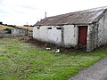 Former homestead byre on Green Lane - geograph.org.uk - 5080988.jpg 4000 × 3000; 3,93 МБ
-
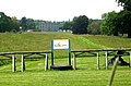
 Fr Finn Park. Louth Village - geograph.org.uk - 5080927.jpg 4000 × 3000; 3,16 МБ
-
 Free to View Telescope ^ Bird Information Point - panoramio.jpg 2560 × 1920; 2,45 МБ
-

-
 Green Lane approaching Fr Finn Park - geograph.org.uk - 5080974.jpg 4000 × 3000; 3,24 МБ
-
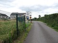
 Green lane linking Ardpatrick church with the L1170 - geograph.org.uk - 5082114.jpg 4000 × 3000; 2,73 МБ
-
 Harvested grain field at Ardpatrick - geograph.org.uk - 5082120.jpg 4000 × 3000; 3,55 МБ
-

-

-
 Houses in Fr Finn Park, Louth Village - geograph.org.uk - 5080930.jpg 4000 × 3000; 3,35 МБ
-
 Houses on the Ballyoran Road - geograph.org.uk - 5080427.jpg 2618 × 1998; 3,07 МБ
-
 Immaculate Conception Louth.jpg 640 × 480; 73 КБ
-

-
 IrelandBaronies1899Map (Louth).jpg 517 × 611; 60 КБ
-
 Louth Foodstore at the centre of Louth Village - geograph.org.uk - 5082681.jpg 3005 × 1999; 3,08 МБ
-
 Mullavalley Court off the L1170 at Louth Village - geograph.org.uk - 5082675.jpg 2670 × 1999; 3,73 МБ
-
 No windmill at Chanonrock - geograph.org.uk - 1772313.jpg 640 × 480; 84 КБ
-
 Pasture land north of the R171 - geograph.org.uk - 5080383.jpg 1949 × 2629; 2,04 МБ
-

-
 Raymond Bird, Commons Road, Louth Village - geograph.org.uk - 5079493.jpg 4000 × 1998; 4,73 МБ
-
 St Mary's Priory, Louth Village - geograph.org.uk - 5080340.jpg 2212 × 1333; 1,96 МБ
-

-
 The altar at the ruined Ardpatrick church - geograph.org.uk - 5082100.jpg 4000 × 3000; 4,75 МБ
-
 The Ballyoran Road, Louth - geograph.org.uk - 5080393.jpg 2670 × 2202; 3,02 МБ
-
 The blocked off entry to Commons Road - geograph.org.uk - 5079479.jpg 3217 × 1999; 3,58 МБ
-

-
 The Hill, Mullacrew - geograph.org.uk - 718132.jpg 640 × 480; 78 КБ
-
 The junction of Commons Road and Green Road - geograph.org.uk - 5079501.jpg 4000 × 3000; 3,22 МБ
-
 The L1170 east of Ardpatrick - geograph.org.uk - 5084611.jpg 4000 × 3000; 3,93 МБ
-
 The Louth Village branch of the Louth Credit Union - geograph.org.uk - 5079571.jpg 3629 × 1954; 4,05 МБ
-

-
 The Ploughman's Inn, Louth Village - geograph.org.uk - 5071399.jpg 3526 × 2013; 3,26 МБ
-
 The R171 in the centre of Louth Village - geograph.org.uk - 5082677.jpg 2670 × 1998; 2,75 МБ
-

-
 The ruined Louth Priory, Louth Village - geograph.org.uk - 5080290.jpg 3318 × 2185; 4,13 МБ
-
 The ruins of Ardpatrick Church - geograph.org.uk - 5082080.jpg 4000 × 3000; 5,45 МБ
-

-
 Traditional long house on Green Lane - geograph.org.uk - 5080979.jpg 4000 × 3000; 3,31 МБ
-
 View north along Green Lane - geograph.org.uk - 5080994.jpg 4000 × 3000; 4,03 МБ
-
 View north from Ardpatrick across the L1170 - geograph.org.uk - 5082136.jpg 4000 × 3000; 3,86 МБ
-
-

-
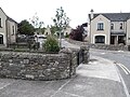
 Village Square at Louth Village - geograph.org.uk - 5080331.jpg 4000 × 3000; 3,12 МБ
-

-
 Widok z Omeath - panoramio - Marcin Skiba.jpg 1549 × 871; 268 КБ
-
 Widok z Omeath - panoramio.jpg 1549 × 871; 258 КБ
-
 Wild flowers on the northern verge of the L1170 - geograph.org.uk - 5084597.jpg 2611 × 1922; 3,27 МБ


.jpg)


.jpg)


_road_-_geograph.org.uk_-_5072253.jpg)


