Category:Lower Caversham
Jump to navigation
Jump to search
village in Berkshire, United Kingdom  | |||||
| Upload media | |||||
| Instance of | |||||
|---|---|---|---|---|---|
| Location | Reading, Berkshire, South East England, England | ||||
 | |||||
English: Lower Caversham is an area of the former town of Caversham, which today is itself a suburb of the larger town of Reading, in the English county of Berkshire. Lower Caversham has no formal boundaries, but the name usually refers to that part of Caversham situated on lower ground to the east of central Caversham, close to the River Thames.
Subcategories
This category has the following 12 subcategories, out of 12 total.
B
C
- Christchurch Bridge (9 F)
D
- De Bohun Island, Caversham (2 F)
H
- Heron Island, Caversham (2 F)
- Hills Meadow (10 F)
L
- Lock Island, Caversham (2 F)
R
- Reading Bridge (30 F)
T
- The Red Cow, Caversham (3 F)
V
Media in category "Lower Caversham"
The following 125 files are in this category, out of 125 total.
-
 'Thames Path' at Reading Bridge - geograph.org.uk - 3438331.jpg 480 × 640; 92 KB
-
 An old bus shelter in Henley Road - geograph.org.uk - 3836021.jpg 640 × 427; 338 KB
-
 Apartments at King's Meadow, Reading - geograph.org.uk - 4107407.jpg 800 × 450; 87 KB
-
 Autumn trees on Nire Road - geograph.org.uk - 5976162.jpg 1,024 × 683; 279 KB
-
 Backwater, Lower Caversham - geograph.org.uk - 3759064.jpg 1,600 × 1,201; 914 KB
-
 Benchmark on New Bridge Nursery School - geograph.org.uk - 5976652.jpg 1,024 × 677; 229 KB
-

-

-
 Benchmark on ^96 South View - geograph.org.uk - 5976680.jpg 683 × 1,024; 249 KB
-
 Better Boating Co yard at Mill Green - geograph.org.uk - 3566369.jpg 1,024 × 679; 203 KB
-
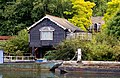 Boathouse on the Thames - geograph.org.uk - 2127253.jpg 1,500 × 981; 364 KB
-
 Boats moored on the Thames - geograph.org.uk - 307355.jpg 640 × 480; 86 KB
-

-
 Caversham Lock - geograph.org.uk - 2127246.jpg 1,500 × 1,000; 297 KB
-
 Caversham Lock - geograph.org.uk - 2127247.jpg 1,500 × 1,000; 284 KB
-
 Caversham Lock - geograph.org.uk - 2127249.jpg 1,500 × 996; 237 KB
-
 Caversham Lock - geograph.org.uk - 2127251.jpg 1,500 × 1,000; 213 KB
-
 Caversham Lock - geograph.org.uk - 2511061.jpg 1,024 × 680; 235 KB
-
 Caversham Lock and weir - geograph.org.uk - 2127245.jpg 1,500 × 1,000; 269 KB
-
 Caversham Lock and Weir - geograph.org.uk - 2511066.jpg 1,024 × 680; 165 KB
-

-
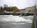
 Caversham Weir - geograph.org.uk - 2511431.jpg 1,024 × 680; 206 KB
-
 Caversham Weir - geograph.org.uk - 3264847.jpg 640 × 480; 275 KB
-
 Caversham weir and lock - geograph.org.uk - 1110602.jpg 640 × 480; 74 KB
-
 CavershamLockReach01.JPG 1,919 × 1,404; 1.08 MB
-
 Christchurch Meadows - geograph.org.uk - 3997381.jpg 1,280 × 851; 342 KB
-

-
 Coldicutt Road, Caversham - geograph.org.uk - 2345273.jpg 640 × 458; 95 KB
-
 Decathlon - geograph.org.uk - 3914584.jpg 640 × 356; 44 KB
-
 Entrance to sports ground from Thames tow path - geograph.org.uk - 5976967.jpg 1,024 × 683; 341 KB
-
 Footpath goes north from Henley Road - geograph.org.uk - 3590752.jpg 600 × 800; 180 KB
-
 Geese on King's Meadow, Reading - geograph.org.uk - 4753311.jpg 640 × 480; 116 KB
-
 George Close, Caversham - geograph.org.uk - 3699023.jpg 1,600 × 1,200; 653 KB
-
 Gosbrook Road, Lower Caversham - geograph.org.uk - 3759078.jpg 1,600 × 1,116; 325 KB
-
 Hawker House - geograph.org.uk - 3954381.jpg 640 × 430; 69 KB
-
 Henley Rd (A4155) - geograph.org.uk - 3679287.jpg 640 × 430; 46 KB
-
 Houses on Henley Road, Caversham - geograph.org.uk - 4460858.jpg 2,560 × 1,920; 1.33 MB
-
 Houses on Heron Island - geograph.org.uk - 3568994.jpg 640 × 424; 124 KB
-
-
 Ian Mikardo Way - geograph.org.uk - 4893783.jpg 3,325 × 2,993; 2.22 MB
-

-
 Junction of South View and St John's Road - geograph.org.uk - 5976597.jpg 1,024 × 683; 253 KB
-
 Junction of St John's Road and South View Avenue - geograph.org.uk - 3931245.jpg 1,024 × 683; 248 KB
-

-
 Junction on Henley Road - geograph.org.uk - 2345313.jpg 640 × 480; 77 KB
-
 King's Meadow - geograph.org.uk - 3954386.jpg 640 × 430; 84 KB
-
 King's Meadow - geograph.org.uk - 4673300.jpg 640 × 426; 69 KB
-
 King's Meadow - geograph.org.uk - 4897375.jpg 640 × 426; 67 KB
-
 King's Meadow - geograph.org.uk - 5171086.jpg 3,264 × 2,448; 2.21 MB
-
 King's Meadow - geograph.org.uk - 5374601.jpg 640 × 426; 78 KB
-
 King's Meadow, Reading, 1966 - geograph.org.uk - 3299780.jpg 640 × 347; 40 KB
-
 Kings Meadow - geograph.org.uk - 5201361.jpg 640 × 426; 63 KB
-
 Lock Keeper's House, Caversham Lock - geograph.org.uk - 3264819.jpg 640 × 480; 295 KB
-
 Lock-keepers cabin at Caversham Lock - geograph.org.uk - 2127248.jpg 1,500 × 976; 322 KB
-

-
 Looking into Rossendale Road - geograph.org.uk - 3590739.jpg 800 × 600; 117 KB
-
-
 Looking upstream towards Reading Bridge - geograph.org.uk - 2125838.jpg 1,500 × 992; 192 KB
-
 Lower Henley Road - geograph.org.uk - 2818869.jpg 3,648 × 2,663; 1.33 MB
-
 Lucinia View, Reading - geograph.org.uk - 2862562.jpg 4,288 × 3,216; 4.91 MB
-
 Managua Close, Lower Caversham - geograph.org.uk - 4893707.jpg 3,680 × 2,422; 2 MB
-
 McDonald's, Forbury Retail Park - geograph.org.uk - 2862645.jpg 4,288 × 3,216; 5.71 MB
-
 Moorings at Mill Green - geograph.org.uk - 3569005.jpg 640 × 424; 105 KB
-
 Moorings on the weir stream - geograph.org.uk - 2125831.jpg 1,500 × 995; 232 KB
-
 New Bridge Nursery School, Montague Street - geograph.org.uk - 3946162.jpg 1,024 × 683; 227 KB
-
 New Bridge Nursery School, Montague Street - geograph.org.uk - 5976662.jpg 1,024 × 661; 194 KB
-
 New riverside houses in Lower Caversham - geograph.org.uk - 4442188.jpg 2,592 × 1,944; 1.82 MB
-
 Nos. 96 and 98 South View - geograph.org.uk - 5976698.jpg 1,024 × 748; 200 KB
-
 Path from Gosbrook Road to Westfield Rec - geograph.org.uk - 2693025.jpg 480 × 640; 126 KB
-
 Path from Hill's Meadow - geograph.org.uk - 2345259.jpg 640 × 480; 87 KB
-

-
 Petrol station, Henley Road - geograph.org.uk - 2345379.jpg 640 × 429; 55 KB
-
 Playground, Amersham Road - geograph.org.uk - 4893661.jpg 4,000 × 3,000; 2.34 MB
-
 Pleasure boat on the Thames - geograph.org.uk - 2125815.jpg 1,500 × 986; 236 KB
-

-
 Queen's Road, Caversham - geograph.org.uk - 2345269.jpg 640 × 469; 60 KB
-
 Rain gauges at Caversham Lock - geograph.org.uk - 3264834.jpg 640 × 480; 342 KB
-
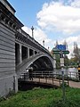
 Reading Bridge - geograph.org.uk - 2510560.jpg 1,024 × 680; 173 KB
-
 Reading Bridge - geograph.org.uk - 3997892.jpg 1,280 × 851; 307 KB
-
 Reading Bridge - geograph.org.uk - 3997909.jpg 851 × 1,280; 252 KB
-
 Reading Bridge - geograph.org.uk - 5264512.jpg 800 × 531; 109 KB
-
 Reading Bridge and River Thames - geograph.org.uk - 2510573.jpg 680 × 1,024; 230 KB
-
 River Thames - geograph.org.uk - 2203154.jpg 640 × 480; 73 KB
-
 River Thames by Heron Island - geograph.org.uk - 3568999.jpg 640 × 424; 120 KB
-
 River Thames from Reading Bridge - geograph.org.uk - 2344894.jpg 640 × 452; 57 KB
-
 River Thames, Reading - geograph.org.uk - 3998506.jpg 1,280 × 851; 395 KB
-
 Riverside, Lower Caversham - geograph.org.uk - 2344907.jpg 640 × 480; 82 KB
-
 Semi-detached houses on South View Avenue - geograph.org.uk - 3931167.jpg 1,024 × 814; 235 KB
-
 Shops on Henley Road, Caversham - geograph.org.uk - 4458640.jpg 2,560 × 1,920; 1.98 MB
-
 Speed bump in Washington Road - geograph.org.uk - 2692098.jpg 640 × 480; 55 KB
-
 St John the Baptist Church - geograph.org.uk - 2818868.jpg 2,923 × 2,444; 1.09 MB
-
 St John the Baptist Church, Gosbrook Road - geograph.org.uk - 3931258.jpg 1,024 × 683; 202 KB
-
 Staples, Reading - geograph.org.uk - 3914586.jpg 640 × 367; 48 KB
-
 Striking riverside house, Caversham - geograph.org.uk - 5907064.jpg 3,323 × 2,209; 2.34 MB
-
 Tesco Extra, King's Meadow - geograph.org.uk - 3954387.jpg 640 × 430; 78 KB
-
 Tesco Extra, King's Meadow - geograph.org.uk - 4673302.jpg 640 × 426; 61 KB
-
 Tesco King's Meadow, Reading - geograph.org.uk - 2862539.jpg 4,288 × 3,216; 4.39 MB
-
 Tesco King's Meadow, Reading - geograph.org.uk - 2862545.jpg 4,288 × 3,216; 4.75 MB
-
 Thames at Reading Bridge - geograph.org.uk - 2275238.jpg 640 × 469; 65 KB
-
 Thames backwater in Reading - geograph.org.uk - 2125830.jpg 1,500 × 1,000; 315 KB
-
 Thames Court - geograph.org.uk - 2174065.jpg 1,600 × 1,200; 428 KB
-
 Thames Path - King's Meadow - geograph.org.uk - 3569003.jpg 640 × 424; 155 KB
-
 The cut above Caversham Lock - geograph.org.uk - 2127250.jpg 1,500 × 1,000; 281 KB
-
 The Edge of Town - geograph.org.uk - 4893753.jpg 4,000 × 3,000; 3.06 MB
-
 The footpath along View Island - geograph.org.uk - 2127252.jpg 1,000 × 1,500; 332 KB
-

-
 The River Thames and Reading Bridge - geograph.org.uk - 5264511.jpg 800 × 531; 103 KB
-
 The River Thames at Caversham Lock - geograph.org.uk - 3295143.jpg 640 × 480; 55 KB
-
 The River Thames by Caversham Lock - geograph.org.uk - 2125836.jpg 1,500 × 988; 199 KB
-
 The Thames at Reading - geograph.org.uk - 2125821.jpg 1,500 × 986; 267 KB
-
 The Thames below Caversham Lock - geograph.org.uk - 2127244.jpg 1,500 × 989; 231 KB
-
 The Thames by King's Meadow - geograph.org.uk - 3569014.jpg 640 × 424; 131 KB
-
 The Travellers Rest - geograph.org.uk - 2818870.jpg 2,339 × 1,778; 912 KB
-
 The weir at Caversham Lock - geograph.org.uk - 2125839.jpg 1,500 × 1,000; 228 KB
-
 The weir at Caversham Lock - geograph.org.uk - 2125841.jpg 1,500 × 982; 288 KB
-
 Traffic lights in Gosbrook Road - geograph.org.uk - 2692112.jpg 640 × 480; 62 KB
-

-
 Trees in King's Meadow - geograph.org.uk - 2862638.jpg 4,288 × 3,216; 6.02 MB
-
 Under Reading Bridge - geograph.org.uk - 3997870.jpg 851 × 1,280; 223 KB
-
 View across The Thames - geograph.org.uk - 3569011.jpg 640 × 424; 135 KB
-
 View across The Thames - geograph.org.uk - 3569015.jpg 640 × 424; 126 KB
-
 West face of St John the Baptist's Church - geograph.org.uk - 5976638.jpg 628 × 1,024; 187 KB
-
 Wooden carving on View Island - geograph.org.uk - 2125832.jpg 1,500 × 1,000; 331 KB
-
 ^230 Gosbrook Road at Washington Road junction - geograph.org.uk - 3947098.jpg 1,024 × 683; 173 KB
-
 ^53 South View Avenue - geograph.org.uk - 3931067.jpg 683 × 1,024; 176 KB


_-_geograph.org.uk_-_3679287.jpg)


