Category:Reading, Berkshire
Jump to navigation
Jump to search


historic market town in Berkshire, England  | |||||
| Upload media | |||||
| Instance of | |||||
|---|---|---|---|---|---|
| Location |
| ||||
| Located in or next to body of water | |||||
| Official language | |||||
| Inception |
| ||||
| Significant event |
| ||||
| Population |
| ||||
| Area |
| ||||
| Elevation above sea level |
| ||||
| Different from | |||||
| official website | |||||
 | |||||
 | |||||


English: Images relating to the town of Reading, in Berkshire, England. For more information, see the Wikipedia article on Reading, Berkshire.
Deutsch: Bilder über die Stadt Reading, in Berkshire, England. Weitere Informationen finden Sie in der Wikipedia-Artikel über die Reading, Berkshire.
Français : Des images relatives à la ville de Reading, dans le Berkshire, Angleterre. Pour plus d'informations, voir l'article Wikipedia sur le Reading, Berkshire.
Subcategories
This category has the following 20 subcategories, out of 20 total.
Pages in category "Reading, Berkshire"
This category contains only the following page.
Media in category "Reading, Berkshire"
The following 200 files are in this category, out of 957 total.
(previous page) (next page)-
 118 Oxford Road, Reading - geograph.org.uk - 3406292.jpg 640 × 480; 163 KB
-
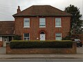 25, Church Road.jpg 2,661 × 1,995; 1.64 MB
-
 2lb of stewing steak please - geograph.org.uk - 3851719.jpg 3,264 × 4,264; 3.52 MB
-
 A rapidly changing view - geograph.org.uk - 3787711.jpg 1,024 × 729; 214 KB
-

-
 A sunny morning in Reading - geograph.org.uk - 2802221.jpg 1,024 × 768; 176 KB
-
 A.F. Jones, Stone ^ Marble Masons - geograph.org.uk - 3498020.jpg 4,320 × 3,240; 2.27 MB
-
 A329 - geograph.org.uk - 4897345.jpg 640 × 426; 64 KB
-
 A329 - geograph.org.uk - 5196789.jpg 640 × 426; 62 KB
-
 A329 - geograph.org.uk - 5922041.jpg 1,024 × 681; 131 KB
-
 A329 passes The Pond House - geograph.org.uk - 3506130.jpg 2,792 × 2,527; 1.03 MB
-
 A329 passes The Roebuck - geograph.org.uk - 3506088.jpg 3,318 × 2,579; 1.35 MB
-
 A329, Oxford Rd - geograph.org.uk - 3914661.jpg 640 × 392; 85 KB
-
 A329, Reading - geograph.org.uk - 5383419.jpg 640 × 426; 64 KB
-
 A329, Reading - geograph.org.uk - 5458123.jpg 640 × 372; 45 KB
-
 A33 - geograph.org.uk - 3668625.jpg 640 × 430; 53 KB
-
 Access Self Storage on Wigmore Lane, Norcot - geograph.org.uk - 5065548.jpg 2,048 × 1,536; 1.5 MB
-
 Across the gantries - geograph.org.uk - 4177443.jpg 1,600 × 1,200; 429 KB
-
 Across the Lock - geograph.org.uk - 3859924.jpg 1,024 × 768; 218 KB
-
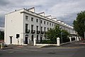
-

-
 All fenced off - geograph.org.uk - 3248957.jpg 1,024 × 768; 161 KB
-
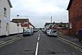 Alma St - geograph.org.uk - 3668187.jpg 640 × 430; 56 KB
-
 Along by the Wall - geograph.org.uk - 5318635.jpg 1,024 × 683; 204 KB
-
 Along County Lock - geograph.org.uk - 3860154.jpg 1,024 × 768; 188 KB
-
 Alternative route, River Kennet, Reading - geograph.org.uk - 4753608.jpg 640 × 480; 135 KB
-
 Always worth a visit - geograph.org.uk - 3628758.jpg 480 × 640; 91 KB
-
 American Nails - geograph.org.uk - 5304602.jpg 1,024 × 683; 165 KB
-
 An Art Nouveau 8 - geograph.org.uk - 4797173.jpg 1,532 × 2,052; 774 KB
-
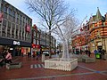 An hour later - geograph.org.uk - 3863187.jpg 1,600 × 1,200; 547 KB
-
 And here is the Target - geograph.org.uk - 5291436.jpg 533 × 800; 99 KB
-
 And that is the weir - geograph.org.uk - 3277446.jpg 1,024 × 768; 170 KB
-

-
 Another bit of Art ^^ - geograph.org.uk - 5326514.jpg 600 × 800; 38 KB
-
 Another Section - geograph.org.uk - 4103127.jpg 1,024 × 768; 154 KB
-
 Apex Plaza - geograph.org.uk - 2222334.jpg 1,024 × 768; 162 KB
-
 Approach to Reading station - geograph.org.uk - 3418782.jpg 640 × 424; 46 KB
-
 Approaching Southcote Lock - geograph.org.uk - 847578.jpg 640 × 427; 102 KB
-
 Arch along West Street - geograph.org.uk - 5304600.jpg 533 × 800; 95 KB
-
 Archers on the Post - geograph.org.uk - 5291429.jpg 533 × 800; 92 KB
-
 As straight as a canal - geograph.org.uk - 2943058.jpg 640 × 480; 57 KB
-
 B ^ M Homestore in Reading Retail Park - geograph.org.uk - 3653231.jpg 1,500 × 999; 159 KB
-
 Back of St James - geograph.org.uk - 5320115.jpg 1,024 × 768; 151 KB
-
 Back of Waterstones - geograph.org.uk - 5291651.jpg 1,024 × 683; 163 KB
-
 Banks of the Kennet ^ Avon - geograph.org.uk - 2943049.jpg 640 × 480; 57 KB
-

-
 Bedford Road ^ William Street - geograph.org.uk - 3498064.jpg 4,320 × 3,240; 2.19 MB
-
 Behind the Fence - geograph.org.uk - 5291671.jpg 1,024 × 683; 168 KB
-
 Behind the Hoarding - geograph.org.uk - 5291661.jpg 1,024 × 683; 158 KB
-
 Benchmark On Greyfriars - geograph.org.uk - 5297423.jpg 1,024 × 683; 176 KB
-
 Benchmark on St Giles - geograph.org.uk - 5317618.jpg 533 × 800; 153 KB
-
 Bill's and John Lewis - geograph.org.uk - 3980116.jpg 1,600 × 1,243; 575 KB
-
 Bill's Restaurant - geograph.org.uk - 3336149.jpg 1,024 × 768; 276 KB
-
 Bill's Restaurant - geograph.org.uk - 4308691.jpg 768 × 1,024; 233 KB
-
 Birds of a feather - geograph.org.uk - 3277453.jpg 1,024 × 768; 168 KB
-
 Bit of a problem - geograph.org.uk - 3277449.jpg 1,024 × 768; 172 KB
-
 Black and White and Empty - geograph.org.uk - 3698738.jpg 1,600 × 1,200; 435 KB
-
 Blade near the Prison - geograph.org.uk - 5326532.jpg 600 × 800; 67 KB
-
 Blakes Weir - River Kennet - geograph.org.uk - 3569317.jpg 640 × 424; 109 KB
-
 Boat by River Kennet - geograph.org.uk - 2863651.jpg 1,600 × 1,200; 573 KB
-
 Boathouse on the Thames - geograph.org.uk - 609695.jpg 640 × 477; 102 KB
-
 Boats moored at Crane Wharf - geograph.org.uk - 3714136.jpg 1,024 × 768; 135 KB
-
 Bollard in the road - geograph.org.uk - 2215961.jpg 1,024 × 768; 144 KB
-
 Books on the Shelves - geograph.org.uk - 5321431.jpg 600 × 800; 69 KB
-
 Books on the Table - geograph.org.uk - 5321426.jpg 1,024 × 768; 72 KB
-
 Borough of Reading population growth.svg 750 × 580; 7 KB
-
 Bottom of King Street - geograph.org.uk - 2221392.jpg 1,024 × 768; 165 KB
-

-
 Bridge 11 - Kennet ^ Avon navigation - geograph.org.uk - 2943097.jpg 640 × 480; 81 KB
-
 Bridge in the water - geograph.org.uk - 3278746.jpg 1,024 × 768; 210 KB
-
 Bridge over Holy Brook - geograph.org.uk - 2217254.jpg 600 × 800; 140 KB
-
 Bridge over Kennet ^ Avon Canal - geograph.org.uk - 2864474.jpg 1,600 × 1,292; 507 KB
-
 Bridge Street - Sun Street - geograph.org.uk - 3860335.jpg 4,912 × 3,264; 4.22 MB
-
 Bristol And West Arcade - geograph.org.uk - 2803642.jpg 1,024 × 768; 255 KB
-
 Bristol and West Arcade - geograph.org.uk - 4797197.jpg 2,052 × 1,532; 978 KB
-
 Broad Street by the Oracle - geograph.org.uk - 4370096.jpg 1,024 × 768; 177 KB
-
 Broad Street in Reading - geograph.org.uk - 6250277.jpg 2,700 × 2,025; 794 KB
-
 Broad Street in Reading - geograph.org.uk - 6250284.jpg 2,700 × 2,025; 711 KB
-
 Brook by the blade - geograph.org.uk - 2218993.jpg 600 × 800; 143 KB
-
 Building by the Great Western Line - geograph.org.uk - 3914616.jpg 640 × 430; 51 KB
-
 Building to the Boundary - geograph.org.uk - 2788547.jpg 1,024 × 693; 165 KB
-

-
 Buildings by Forbury Road, Reading - geograph.org.uk - 4612489.jpg 2,304 × 1,728; 1.08 MB
-
 Buildings near Little John's Farm - geograph.org.uk - 3499142.jpg 1,600 × 1,200; 414 KB
-
 Buildings on London Street - geograph.org.uk - 3628646.jpg 640 × 475; 82 KB
-
-
 Bus stop on Henley Road - geograph.org.uk - 3590726.jpg 800 × 631; 173 KB
-
 Buses and taxis - geograph.org.uk - 3699995.jpg 800 × 600; 67 KB
-
 Businesses on London Street - geograph.org.uk - 3628641.jpg 640 × 457; 76 KB
-
 Buskers in Smelly Alley - geograph.org.uk - 4299303.jpg 3,488 × 2,352; 3.73 MB
-
 Butter Market, street cafes - geograph.org.uk - 3835892.jpg 640 × 462; 357 KB
-
 By the North Wall - geograph.org.uk - 5317493.jpg 1,024 × 683; 190 KB
-
 Can you see the graffiti^ - geograph.org.uk - 3787573.jpg 531 × 800; 118 KB
-
 Canal left, River Kennet right - geograph.org.uk - 2943091.jpg 640 × 480; 84 KB
-
 Carpark entrance - geograph.org.uk - 3280187.jpg 600 × 800; 78 KB
-
 Catching the Ball - geograph.org.uk - 4370185.jpg 600 × 800; 89 KB
-
 Cause of Chaos - geograph.org.uk - 4292339.jpg 1,600 × 1,200; 373 KB
-
 Caversham Park Road - geograph.org.uk - 2345553.jpg 640 × 398; 57 KB
-

-
 Caversham Road in Reading - geograph.org.uk - 2769925.jpg 1,500 × 1,000; 131 KB
-
 Caversham Road, Reading - geograph.org.uk - 4003493.jpg 1,280 × 851; 265 KB
-
 Chapel Windows - geograph.org.uk - 5326407.jpg 600 × 800; 95 KB
-
 Chatham Place - geograph.org.uk - 3860330.jpg 4,912 × 3,264; 7.09 MB
-
 Cherwell Road at the junction of Gravel Hill - geograph.org.uk - 4458728.jpg 2,560 × 1,920; 2.03 MB
-

-
 Churchyard across the Road - geograph.org.uk - 5318625.jpg 1,024 × 683; 188 KB
-
 Churchyard by the Road - geograph.org.uk - 5305636.jpg 1,024 × 683; 193 KB
-
 Cleaning Up - geograph.org.uk - 3861760.jpg 1,024 × 768; 200 KB
-
 Clevedon Road, Tilehurst - geograph.org.uk - 3744980.jpg 1,024 × 712; 345 KB
-
 Clock near Civic Centre - geograph.org.uk - 2863838.jpg 1,200 × 1,600; 409 KB
-
 Closer View of the Benchmark - geograph.org.uk - 5297425.jpg 1,024 × 683; 177 KB
-
 Closing-Down Sale - geograph.org.uk - 3861851.jpg 1,600 × 1,200; 403 KB
-
 Co-operative Funeralcare on Southampton Street - geograph.org.uk - 4854489.jpg 2,048 × 1,536; 1.47 MB
-
 Community Youth Building - geograph.org.uk - 3860447.jpg 1,024 × 768; 167 KB
-
 Container train passing Tilehurst - geograph.org.uk - 3862812.jpg 1,024 × 682; 1.01 MB
-
 Copa of Reading - geograph.org.uk - 3569343.jpg 640 × 424; 125 KB
-
 Corner of Minster Street - geograph.org.uk - 3339164.jpg 1,024 × 768; 184 KB
-
 Coronation of His majesty - geograph.org.uk - 3248956.jpg 600 × 800; 124 KB
-
 County Lock - geograph.org.uk - 3855777.jpg 1,024 × 768; 275 KB
-
 County Lock - geograph.org.uk - 3855818.jpg 1,024 × 768; 216 KB
-
 County Lock, River Kennet Navigation - geograph.org.uk - 4753376.jpg 640 × 480; 112 KB
-
 Cover on the Building - geograph.org.uk - 4370089.jpg 1,024 × 768; 120 KB
-
 Cow Lane - geograph.org.uk - 3590240.jpg 800 × 600; 158 KB
-
 Crane Wharf, Reading - geograph.org.uk - 4753813.jpg 640 × 428; 126 KB
-
 Cranes on the Track - geograph.org.uk - 3893621.jpg 1,024 × 768; 160 KB
-
 Crocuses by the Walk - geograph.org.uk - 4388098.jpg 1,024 × 768; 218 KB
-
 Cross ^ Screen - geograph.org.uk - 5312176.jpg 1,024 × 683; 264 KB
-
 Crosses at the Base - geograph.org.uk - 5305648.jpg 1,024 × 683; 206 KB
-
 Crossing beside the Roundabout - geograph.org.uk - 5304598.jpg 1,024 × 683; 148 KB
-
 Crossing by Cheapside - geograph.org.uk - 5304596.jpg 1,024 × 683; 143 KB
-
 Crossing Queen's Road - geograph.org.uk - 3628728.jpg 640 × 458; 89 KB
-
 Crossing the fish ladder - geograph.org.uk - 2943079.jpg 640 × 480; 67 KB
-
 Crossing the Kennet ^ Avon - geograph.org.uk - 2943093.jpg 640 × 480; 79 KB
-
 Crossland Road - geograph.org.uk - 3589719.jpg 800 × 600; 130 KB
-
 Crossrail line, Reading - geograph.org.uk - 4897311.jpg 640 × 426; 58 KB
-
 Crossrail line, Reading - geograph.org.uk - 4897316.jpg 640 × 426; 41 KB
-

-
 Dawn Sky - geograph.org.uk - 3784668.jpg 1,024 × 683; 103 KB
-
 Debenhams, Oracle Centre, Reading - geograph.org.uk - 6103250.jpg 1,200 × 1,600; 462 KB
-

-

-
 Detail of the Font - geograph.org.uk - 5303683.jpg 533 × 800; 69 KB
-
 Detail, former post office, Reading - geograph.org.uk - 4375937.jpg 516 × 347; 95 KB
-
 Different Styles - geograph.org.uk - 5317360.jpg 533 × 800; 142 KB
-
 Dig the hole here - geograph.org.uk - 4117430.jpg 1,024 × 673; 115 KB
-
 Digging In The Basement - geograph.org.uk - 3512586.jpg 1,920 × 2,750; 1.18 MB
-
 Do I Don't I - geograph.org.uk - 3699901.jpg 800 × 600; 71 KB
-
 Do not alight here - geograph.org.uk - 3832104.jpg 1,024 × 680; 196 KB
-
 Don't go that way - geograph.org.uk - 3277391.jpg 600 × 800; 89 KB
-
 Down 'Merchant Venturor' entering Reading, 1958 - geograph.org.uk - 4530568.jpg 2,137 × 1,364; 1.41 MB
-
 Down Station Hill - geograph.org.uk - 4310432.jpg 1,024 × 768; 118 KB
-
 Downstream from Fobney Weir - geograph.org.uk - 2943081.jpg 640 × 480; 57 KB
-
 Drinking trough in Bedford Road - geograph.org.uk - 4291274.jpg 640 × 480; 351 KB
-
 Ducks at the gate - geograph.org.uk - 3855822.jpg 1,024 × 768; 209 KB
-
 Ducks on the Lock - geograph.org.uk - 3859936.jpg 1,024 × 768; 225 KB
-
 Duke Street - geograph.org.uk - 3862056.jpg 1,600 × 1,200; 434 KB
-
 Dukesbridge House - Reading - geograph.org.uk - 2355254.jpg 800 × 600; 127 KB
-
 Eastern End of Friar Street, Reading - geograph.org.uk - 3773249.jpg 640 × 456; 75 KB
-
 Ecmwf.png 215 × 143; 54 KB
-
 Eden Vauxhall, Portman Road - geograph.org.uk - 3503300.jpg 640 × 434; 51 KB
-
 Edward VII, Station Road, Reading - geograph.org.uk - 3773254.jpg 472 × 640; 68 KB
-
 Eldon Road - King's Road - geograph.org.uk - 3628697.jpg 640 × 498; 93 KB
-
 Eldon Road - King's Road - geograph.org.uk - 3628723.jpg 640 × 453; 82 KB
-
 Eldon Road approaching King's Road - geograph.org.uk - 3628608.jpg 640 × 481; 76 KB
-
 Empty shelves - geograph.org.uk - 3863186.jpg 1,024 × 768; 136 KB
-
 End of platform 1 - Reading - geograph.org.uk - 3555912.jpg 640 × 480; 103 KB
-
 End of the line, Reading Station - geograph.org.uk - 4968866.jpg 640 × 426; 87 KB
-
 End of Town - geograph.org.uk - 2791493.jpg 1,600 × 1,097; 340 KB
-
 Engine shed - geograph.org.uk - 5652133.jpg 640 × 426; 48 KB
-
 Engine shed, west of Reading - geograph.org.uk - 5374521.jpg 640 × 426; 55 KB
-
 Entrance in the Transept - geograph.org.uk - 5317188.jpg 1,024 × 683; 151 KB
-
 Entrance to the carpark - geograph.org.uk - 3280186.jpg 1,024 × 768; 163 KB
-
 Entrance to The Walk - geograph.org.uk - 2085772.jpg 600 × 800; 111 KB
-
 Escalator, Reading Station - geograph.org.uk - 5582481.jpg 640 × 426; 61 KB
-
 Escalators, Reading Station - geograph.org.uk - 4691548.jpg 3,072 × 2,048; 1,024 KB
-
 Even More Chaos - geograph.org.uk - 4292342.jpg 1,600 × 1,200; 419 KB
-
 Evening Light and Buses - geograph.org.uk - 3512597.jpg 2,560 × 1,920; 794 KB
-
 Face on King's Point - geograph.org.uk - 4311269.jpg 1,024 × 768; 107 KB
-
 Faces in the Sphere - geograph.org.uk - 4388231.jpg 1,024 × 768; 240 KB
-
 Facing the railway - geograph.org.uk - 3337685.jpg 600 × 800; 110 KB
-
 Farmers' market in Market Place - geograph.org.uk - 3835880.jpg 640 × 427; 361 KB
-
 Field by Fobney Weir - geograph.org.uk - 2943082.jpg 640 × 480; 69 KB
-
 Field by Fobney Weir - geograph.org.uk - 2943083.jpg 640 × 480; 85 KB
-
 Field, Burghfield - geograph.org.uk - 2331606.jpg 640 × 480; 128 KB
-
 Fingers crossed - geograph.org.uk - 3851754.jpg 4,912 × 3,264; 6.63 MB
-
 Fire exits for flats - geograph.org.uk - 3628752.jpg 640 × 536; 107 KB
-
 Fire tower - geograph.org.uk - 5652157.jpg 640 × 426; 73 KB
-
 Fire tower - geograph.org.uk - 5655356.jpg 640 × 426; 57 KB
-
 Fire tower, Reading - geograph.org.uk - 5582476.jpg 640 × 426; 75 KB
-
 First Floor Window - geograph.org.uk - 5321447.jpg 600 × 800; 77 KB
-
 First Wing - geograph.org.uk - 5320287.jpg 1,024 × 768; 108 KB
-
 Fishing off the island - geograph.org.uk - 2088878.jpg 1,024 × 768; 305 KB
-
 Fixed to the Floor - geograph.org.uk - 5321175.jpg 600 × 800; 59 KB
-
 Flashing by - geograph.org.uk - 3861978.jpg 1,600 × 1,200; 383 KB
-
 Flooding in Reading town centre - geograph.org.uk - 3860316.jpg 4,912 × 3,264; 6.84 MB
-
 Flooding south of Reading - geograph.org.uk - 3860340.jpg 4,797 × 3,059; 4.33 MB
-
 Flowing through the Riverside - geograph.org.uk - 3893488.jpg 1,024 × 768; 187 KB
-
 Fobney Weir - geograph.org.uk - 2875014.jpg 800 × 600; 124 KB
-
 Fobney Weir - geograph.org.uk - 2943085.jpg 640 × 480; 90 KB
-
 Fobney Weir - geograph.org.uk - 2943088.jpg 640 × 480; 83 KB


.jpg)


