Category:Lower Kinnerton
Jump to navigation
Jump to search
Cymraeg: Pentref a phlwyf sifil yn Swydd Gaer, Lloegr yw Lower Kinnerton. Fe'i lleolir ar y ffin rhwng Cymru (Sir y Fflint) a Lloegr, i'r de o Frychdyn ac i'r gogledd-orllewin o bentref bychan Dodleston. Gorwedd y pentref cyfagos Higher Kinnerton dros y ffin yn Sir y Fflint.
English: Lower Kinnerton is a village and former civil parish in the unitary authority of Cheshire West and Chester and the ceremonial county of Cheshire, situated on the border between England and Wales. The village is located south of Broughton and to the north west of the parish village of Dodleston. The neighbouring village of Higher Kinnerton is across the border in Flintshire.
village and former civil parish in Cheshire, UK  | |||||
| Upload media | |||||
| Instance of | |||||
|---|---|---|---|---|---|
| Location | Dodleston, Cheshire West and Chester, Cheshire, North West England, England | ||||
 | |||||
Media in category "Lower Kinnerton"
The following 19 files are in this category, out of 19 total.
-
 Brick Road, Lower Kinnerton - geograph.org.uk - 3361189.jpg 5,184 × 3,456; 4.91 MB
-
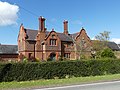
 Broadhey Farmhouse, Lower Kinnerton 01.jpg 4,000 × 3,000; 5.27 MB
-
 Broadhey Farmhouse, Lower Kinnerton 02.jpg 4,000 × 3,000; 4.87 MB
-
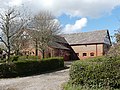 Buildings at Broadhey Farm, Lower Kinnerton.jpg 4,000 × 3,000; 1.73 MB
-
 Dismantled Rail Line - geograph.org.uk - 285340.jpg 640 × 480; 161 KB
-
 Disused railway near Lower Kinnerton - geograph.org.uk - 208756.jpg 640 × 480; 79 KB
-
 Farm building at Moor End Farm 01.jpg 4,000 × 3,000; 4.89 MB
-
 Farm building at Moor End Farm 02.jpg 4,000 × 3,000; 5.11 MB
-
 Farm building at Moor End Farm 03.jpg 4,000 × 3,000; 4.74 MB
-
 First shall be Last - geograph.org.uk - 134189.jpg 640 × 426; 83 KB
-
 Gell Farmhouse, Lower Kinnerton 01.jpg 4,000 × 3,000; 1.14 MB
-
 Gell Farmhouse, Lower Kinnerton 02.jpg 4,000 × 3,000; 4.93 MB
-
 Gell Farmhouse, Lower Kinnerton 03.jpg 4,000 × 3,000; 4.81 MB
-
 Old School House, Lower Kinnerton.jpg 4,000 × 3,000; 5.11 MB
-
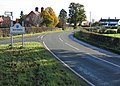 Road Junction at Gorstella - geograph.org.uk - 281643.jpg 640 × 457; 181 KB
-
 Stile and footbridge - geograph.org.uk - 460725.jpg 640 × 427; 141 KB
-
 View of the Footpath to Broughton - geograph.org.uk - 1380388.jpg 480 × 640; 79 KB
-

-
 Moor Lane - geograph.org.uk - 460646.jpg 427 × 640; 103 KB


