Category:Lowick, Northumberland
Jump to navigation
Jump to search
village and civil parish in Northumberland, UK  | |||||
| Upload media | |||||
| Instance of | |||||
|---|---|---|---|---|---|
| Location | Northumberland, North East England, England | ||||
 | |||||
English: Lowick (, with the first syllable rhyming with "cow") is a village in Northumberland, England. It appears in records as early as 1181 as Lowich, and in 1242 as Lowyc. The name derives from Old English meaning settlement (OE: wic, cognate to Latin vicus) on the River Low.
Subcategories
This category has the following 9 subcategories, out of 9 total.
B
- Barmoor Castle (2 F)
- Barmoor War Memorial (1 F)
- Black Bull, Lowick (4 F)
H
- Lowick Hall, Northumberland (1 F)
- Holburn Lake (2 F)
L
S
W
- The White Swan Inn, Lowick (4 F)
Media in category "Lowick, Northumberland"
The following 200 files are in this category, out of 659 total.
(previous page) (next page)-

-
 A body uncovered in St Cuthbert's Cave Wood - geograph.org.uk - 4828351.jpg 1,536 × 2,048; 1.75 MB
-
 A flat grass field - geograph.org.uk - 3408477.jpg 640 × 480; 237 KB
-
 A gateway to Holburn Forest - geograph.org.uk - 2277829.jpg 640 × 480; 171 KB
-
 A prickly path - geograph.org.uk - 2978974.jpg 1,024 × 768; 761 KB
-
 A wood under Greensheen Hill - geograph.org.uk - 5526412.jpg 1,024 × 683; 368 KB
-
 Access into Kyloe Wood - geograph.org.uk - 4842676.jpg 1,600 × 1,194; 515 KB
-
 Access road to Barmoor Wind Farm - geograph.org.uk - 5059876.jpg 1,600 × 1,200; 281 KB
-
 Access to Shiellow Crag House - geograph.org.uk - 4206454.jpg 5,099 × 3,431; 6.67 MB
-

-
 Agricultural equipment at Holburn Grange - geograph.org.uk - 3837408.jpg 1,600 × 1,200; 372 KB
-
 Approaching Barmoor Lane End - geograph.org.uk - 3398590.jpg 2,574 × 1,920; 1.76 MB
-
 Approaching Laverock Law from the east - geograph.org.uk - 4124330.jpg 2,048 × 1,536; 1.07 MB
-
 Approaching Lowick High Stead - geograph.org.uk - 4601152.jpg 640 × 480; 57 KB
-
 Apprroching Finis Wood - geograph.org.uk - 4462657.jpg 640 × 480; 55 KB
-
 Arable field east of Watchlaw - geograph.org.uk - 4566710.jpg 2,048 × 1,536; 1.08 MB
-
 Arable field margin near Watchlaw - geograph.org.uk - 4566701.jpg 2,048 × 1,536; 1,021 KB
-
 Arable field near Lowick - geograph.org.uk - 3015185.jpg 1,024 × 768; 536 KB
-
 Arable field north of Holburn Grange - geograph.org.uk - 3798288.jpg 1,024 × 768; 213 KB
-
 Arable field west of Kentstone - geograph.org.uk - 2961232.jpg 800 × 478; 108 KB
-
 Arable fields near Laverock Law - geograph.org.uk - 2940587.jpg 1,024 × 768; 477 KB
-
 Arable land at Dunsall - geograph.org.uk - 4215917.jpg 2,048 × 1,536; 1.35 MB
-
 Arable land beneath Cockenheugh - geograph.org.uk - 3835414.jpg 640 × 360; 219 KB
-
 Arable land near Laverock Law - geograph.org.uk - 2941791.jpg 1,024 × 768; 460 KB
-
 Arable land west of Brackenside - geograph.org.uk - 3626497.jpg 1,024 × 768; 382 KB
-
 Arable land, Bar Moor - geograph.org.uk - 2441887.jpg 640 × 480; 278 KB
-
 Arable land, Kentstone - geograph.org.uk - 3430184.jpg 640 × 360; 227 KB
-
 Arable land, Lowick - geograph.org.uk - 3408127.jpg 640 × 360; 215 KB
-
 Arable land, Lowick - geograph.org.uk - 3408215.jpg 640 × 480; 260 KB
-
 Arable land, Lowick - geograph.org.uk - 3408224.jpg 640 × 360; 210 KB
-
 Area of clear felled trees, Kyloe Wood - geograph.org.uk - 3471915.jpg 1,024 × 768; 339 KB
-
 Autumn Ploughing - geograph.org.uk - 3160510.jpg 1,024 × 768; 290 KB
-
 Auxiliary Unit Operational Base - Bolt Hole - geograph.org.uk - 3809092.jpg 4,592 × 3,448; 4.44 MB
-
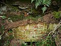 Auxiliary Unit Operational Base - Construction Detail - geograph.org.uk - 3809110.jpg 4,592 × 3,448; 4.28 MB
-
 B6353 - geograph.org.uk - 3200749.jpg 640 × 480; 61 KB
-
 B6353 - geograph.org.uk - 3200752.jpg 640 × 480; 49 KB
-
 B6353 eastbound - geograph.org.uk - 4720288.jpg 640 × 480; 54 KB
-
 B6353 towards Fenwick - geograph.org.uk - 4461045.jpg 640 × 480; 60 KB
-
 B6353 towards Fenwick - geograph.org.uk - 4461049.jpg 640 × 480; 70 KB
-
 B6353 towards Fenwick - geograph.org.uk - 4461055.jpg 640 × 480; 68 KB
-
 B6353 towards Lowick - geograph.org.uk - 4461017.jpg 640 × 480; 49 KB
-
 B6353 towards Lowick - geograph.org.uk - 4599963.jpg 640 × 480; 71 KB
-
 B6353 towards Lowick - geograph.org.uk - 4599968.jpg 640 × 480; 71 KB
-
 B6353 towards Lowick - geograph.org.uk - 4599971.jpg 640 × 480; 84 KB
-
 B6353, Barmoor Ridge - geograph.org.uk - 4599957.jpg 640 × 480; 60 KB
-
 B6525 heading south - geograph.org.uk - 4461011.jpg 640 × 480; 73 KB
-
 B6525 near Biteabout - geograph.org.uk - 5017668.jpg 640 × 480; 57 KB
-
 B6525 towards Doddington - geograph.org.uk - 5017664.jpg 640 × 480; 49 KB
-
 B6525 towards Doddington - geograph.org.uk - 5017671.jpg 640 × 480; 56 KB
-
 B6525 towards Wooler - geograph.org.uk - 4599974.jpg 640 × 480; 62 KB
-
 B6525 towards Wooler - geograph.org.uk - 4601149.jpg 640 × 480; 61 KB
-
 Baked ruts, Brownridge - geograph.org.uk - 5766735.jpg 1,024 × 683; 403 KB
-
 Bar Moor - geograph.org.uk - 3842088.jpg 640 × 480; 267 KB
-
 Barley, Moss House - geograph.org.uk - 2441848.jpg 640 × 359; 220 KB
-
 Barmoor Lane End - geograph.org.uk - 3398615.jpg 2,592 × 1,944; 1.29 MB
-
 Barmoor Lane End and The Cottage - geograph.org.uk - 5059995.jpg 1,600 × 1,093; 294 KB
-
 Barmoor Red House - geograph.org.uk - 4055473.jpg 2,048 × 1,536; 793 KB
-
 Barmoor Red House - geograph.org.uk - 5090432.jpg 1,600 × 1,182; 369 KB
-
 Barmoor South Moor road junction - geograph.org.uk - 3413317.jpg 1,024 × 768; 277 KB
-
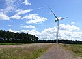
 Barmoor Wind Farm - geograph.org.uk - 5059820.jpg 1,600 × 1,250; 209 KB
-
 Barmoor Wind Farm - geograph.org.uk - 5059925.jpg 1,600 × 1,159; 234 KB
-
 Barmoor Wind Farm - geograph.org.uk - 5059934.jpg 1,600 × 1,296; 200 KB
-
 Barmoor Wind Farm access road - geograph.org.uk - 4055455.jpg 2,048 × 1,152; 465 KB
-
 Barmoor Wind Farm Access Road - geograph.org.uk - 4279694.jpg 2,048 × 1,536; 893 KB
-
 Barmoor Wind Farm construction access - geograph.org.uk - 4215900.jpg 2,048 × 1,536; 1.29 MB
-
 Barmoor Wind Farm control building (1) - geograph.org.uk - 4215907.jpg 2,048 × 1,536; 1.08 MB
-
 Barmoor Wind Farm control building (2) - geograph.org.uk - 4215911.jpg 2,048 × 1,536; 1.04 MB
-
 Barmoor Wind Farm control building - geograph.org.uk - 4566743.jpg 2,048 × 1,536; 834 KB
-
 Barmoor Wind Farm viewed from the summit of Greensheen Hill - geograph.org.uk - 4290509.jpg 4,000 × 2,250; 1.99 MB
-
 Bend in the road near Holburn Bridge - geograph.org.uk - 4462661.jpg 640 × 480; 77 KB
-
 Beside Bootjack Wood - geograph.org.uk - 3412503.jpg 640 × 480; 320 KB
-
 Between Raven's Crag and Rabbit Hill - geograph.org.uk - 1750715.jpg 1,600 × 1,067; 485 KB
-
 Black Heddon Smallholdings - geograph.org.uk - 4842686.jpg 1,600 × 1,264; 298 KB
-
 Blue House - geograph.org.uk - 5059943.jpg 1,600 × 1,346; 370 KB
-
 Bluebells, The Glen - geograph.org.uk - 5766682.jpg 1,024 × 683; 502 KB
-
 Bootjack Wood - geograph.org.uk - 3836818.jpg 640 × 480; 365 KB
-

-
 Bridleway near Holburn - geograph.org.uk - 1750683.jpg 1,067 × 1,600; 500 KB
-
 Bridleway near Raven's Crag - geograph.org.uk - 1750703.jpg 1,600 × 1,067; 609 KB
-
 Bridleway sign and snowy Cheviots - geograph.org.uk - 3398800.jpg 2,592 × 1,944; 1.81 MB
-
 Bridleway south from Dunsall - geograph.org.uk - 3398788.jpg 2,592 × 1,944; 1.87 MB
-
 Bridleway through Shiellow Wood - geograph.org.uk - 3726412.jpg 1,066 × 800; 373 KB
-
 Bridleway to Lowick High Stead - geograph.org.uk - 3398553.jpg 2,592 × 1,944; 2.04 MB
-

-
 Bridleway towards White House - geograph.org.uk - 3015192.jpg 1,024 × 768; 638 KB
-
 Brownridge - geograph.org.uk - 5090449.jpg 1,600 × 1,130; 377 KB
-
 Buildings at Holburn Grange - geograph.org.uk - 4304886.jpg 2,048 × 1,536; 1.1 MB
-
 Buildings at Moss Hall farm - geograph.org.uk - 4055435.jpg 2,048 × 1,536; 608 KB
-
 Bungalow on the B6525 - geograph.org.uk - 4595127.jpg 640 × 480; 57 KB
-
 Burnt heather on Greensheen Hill - geograph.org.uk - 3948622.jpg 1,024 × 768; 268 KB
-
 Cairn on hill immediately above St Cuthbert's Cave - geograph.org.uk - 3837405.jpg 1,600 × 1,200; 293 KB
-
 Car park for St Cuthbert's Cave - geograph.org.uk - 4304893.jpg 2,048 × 1,536; 1.3 MB
-
 Cattle grazing at Moorhouse - geograph.org.uk - 4124423.jpg 2,048 × 1,536; 742 KB
-
 Cattle grazing east of Brownridge - geograph.org.uk - 4124288.jpg 2,048 × 1,536; 1.25 MB
-
 Cattle, calves and chilly Cheviots - geograph.org.uk - 3398861.jpg 2,218 × 1,708; 1.95 MB
-
 Cereal field with Laverock Law in the background - geograph.org.uk - 2940578.jpg 1,024 × 768; 458 KB
-
 Chalets at Barmoor Castle - geograph.org.uk - 5059939.jpg 1,600 × 1,171; 352 KB
-
-
 Church Lane, Lowick - geograph.org.uk - 3015222.jpg 1,024 × 768; 555 KB
-
 Church of St John the Baptist, Lowick - geograph.org.uk - 4461021.jpg 640 × 480; 135 KB
-
 Clear felled and replanted areas, Holburn Forest - geograph.org.uk - 3687276.jpg 1,024 × 768; 310 KB
-
 Collar Heugh - geograph.org.uk - 4842684.jpg 1,600 × 1,152; 350 KB
-
 Combine Harvester at work - geograph.org.uk - 3624950.jpg 1,024 × 768; 604 KB
-
 Container, Moor End - geograph.org.uk - 5526403.jpg 1,024 × 683; 334 KB
-
 Corn field at sunset - geograph.org.uk - 2017476.jpg 640 × 480; 81 KB
-
 Corn field at sunset - geograph.org.uk - 2017483.jpg 640 × 480; 94 KB
-
 Corner of plantation on Greensheen Hill - geograph.org.uk - 3948578.jpg 1,024 × 768; 268 KB
-
 Cottage and Jacob sheep at Barmoor Ridge - geograph.org.uk - 5584246.jpg 640 × 480; 288 KB
-
 Cottage at Barmoor Ridge - geograph.org.uk - 5059826.jpg 1,600 × 1,200; 374 KB
-
 Cottages, Lowick - geograph.org.uk - 4461023.jpg 640 × 480; 68 KB
-
 Country lane - geograph.org.uk - 4616477.jpg 1,600 × 1,200; 486 KB
-
 Country road alongside Topboot Wood - geograph.org.uk - 3798278.jpg 1,024 × 768; 448 KB
-
 Country road east of Holburn Mill - geograph.org.uk - 3309190.jpg 1,024 × 768; 194 KB
-
 Country road near Lowick - geograph.org.uk - 3015227.jpg 1,024 × 768; 596 KB
-
 Country road towards Milfield - geograph.org.uk - 4055448.jpg 2,048 × 1,536; 549 KB
-
 Crane and turbine, Barmoor Wind Farm - geograph.org.uk - 4279687.jpg 2,048 × 1,536; 1.14 MB
-
 Creative recycling - geograph.org.uk - 909946.jpg 640 × 480; 62 KB
-
 Crop field and hedgerow - geograph.org.uk - 4601154.jpg 640 × 480; 105 KB
-
 Crop field beside North Wood - geograph.org.uk - 4462652.jpg 640 × 480; 77 KB
-
 Crop field east of the B6525 - geograph.org.uk - 4461008.jpg 640 × 480; 45 KB
-
 Crop field near Hetton North Farm - geograph.org.uk - 4596327.jpg 640 × 480; 88 KB
-
 Crop field near Holburn Mill - geograph.org.uk - 4455734.jpg 640 × 480; 67 KB
-
 Crop field near Lowick - geograph.org.uk - 4455701.jpg 640 × 480; 59 KB
-
 Crop field near Lowick High Stead - geograph.org.uk - 4595131.jpg 640 × 480; 91 KB
-
 Crop field near Sitwell's Lair Wood - geograph.org.uk - 4595100.jpg 640 × 480; 78 KB
-
 Crop field near Watchlaw - geograph.org.uk - 4599955.jpg 640 × 480; 75 KB
-
 Crop field north of Holburn - geograph.org.uk - 4455727.jpg 640 × 480; 82 KB
-
 Crop field north of Lowick - geograph.org.uk - 4455691.jpg 640 × 480; 67 KB
-
 Crop field off the B6525 - geograph.org.uk - 4595129.jpg 640 × 480; 81 KB
-
 Crop field towards Kentstone - geograph.org.uk - 4455705.jpg 640 × 480; 58 KB
-
 Crop field towards Moss Wood - geograph.org.uk - 4595125.jpg 640 × 480; 78 KB
-
 Crop field towards Moss Wood - geograph.org.uk - 5017638.jpg 640 × 480; 74 KB
-
 Crop field towards North Wood - geograph.org.uk - 4455719.jpg 640 × 480; 85 KB
-
 Crop field, Barmoor Lane End - geograph.org.uk - 4461015.jpg 640 × 480; 51 KB
-
 Crossroads near Lowick - geograph.org.uk - 2940642.jpg 1,024 × 768; 412 KB
-
 Cultivated farm land on Whitelee Moor - geograph.org.uk - 3626518.jpg 1,024 × 768; 310 KB
-
 Cutting the verges at Eelwell - geograph.org.uk - 5598791.jpg 1,024 × 768; 240 KB
-
 Deception Crack - geograph.org.uk - 909789.jpg 480 × 640; 105 KB
-
 Devil's Causeway - geograph.org.uk - 5766731.jpg 1,024 × 683; 328 KB
-
 Disused Discs, near Catton Ridge - geograph.org.uk - 3687271.jpg 1,024 × 768; 331 KB
-
 Drainage ditch - geograph.org.uk - 5525319.jpg 1,024 × 683; 482 KB
-
 Drilling - geograph.org.uk - 3412545.jpg 640 × 360; 197 KB
-
 Dunsall Farm - geograph.org.uk - 3398805.jpg 2,580 × 1,928; 1.79 MB
-
 Dunsall Farm - geograph.org.uk - 3398815.jpg 2,592 × 1,944; 1.29 MB
-
 East Holburn - geograph.org.uk - 1750910.jpg 1,600 × 1,067; 316 KB
-
 East Holburn Farm - geograph.org.uk - 2448997.jpg 750 × 563; 67 KB
-
 Eel Well Road, Lowick - geograph.org.uk - 3398528.jpg 2,160 × 1,660; 1.55 MB
-
 End of Raven's Crag - geograph.org.uk - 1750701.jpg 1,600 × 1,067; 550 KB
-
 Entering Holburn - geograph.org.uk - 4462663.jpg 640 × 480; 82 KB
-
 Entering Lowick Village - geograph.org.uk - 4461018.jpg 640 × 480; 54 KB
-
 Entering Lowick Village - geograph.org.uk - 4461041.jpg 640 × 480; 66 KB
-
 Entrance to Barmoor Castle Country Park - geograph.org.uk - 3626569.jpg 1,024 × 768; 368 KB
-
 Entrance to Lowick Village - geograph.org.uk - 3200758.jpg 640 × 444; 73 KB
-
 Entrance to Shiellow Crag - geograph.org.uk - 2037609.jpg 2,048 × 1,536; 1.56 MB
-
 Extraction lane, Rabbit Hill - geograph.org.uk - 5525312.jpg 1,024 × 576; 422 KB
-
 Fake crime scene at St Cuthbert's Cave - geograph.org.uk - 4828358.jpg 2,048 × 1,536; 1.8 MB
-
 Fake wall inside St Cuthbert's Cave - geograph.org.uk - 4828329.jpg 2,048 × 1,152; 1.19 MB
-
 Farm buildings at Barmoor Ridge - geograph.org.uk - 3626505.jpg 1,024 × 768; 289 KB
-
 Farm buildings at Moorhouse - geograph.org.uk - 4124419.jpg 2,048 × 1,536; 530 KB
-
 Farm track (footpath) east of Lowick - geograph.org.uk - 4461037.jpg 640 × 480; 49 KB
-
 Farm track along edge of Finis Wood - geograph.org.uk - 3687246.jpg 768 × 1,024; 347 KB
-
 Farm track and public footpath west of Bowsden Mill Farm - geograph.org.uk - 4566672.jpg 2,048 × 1,536; 1.12 MB
-
 Farm track at Brackenside - geograph.org.uk - 4566696.jpg 2,048 × 1,536; 1.39 MB
-
 Farm track beside crop field - geograph.org.uk - 4595103.jpg 640 × 480; 88 KB
-
 Farm track between arable fields - geograph.org.uk - 4566680.jpg 1,536 × 2,048; 1.2 MB
-
 Farm track near Barmoor Ridge - geograph.org.uk - 4599962.jpg 640 × 480; 77 KB
-
 Farm track near Lowick - geograph.org.uk - 3430183.jpg 640 × 360; 257 KB
-
 Farm track off the B6353 - geograph.org.uk - 4461047.jpg 640 × 480; 65 KB
-
 Farm track off the B6525 - geograph.org.uk - 5017662.jpg 640 × 480; 57 KB
-
 Farm track towards North Hazelrigg - geograph.org.uk - 2979858.jpg 1,024 × 768; 550 KB
-
 Farm track towards woodland - geograph.org.uk - 4455716.jpg 640 × 480; 81 KB
-

-
 Farmland and gorse bank - geograph.org.uk - 4462655.jpg 640 × 480; 81 KB
-
 Farmland at Barmoor Ridge - geograph.org.uk - 4260494.jpg 2,048 × 1,152; 624 KB
-
 Farmland at Black Heddon - geograph.org.uk - 2277823.jpg 640 × 471; 175 KB
-
 Farmland at Lowick - geograph.org.uk - 2277830.jpg 640 × 480; 158 KB
-
 Farmland near Brownridge - geograph.org.uk - 4601163.jpg 640 × 480; 72 KB
-
 Farmland near Holburn Grange - geograph.org.uk - 4462688.jpg 640 × 480; 64 KB
-
 Farmland near Moorhouse - geograph.org.uk - 4462649.jpg 640 × 480; 85 KB
-
 Field beside Bootjack Wood - geograph.org.uk - 3412508.jpg 640 × 360; 215 KB
-
 Field by Brownridge - geograph.org.uk - 5766738.jpg 1,024 × 683; 345 KB
-
 Field entrance off the B6353 - geograph.org.uk - 4599967.jpg 640 × 480; 67 KB
-
 Field entrance, Bar Moor - geograph.org.uk - 5017630.jpg 640 × 480; 108 KB
-
 Field entrance, Brownridge - geograph.org.uk - 4595140.jpg 640 × 480; 82 KB
-
 Field of clover - geograph.org.uk - 5090455.jpg 1,600 × 1,279; 394 KB
-
 Field of peas east of Barmoor Ridge - geograph.org.uk - 4566726.jpg 2,048 × 1,536; 1.29 MB
-
 Field, Brownridge - geograph.org.uk - 3408463.jpg 640 × 360; 202 KB
-
 Field, Dunsall - geograph.org.uk - 3843459.jpg 640 × 480; 259 KB
-
 Fine drystone wall - geograph.org.uk - 3837705.jpg 1,600 × 1,200; 294 KB
-
 Fine field gate - geograph.org.uk - 5059887.jpg 1,600 × 1,200; 339 KB
-
 Finis Wood - geograph.org.uk - 3412529.jpg 640 × 360; 217 KB
-
 Finis Wood - geograph.org.uk - 4462659.jpg 640 × 480; 65 KB
-
 Flake Crack - geograph.org.uk - 909798.jpg 480 × 640; 121 KB
-
 Football field, Lowick - geograph.org.uk - 4455694.jpg 640 × 480; 42 KB
-
 Footbridge and stile, Kyloe Wood - geograph.org.uk - 4121582.jpg 1,024 × 678; 265 KB
-
 Footpath on Greensheen Hill - geograph.org.uk - 2037510.jpg 2,048 × 1,536; 1.31 MB
-
 Footpath through the field - geograph.org.uk - 2961284.jpg 800 × 478; 127 KB
-
 Footpath through the trees - geograph.org.uk - 2978960.jpg 1,024 × 768; 784 KB
-
 Footpath to Detchant Park - geograph.org.uk - 4842670.jpg 1,600 × 1,166; 476 KB
-
 Footpath to Holburn - geograph.org.uk - 3837097.jpg 3,351 × 2,093; 1,006 KB


_-_geograph.org.uk_-_4215907.jpg)
_-_geograph.org.uk_-_4215911.jpg)


_east_of_Lowick_-_geograph.org.uk_-_4461037.jpg)


