Category:Luchtenburg (Ulvenhout)
Jump to navigation
Jump to search
| Camera location | | View all coordinates using: OpenStreetMap |
|---|
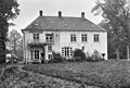
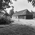
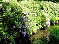
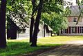
Nederlands: Afbeeldingen van Luchtenburg (Ulvenhout) bestaande uit het landgoed Luchtenburg met onder meer het landhuis Huize Luchtenburg, Luchtenburgseweg 1, 4858 RJ Ulvenhout AC. Gelegen nabij Ulvenhout in de provincie Noord-Brabant in het zuiden van Nederland. Het landgoed is in particulier bezit. Het is een rijksmonument
|
This is a category about rijksmonumentcomplex number 511880
|
Landhuis:
|
This is a category about rijksmonument number 511879
|
Langerekte boerderij:
|
This is a category about rijksmonument number 511882
|
Tiendschuur:
|
This is a category about rijksmonument number 511883
|
Koetshuis:
|
This is a category about rijksmonument number 511884
|
BP Luchtenburg, Historische Park:
|
This is a category about rijksmonument number 530965
|
 | |||||
| Upload media | |||||
| Instance of | |||||
|---|---|---|---|---|---|
| Part of | |||||
| Location |
| ||||
| Street address |
| ||||
| Heritage designation |
| ||||
 | |||||
Media in category "Luchtenburg (Ulvenhout)"
The following 53 files are in this category, out of 53 total.
-
 Achtergevel - Ulvenhout - 20211542 - RCE.jpg 1,200 × 810; 293 KB
-
 Bakhuisje van bijbehorende boerderij - Ulvenhout - 20211514 - RCE.jpg 1,200 × 1,200; 460 KB
-
 Bijbehorende boerderij - Ulvenhout - 20211506 - RCE.jpg 1,195 × 1,200; 371 KB
-
 Bijbehorende boerderij - Ulvenhout - 20211507 - RCE.jpg 1,197 × 1,200; 409 KB
-
 Bijbehorende boerderij - Ulvenhout - 20211508 - RCE.jpg 1,200 × 1,195; 384 KB
-
 Bijbehorende boerderij - Ulvenhout - 20211509 - RCE.jpg 1,200 × 1,192; 355 KB
-
 Bijbehorende boerderij - Ulvenhout - 20211511 - RCE.jpg 1,200 × 1,200; 428 KB
-
 Binnenzijde kopgevel - Ulvenhout - 20507830 - RCE.jpg 1,200 × 900; 162 KB
-
 Binnenzijden kop- en zijgevel - Ulvenhout - 20507834 - RCE.jpg 1,200 × 900; 160 KB
-
 Bomen, landgoed, grove den, luchtenburg, Bestanddeelnr 192-0530.jpg 2,499 × 3,323; 1.74 MB
-
 Deel zijgevel - Ulvenhout - 20507840 - RCE.jpg 1,200 × 900; 199 KB
-
 Deeldeuren zijgevel - Ulvenhout - 20507831 - RCE.jpg 1,200 × 900; 169 KB
-
 Deeldeuren zijgevel - Ulvenhout - 20507839 - RCE.jpg 1,200 × 900; 164 KB
-
 Deur zijgevel - Ulvenhout - 20507829 - RCE.jpg 1,200 × 900; 116 KB
-
 Gebint- en kapconstructie - Ulvenhout - 20507826 - RCE.jpg 1,200 × 900; 144 KB
-
 Gebint- en kapconstructie - Ulvenhout - 20507827 - RCE.jpg 1,200 × 900; 160 KB
-
 Gebintconstructie - Ulvenhout - 20507828 - RCE.jpg 1,200 × 900; 104 KB
-
 Gebintconstructie - Ulvenhout - 20507837 - RCE.jpg 1,200 × 900; 155 KB
-
 Gebintconstructie - Ulvenhout - 20507841 - RCE.jpg 1,200 × 900; 106 KB
-
 Kapconstructie - Ulvenhout - 20507832 - RCE.jpg 1,200 × 900; 108 KB
-
 Kapconstructie - Ulvenhout - 20507833 - RCE.jpg 1,200 × 900; 161 KB
-
 Kapconstructie - Ulvenhout - 20507836 - RCE.jpg 1,200 × 900; 160 KB
-
 Kopgevel - Ulvenhout - 20507835 - RCE.jpg 1,200 × 900; 168 KB
-
 Luchtenburg (Ulvenhout) DSCF1815.jpg 2,048 × 1,536; 1.52 MB
-
 Luchtenburg (Ulvenhout) DSCF1819.jpg 2,048 × 1,536; 1.51 MB
-
 Luchtenburg (Ulvenhout) DSCF1820.jpg 2,048 × 1,536; 1.52 MB
-
 Luchtenburg (Ulvenhout) DSCF3432.JPG 2,816 × 1,864; 2.41 MB
-
 Luchtenburg (Ulvenhout) DSCF3433.JPG 2,816 × 1,864; 2.5 MB
-
 Luchtenburg (Ulvenhout) DSCF3434.JPG 2,816 × 1,864; 2.56 MB
-
 Luchtenburg (Ulvenhout) DSCF3459.JPG 2,816 × 1,864; 2.5 MB
-
 Luchtenburg (Ulvenhout) DSCF3460.JPG 2,816 × 1,864; 2.51 MB
-
 Luchtenburg (Ulvenhout) DSCF3461.JPG 2,816 × 1,864; 2.54 MB
-
 Luchtenburg (Ulvenhout) DSCF3462.JPG 2,816 × 1,864; 2.55 MB
-
 Luchtenburg (Ulvenhout) DSCF3463.JPG 2,816 × 1,864; 2.59 MB
-
 Luchtenburg (Ulvenhout) DSCF3464.JPG 2,816 × 1,864; 2.55 MB
-
 Luchtenburg en Hondsdonk - Aerial photograph.jpg 2,592 × 1,944; 1.15 MB
-
 Luchtenburg schuur.jpg 1,438 × 987; 395 KB
-
 Luchtenburg", voorgevel - Ulvenhout - 20211540 - RCE.jpg 1,200 × 810; 256 KB
-
 Luchtenburg.jpg 2,154 × 1,482; 737 KB
-
 Overzicht - Ulvenhout - 20211539 - RCE.jpg 1,200 × 811; 321 KB
-
 Overzicht achtergevel - Ulvenhout - 20211505 - RCE.jpg 1,200 × 955; 286 KB
-

-

-
 Overzicht voorgevel - Ulvenhout - 20211504 - RCE.jpg 1,200 × 962; 321 KB
-
 Overzicht voorgevel landhuis, buitenplaats - Ulvenhout - 20346841 - RCE.jpg 1,174 × 1,200; 447 KB
-
 Schuren - Ulvenhout - 20211543 - RCE.jpg 1,200 × 810; 303 KB
-
 Schuren - Ulvenhout - 20211544 - RCE.jpg 1,200 × 815; 284 KB
-
 Schuur met daarachter woonhuis - Ulvenhout - 20507842 - RCE.jpg 1,200 × 900; 107 KB
-
 Schuur van boerderij - Ulvenhout - 20211512 - RCE.jpg 1,200 × 957; 311 KB
-
 Zijgevel - Ulvenhout - 20211541 - RCE.jpg 1,200 × 818; 242 KB
-
 Zijgevel - Ulvenhout - 20507838 - RCE.jpg 1,200 × 900; 227 KB
-
 Zijgevel boerderij - Ulvenhout - 20211510 - RCE.jpg 1,200 × 948; 318 KB
-
 Zijgevel en achtergevel schuur van boerderij - Ulvenhout - 20211513 - RCE.jpg 1,200 × 956; 313 KB


_DSCF1815.jpg)
_DSCF1819.jpg)
_DSCF1820.jpg)
_DSCF3432.JPG)
_DSCF3433.JPG)
_DSCF3434.JPG)
_DSCF3459.JPG)
_DSCF3460.JPG)
_DSCF3461.JPG)
_DSCF3462.JPG)
_DSCF3463.JPG)
_DSCF3464.JPG)


