Category:Ludmannsdorf
Jump to navigation
Jump to search
municipality in Klagenfurt-Land District, Carinthia, Austria   | |||||
| Upload media | |||||
| Instance of |
| ||||
|---|---|---|---|---|---|
| Location | Klagenfurt-Land District, Carinthia, Austria | ||||
| Population |
| ||||
| Area |
| ||||
| Elevation above sea level |
| ||||
| official website | |||||
 | |||||
Subcategories
This category has the following 13 subcategories, out of 13 total.
- Barns in Ludmannsdorf (3 F)
- Farmhouses in Ludmannsdorf (7 F)
- Wayside shrines in Ludmannsdorf (11 F)
D
- Draubrücke Selkach (8 F)
P
S
- Skulpturenpark Holzbau Gasser (30 F)
Z
- Zikkurat, Ludmannsdorf (7 F)
Media in category "Ludmannsdorf"
The following 52 files are in this category, out of 52 total.
-
 Wappen at ludmannsdorf.png 850 × 850; 21 KB
-
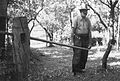
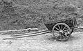 "Harling" - enoosni voz za konja ali vola v Zvrhnji Vesci 1951.jpg 3,000 × 1,859; 340 KB
-

-
 Abzweigung Selkach, Gemeinde Ludmannsdorf, Kärnten.jpg 5,000 × 2,925; 8.47 MB
-
 Aussenkreuz am Friedhof Ludmannsdorf, Design by Meina Schellander, Österreich.jpg 2,343 × 1,711; 2.68 MB
-
 Bach, Gemeinde Ludmannsdorf, Bezirk Klagenfurt Land, Kärnten.jpg 4,287 × 2,668; 6.91 MB
-
 Bildstock in Selkach, Gemeinde Ludmannsdorf, Kärnten.jpg 5,000 × 3,279; 6.39 MB
-
 BILKA - Logo des Slowenischen Kulturvereins in der Gemeinde Ludmannsdorf, Kärnten.jpg 2,586 × 3,500; 2.55 MB
-
 Bilka SPD Vereinshaus, Slowenischer Kulturverein Ludmannsdorf, Kärnten.jpg 4,817 × 2,377; 4.66 MB
-
 Bus Haltestelle Edling, Gemeinde Ludmannsdorf, Kärnten.jpg 5,000 × 2,716; 8.12 MB
-
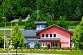
 Ehemaliges Feuerwehrhaus, Edling, Gemeinde Ludmannsdorf, Kärnten.jpg 4,457 × 3,081; 5.38 MB
-
 Friedhof neu auf der Anhöhe in Ludmannsdorf, Klagenfurt Land, Kärnten.jpg 4,638 × 2,854; 9.73 MB
-
 Gemeinde Ludmannsdorf, Austria - panoramio (1).jpg 4,608 × 2,592; 2.64 MB
-
 Gemeindeamt 2-sprachig, Ludmannsdorf, Kärnten.jpg 4,910 × 2,704; 5.7 MB
-
 Kindergarten, slowenisch Otroški vrtec, Ludmannsdorf, Kärnten.jpg 5,000 × 3,285; 5.16 MB
-
 Kruzifix in Pugrad, Gemeinde Ludmannsdorf, Kärnten.jpg 5,000 × 3,333; 16.51 MB
-
 Saligenwanderung Aufstieg Rupertiberg Kneipp Bach 23092006 03.jpg 3,872 × 2,592; 1.98 MB
-
 Ludmannsdorf (Ortstafel).jpg 1,280 × 960; 456 KB
-
 Ludmannsdorf Bilcóvs Infotafel, Bezirk Klagenfurt Land, Kärnten, Österreich.jpg 1,463 × 461; 420 KB
-
 Ludmannsdorf Feuerwehr 20110616 813.jpg 4,288 × 2,848; 2.71 MB
-
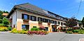 Ludmannsdorf Gasthof Ogris 20110616 801.jpg 4,243 × 2,052; 1.75 MB
-
 Ludmannsdorf Gemeindeamt, Infotafel, Kärnten.jpg 5,000 × 2,979; 5.1 MB
-
 Ludmannsdorf Grosskleinberg Landschaft 20110616 223.jpg 4,288 × 2,848; 2.18 MB
-
 Ludmannsdorf Grosskleinberg Ogris-Hoehe 20110616 222.jpg 4,288 × 2,848; 1.89 MB
-
 Ludmannsdorf Grosskleinberg Waldkapelle 16062011 121.jpg 2,848 × 4,288; 1.73 MB
-
 Ludmannsdorf Grosskleinberg Waldkapelle 16062011 122.jpg 2,848 × 4,288; 2.4 MB
-
 Ludmannsdorf Grosskleinberg Waldkapelle Nischenmalerei 20110616 201.jpg 4,288 × 2,848; 2.64 MB
-
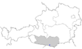
 Ludmannsdorf im Bezirk KL.png 645 × 645; 25 KB
-
 Ludmannsdorf Muschkau Holzwegkreuz 11122007 95.jpg 2,592 × 3,872; 2.17 MB
-
 Ludmannsdorf Pugrad 20110616 755.jpg 4,288 × 2,848; 1.87 MB
-
 Ludmannsdorf Pugrad 20110616 756.jpg 4,288 × 2,848; 1.37 MB
-
 Ludmannsdorf Selkach peninsula windmill 13122007 11.jpg 2,464 × 1,632; 386 KB
-
 Ludmannsdorf Willkommens Banner, 2-sprachig, Kärnten.jpg 4,832 × 3,333; 7.06 MB
-
 Ludmannsdorf Zedras Ortsschild 20110616 033.jpg 4,194 × 2,786; 1.46 MB
-
 Ludmannsdorf, Aufbahrungshalle, Klagenfurt Land, Kärnten.jpg 5,000 × 3,069; 8.32 MB
-
 Map at carinthia klagenfurt land municipalities.png 348 × 315; 31 KB
-
 Map at ludmannsdorf.png 400 × 240; 3 KB
-
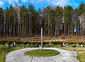
 ORTSZEIT, KRAJEVNI ČAS 1999-2014 by Meina Schellander, Ludmannsdorf, Österreich.jpg 1,742 × 2,789; 1.33 MB
-
 Pugrad, Gemeinde Ludmannsdorf, Klagenfurt Land, Kärnten.jpg 4,599 × 2,967; 7.18 MB
-
 Rupertiberg Kraftort.jpg 2,778 × 2,902; 2.23 MB
-
 Rupertiberg Saligen-Sitze.jpg 3,553 × 3,134; 3.6 MB
-
 Rupertiberg Saligenwanderung Marko Pogacnik Lithopunktur 02.jpg 3,872 × 2,592; 1.77 MB
-
 Rupertiberg Saligenwanderung Racava 01.jpg 3,872 × 2,592; 1.81 MB
-
 Saligenwanderung Aufstieg Rupertiberg Kraeutergarten 23092006 01.jpg 3,872 × 2,592; 1.63 MB
-
 Saligenwanderung Srecno Pec 23092006 07.jpg 2,592 × 3,872; 1.73 MB
-
 Stiskalnica "preša" za "grote" in "ojnice" v Zvrhnji Vesci 1951.jpg 2,814 × 1,895; 318 KB
-
 Strein, Stranje ist ein Ortsteil in der 2-sprachigen Gemeinde Ludmannsdorf, Kärnten.jpg 5,000 × 2,540; 9.14 MB
-
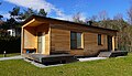 Tiny house, Wohnbox, Ludmannsdorf, Kärnten.jpg 5,000 × 2,889; 7.31 MB
-
 Vodnjak s tehtnico v Zvrhnji Vesci 1951.jpg 1,688 × 3,072; 293 KB
-
 Wegweiser in der Gemeinde Ludmannsdorf 2-sprachig, Südkärnten.jpg 5,000 × 2,924; 6.99 MB
-
 Znamenje v Zvrhnji Vesci 1951.jpg 1,860 × 3,032; 388 KB
-
 Železni nagrobni križ v Zvrhnji Vesci 1951.jpg 1,639 × 2,792; 151 KB


.jpg)


.jpg)


