Category:Ludwigsfelde
Jump to navigation
Jump to search

town in Brandenburg state, Germany    | |||||
| Upload media | |||||
| Instance of |
| ||||
|---|---|---|---|---|---|
| Location | Teltow-Fläming District, Brandenburg, Germany | ||||
| Head of government |
| ||||
| Population |
| ||||
| Area |
| ||||
| Elevation above sea level |
| ||||
| official website | |||||
 | |||||
Subcategories
This category has the following 15 subcategories, out of 15 total.
!
*
E
- Elsbruchgraben (3 F)
G
- Gröbener Fließ (2 F)
I
J
- Jütchendorfer Graben (2 F)
M
N
S
- Siethener Elsbruch (4 F)
- Südlicher Mittelgraben (2 F)
V
Media in category "Ludwigsfelde"
The following 45 files are in this category, out of 45 total.
-
 DE-BB 12-0-72-240 Ludwigsfelde 1965 COA.svg 644 × 723; 13 KB
-
 DE-BB 12-0-72-240 Ludwigsfelde COA.svg 288 × 325; 36 KB
-
 2015 wird Pink - panoramio.jpg 2,448 × 3,264; 3.13 MB
-
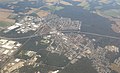 Aerial view, Lugdwigsfelde 01.jpg 3,470 × 2,101; 1.3 MB
-
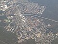 Aerial view, Lugdwigsfelde 02.jpg 3,690 × 2,770; 2.24 MB
-
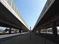 Autobahnbrücke Ludwigsfelde Zentrum - panoramio.jpg 3,264 × 2,448; 2.84 MB
-
 Beschreibung Dieselameise DK3 - SH105968 (505822548).jpg 1,280 × 960; 145 KB
-
 Die Gartenlaube (1875) 585.jpg 3,102 × 4,134; 1.67 MB
-
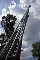 Drehleiter.jpg 2,592 × 3,872; 1.01 MB
-
 Einwohnerentwicklung von Ludwigsfelde (log10).svg 800 × 400; 62 KB
-
 Einwohnerentwicklung von Ludwigsfelde.svg 800 × 400; 48 KB
-
 Gedenkstein "1813" zwischen Wietstock und Ludwigsfelde - panoramio.jpg 2,592 × 1,944; 2.55 MB
-
 IFA LKW Treffen in Ludwigsfelde, 2011.jpg 6,324 × 736; 4.9 MB
-
 Kristalltherme Ludwigsfelde 1.jpg 3,264 × 2,448; 1.39 MB
-
 Kristalltherme Ludwigsfelde 2.jpg 3,264 × 2,448; 1.39 MB
-
 Kristalltherme Ludwigsfelde 3.jpg 2,048 × 1,536; 745 KB
-
 Ludwigsfelde - - geo.hlipp.de - 37969.jpg 640 × 480; 118 KB
-
 Ludwigsfelde - Bundesstrasse 101 - geo.hlipp.de - 37901.jpg 640 × 480; 56 KB
-

-

-
 Ludwigsfelde - Laermschutz (Sound Barrier) - geo.hlipp.de - 37961.jpg 640 × 480; 104 KB
-
 Ludwigsfelde - Potsdamer Strasse - geo.hlipp.de - 37889.jpg 640 × 480; 68 KB
-
 Ludwigsfelde - Stadtrand (Rural Urban Fringe) - geo.hlipp.de - 37967.jpg 640 × 480; 111 KB
-
 Ludwigsfelde - TRABET - geo.hlipp.de - 37900.jpg 640 × 480; 74 KB
-

-
 Ludwigsfelde - Weinbergsweg - geo.hlipp.de - 37899.jpg 640 × 480; 88 KB
-
 Ludwigsfelde - Zossener Landstrasse - geo.hlipp.de - 37896.jpg 640 × 376; 58 KB
-
 Ludwigsfelde Bundesautobahn A10 lub 2022-12-27 img01.jpg 4,032 × 3,024; 5.52 MB
-
 Ludwigsfelde Bundesautobahn A10 lub 2022-12-27 img02 Ludwigsfelder Brücken.jpg 4,032 × 3,024; 5.78 MB
-
 Ludwigsfelde Karte 1903.JPG 556 × 295; 75 KB
-
 Ludwigsfelde Neckarstraße lub 2022-12-27.jpg 4,032 × 3,024; 6.42 MB
-
 Ludwigsfelde Zu den Neckargärten lub 2022-12-27.jpg 4,032 × 3,024; 8.23 MB
-
 Ludwigsfelde Zur Ahrensdorfer Heide lub 2022-12-27.jpg 4,032 × 3,024; 8.65 MB
-
 Ludwigsfelde, Brandenburg - Straßenansicht (Zeno Ansichtskarten).jpg 2,198 × 1,408; 264 KB
-
 Ludwigsfelde12 Brunnen Damsdorf.JPG 577 × 531; 96 KB
-
 Ludwigsfelde14 Gedenkstein.JPG 564 × 531; 91 KB
-
 Nuthe Nieplitz Seen Kern.jpg 1,175 × 1,056; 488 KB
-
 Trafostation - Löwenbruch-1 - panoramio.jpg 2,592 × 1,944; 2.33 MB
-
 Trafostation - Löwenbruch-2 - panoramio.jpg 2,592 × 1,944; 2.93 MB
-
 Trafostation - Löwenbruch-3 - panoramio.jpg 2,592 × 1,944; 2.44 MB
-
 Trafostation bei Wietstock -1 - panoramio.jpg 3,264 × 2,448; 3.12 MB
-
 Trafostation bei Wietstock -2 - panoramio.jpg 3,264 × 2,448; 2.98 MB
-
 Waldteich bei Löwenbruch - panoramio.jpg 4,608 × 3,456; 5.73 MB
-
 Wappen Ludwigsfelde.png 800 × 891; 60 KB
-
 Zimmermannshammer 40998.jpg 3,143 × 2,156; 2.31 MB


.jpg)
_585.jpg)

.svg)


_-_geo.hlipp.de_-_37891.jpg)
_-_geo.hlipp.de_-_37887.jpg)
_-_geo.hlipp.de_-_37961.jpg)

_-_geo.hlipp.de_-_37967.jpg)

_-_geo.hlipp.de_-_37893.jpg)


.jpg)


