Category:Lutherse Kerk (Utrecht)
Jump to navigation
Jump to search
| Object location | | View all coordinates using: OpenStreetMap |
|---|
church building in Utrecht, Netherlands  | |||||
| Upload media | |||||
| Instance of | |||||
|---|---|---|---|---|---|
| Location | Utrecht, Netherlands | ||||
| Street address |
| ||||
| Occupant |
| ||||
| Heritage designation |
| ||||
| Inception |
| ||||
| Significant event |
| ||||
 | |||||
Nederlands: De Lutherse Kerk is een kerk aan de Hamburgerstraat 9 in het centrum van de Nederlandse stad Utrecht.
English: The Lutherse Kerk is a church to the Hamburgerstraat 9 in the center of the Dutch city Utrecht.
|
This is a category about rijksmonument number 36114
|
| Address |
|
Media in category "Lutherse Kerk (Utrecht)"
The following 44 files are in this category, out of 44 total.
-
 2022 Lutherse Kerk (Utrecht) (1).jpg 2,105 × 3,265; 1.29 MB
-
 2022 Lutherse Kerk (Utrecht) (2).jpg 2,108 × 2,714; 1.06 MB
-
 2022 Lutherse Kerk (Utrecht) (3).jpg 2,084 × 2,373; 1.46 MB
-
 2022 Lutherse Kerk (Utrecht) (4).jpg 1,897 × 2,842; 1.88 MB
-
 2022 Lutherse Kerk (Utrecht) (5).jpg 3,198 × 2,946; 2.54 MB
-
 2022 Lutherse Kerk (Utrecht) (6).jpg 4,000 × 3,000; 4.95 MB
-
 Detail zijkant links tijdens werkzaamheden - Utrecht - 20328052 - RCE.jpg 1,200 × 1,186; 179 KB
-
 Exterieur OVERZICHT VOORGEVEL - Utrecht - 20314320 - RCE.jpg 945 × 1,200; 232 KB
-
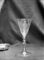 Glazen bokaal, hoogte 0.20 meter - Utrecht - 20234375 - RCE.jpg 893 × 1,200; 116 KB
-
 Hamburgerstraat 9.JPG 2,592 × 3,456; 2.46 MB
-
-
 Interieur kap van het koor gezien naar het zuiden - Utrecht - 20234389 - RCE.jpg 1,200 × 1,192; 313 KB
-

-
 Interieur kap van het schip gezien naar het oosten - Utrecht - 20234386 - RCE.jpg 1,200 × 1,200; 353 KB
-
 Interieur kap van het schip gezien naar het westen - Utrecht - 20234387 - RCE.jpg 1,200 × 1,185; 320 KB
-

-
 Interieur Lutherse kerk.JPG 640 × 480; 48 KB
-
 Interieur naar galerij - Utrecht - 20234378 - RCE.jpg 1,200 × 958; 152 KB
-
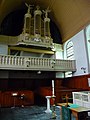
 Interieur naar het orgel - Utrecht - 20234380 - RCE.jpg 968 × 1,200; 191 KB
-
 Interieur naar het westen (klok met omlijsting) - Utrecht - 20234369 - RCE.jpg 1,200 × 885; 139 KB
-
 Interieur naar het zuid-oosten - Utrecht - 20234368 - RCE.jpg 885 × 1,200; 155 KB
-
 Interieur naar preekstoel - Utrecht - 20234383 - RCE.jpg 950 × 1,200; 174 KB
-
 Interieur naar straatzijde (ingang) - Utrecht - 20234384 - RCE.jpg 954 × 1,200; 168 KB
-
 Interieur, aanzicht orgel, orgelnummer 1518 - Utrecht - 20417165 - RCE.jpg 790 × 1,200; 163 KB
-
 Interieur, detail - Utrecht - 20234376 - RCE.jpg 1,200 × 954; 177 KB
-
 Kerk naar het noord-oosten - Utrecht - 20234361 - RCE.jpg 890 × 1,200; 278 KB
-

-
-
 Kerk, Hamburgerstraat, gevel - Utrecht - 20234363 - RCE.jpg 971 × 1,200; 220 KB
-
 Koor - Utrecht - 20234367 - RCE.jpg 2,326 × 3,108; 2.1 MB
-
 L-K Lutherse-kerk Utrecht-2.jpg 3,264 × 2,448; 1.48 MB
-
 L-K Lutherse-kerk Utrecht.jpg 2,448 × 3,264; 1.43 MB
-
 Lutherse Kerk (Utrecht). Reliëf.jpg 1,895 × 2,182; 1.76 MB
-
 Lutherse Kerk Hamburgerstraat Utrecht.JPG 2,128 × 2,832; 4.03 MB
-
 Orgel - Utrecht - 20234379 - RCE.jpg 956 × 1,200; 153 KB
-
 Preekstoel - Utrecht - 20234382 - RCE.jpg 960 × 1,200; 184 KB
-
 Preekstoel, kuip - Utrecht - 20234381 - RCE.jpg 956 × 1,200; 205 KB
-
 Tegeltableau Zwaan Hamburgerstraat Lange Nieuwstraat Utrecht.JPG 3,111 × 2,640; 2.04 MB
-
 Torentje - Utrecht - 20234366 - RCE.jpg 873 × 1,200; 160 KB
-
 Voorgevel - Utrecht - 20235675 - RCE.jpg 798 × 1,200; 177 KB
-

-

-
 Zilveren avondmaalskan, hoogte 0.242 meter - Utrecht - 20234372 - RCE.jpg 1,200 × 894; 158 KB
-
 Zilveren doopschotel, diameter 0.30 meter - Utrecht - 20234373 - RCE.jpg 1,200 × 898; 160 KB
_(1).jpg)
_(2).jpg)
_(3).jpg)
_(4).jpg)
_(5).jpg)
_(6).jpg)


_-_Utrecht_-_20234369_-_RCE.jpg)


_-_Utrecht_-_20234384_-_RCE.jpg)


._Reli%C3%ABf.jpg)


