Category:Luton
Jump to navigation
Jump to search

large town in Bedfordshire, England  Radnice v Lutonu  | |||||
| Upload media | |||||
| Pronunciation audio | |||||
|---|---|---|---|---|---|
| Instance of | |||||
| Location | Luton, Bedfordshire, East of England, England | ||||
| Located in or next to body of water | |||||
| Population |
| ||||
| Area |
| ||||
| Elevation above sea level |
| ||||
| official website | |||||
 | |||||
Main Wikipedia article: Luton.
Main gallery: Luton.
Subcategories
This category has the following 15 subcategories, out of 15 total.
A
- Art in Luton (7 F)
B
C
- Coat of arms of Luton (3 F)
F
H
M
N
- Nature of Luton (9 F)
P
T
V
- Views of Luton (3 F)
W
Media in category "Luton"
The following 200 files are in this category, out of 558 total.
(previous page) (next page)-
 "Penny Farthings" in Chapel Street - geograph.org.uk - 2665077.jpg 640 × 480; 81 KB
-
 1950s Ford Anglia on Barton Road, Luton - geograph.org.uk - 5311372.jpg 2,048 × 1,536; 1.31 MB
-
 1950s Ford Anglia on Barton Road, Luton - geograph.org.uk - 5311381.jpg 2,048 × 1,536; 1.17 MB
-
 1960s Ford Zephyr on Barton Road, Luton - geograph.org.uk - 5311376.jpg 2,048 × 1,536; 1.17 MB
-
 32 George Street, Luton (South Face - 01).jpg 3,263 × 4,445; 8.52 MB
-
 32 George Street, Luton (South Face - 02).jpg 2,951 × 4,256; 7.29 MB
-
 64 Bute Street, Luton (South Face).jpg 4,478 × 3,250; 9.36 MB
-
 68 Bilton Way, Luton.jpg 4,096 × 3,072; 4.45 MB
-
 A pair of EasyJets - geograph.org.uk - 5297290.jpg 640 × 429; 226 KB
-
 Acorn Chemists, Dallow Road Branch - geograph.org.uk - 5840419.jpg 3,264 × 2,448; 2.43 MB
-
 Advice that greets the visitor to Luton - geograph.org.uk - 5293663.jpg 640 × 640; 114 KB
-
 Aircraft weathervane - geograph.org.uk - 2815089.jpg 640 × 446; 82 KB
-
 Aircraft weathervanes - geograph.org.uk - 2815085.jpg 640 × 462; 107 KB
-
 Aircraft weathervanes - geograph.org.uk - 2815093.jpg 640 × 480; 62 KB
-
 Aircraft weathervanes - geograph.org.uk - 2815098.jpg 640 × 480; 144 KB
-
 Albert Road - geograph.org.uk - 2918257.jpg 640 × 290; 67 KB
-
 Albert Road - geograph.org.uk - 2918260.jpg 480 × 640; 142 KB
-
 Albert Road - geograph.org.uk - 2918262.jpg 640 × 394; 100 KB
-
 Albert Road - geograph.org.uk - 2918303.jpg 640 × 480; 132 KB
-
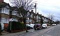
 Alexandra Avenue, Luton - geograph.org.uk - 6132869.jpg 1,892 × 1,236; 1.24 MB
-
 Allotments - geograph.org.uk - 595643.jpg 640 × 480; 116 KB
-
 Alton Road - geograph.org.uk - 2816087.jpg 640 × 421; 118 KB
-
 Alton Road - geograph.org.uk - 2918036.jpg 640 × 384; 112 KB
-
 Ambulift at London (Luton) Airport - geograph.org.uk - 5551303.jpg 3,264 × 2,448; 2.02 MB
-
 Ames Close - geograph.org.uk - 2860017.jpg 640 × 480; 77 KB
-
 Andrea Leadsom visits Dunstable South Children's Centre.jpg 8,005 × 5,339; 5.95 MB
-
-

-
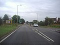
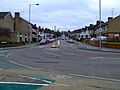
 Approaching roundabout on the A1081 - geograph.org.uk - 3859700.jpg 640 × 480; 79 KB
-

-

-

-

-
-

-
 Arthur Street - geograph.org.uk - 2918286.jpg 640 × 398; 124 KB
-
 Ashburnham Road, Luton - geograph.org.uk - 6230957.jpg 800 × 600; 120 KB
-
 At Junction 11 on the M1 - geograph.org.uk - 2153038.jpg 640 × 480; 96 KB
-
 AW House, Stuart Street - geograph.org.uk - 5840519.jpg 3,264 × 2,448; 2.72 MB
-
 Awkwardly placed pylon - geograph.org.uk - 2777656.jpg 640 × 356; 93 KB
-
 Bailey Hill water tower - geograph.org.uk - 2918368.jpg 480 × 640; 108 KB
-
 Bailey Hill water tower - geograph.org.uk - 2918377.jpg 528 × 640; 153 KB
-
 Bailey Hill water tower - geograph.org.uk - 2918386.jpg 640 × 480; 148 KB
-
 Bailey Hill water tower - geograph.org.uk - 2918391.jpg 640 × 480; 87 KB
-
 Bailey Hill water tower - geograph.org.uk - 2918393.jpg 480 × 640; 126 KB
-
 Bailey Hill water tower - geograph.org.uk - 2918409.jpg 599 × 640; 174 KB
-
 Bailey Hill water tower - geograph.org.uk - 2918424.jpg 2,000 × 1,500; 589 KB
-
 Barbers Lane, Luton - geograph.org.uk - 5432091.jpg 3,813 × 3,246; 2.42 MB
-
 Barton Road by Quantock Rise, Luton - geograph.org.uk - 2558287.jpg 1,600 × 1,200; 510 KB
-
 Barton Road entering Luton - geograph.org.uk - 2558279.jpg 1,600 × 1,200; 530 KB
-
 Barton Road entering Luton - geograph.org.uk - 5297331.jpg 2,044 × 1,489; 770 KB
-
 BBC Three Counties Radio, Luton - geograph.org.uk - 2874470.jpg 3,264 × 2,448; 2.23 MB
-
 Between fences and building - geograph.org.uk - 2613090.jpg 640 × 510; 88 KB
-
 Between the fences - geograph.org.uk - 2613091.jpg 581 × 640; 120 KB
-
 Birds near Luton Airport - geograph.org.uk - 3453257.jpg 640 × 310; 74 KB
-
 Bolton Road - geograph.org.uk - 2705825.jpg 640 × 489; 132 KB
-
 Bradley Road - geograph.org.uk - 4334766.jpg 640 × 480; 53 KB
-
 Bradley Road - geograph.org.uk - 4334777.jpg 640 × 480; 60 KB
-
 Bridge over the River Lea - geograph.org.uk - 5432037.jpg 5,202 × 3,465; 3.74 MB
-
 Bridges over the M1 - geograph.org.uk - 4517451.jpg 3,058 × 1,654; 2.65 MB
-
 Brownfield site on Kimpton Road - geograph.org.uk - 2689393.jpg 640 × 437; 100 KB
-
 Brownfield site on Kimpton Road - geograph.org.uk - 2705534.jpg 640 × 400; 123 KB
-
 Brownfield site on Kimpton Road - geograph.org.uk - 2705538.jpg 640 × 428; 148 KB
-
 Brownfield site on Kimpton Road - geograph.org.uk - 2705541.jpg 640 × 469; 129 KB
-
 Brownfield site on Kimpton Road - geograph.org.uk - 2705547.jpg 640 × 326; 86 KB
-
 Brownfield site on Kimpton Road - geograph.org.uk - 2705558.jpg 640 × 403; 151 KB
-
 Brownfield site on Kimpton Road - geograph.org.uk - 2705562.jpg 640 × 340; 101 KB
-
 Building site on Manor Road - geograph.org.uk - 2705871.jpg 480 × 640; 140 KB
-
 Building site on Manor Road - geograph.org.uk - 2705876.jpg 640 × 480; 190 KB
-
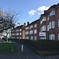
 Bungalows at Leagrave - geograph.org.uk - 5552149.jpg 2,977 × 2,231; 2.51 MB
-
 Burned out plane at Luton Airport - geograph.org.uk - 2109544.jpg 2,848 × 2,136; 2.97 MB
-

-
 Bus shelter in Silver Street - geograph.org.uk - 2665953.jpg 640 × 480; 76 KB
-
 Bus stop in Chapel Street - geograph.org.uk - 2661532.jpg 640 × 491; 59 KB
-
 Business premises in John Street - geograph.org.uk - 2665826.jpg 640 × 480; 93 KB
-

-
 Bute Street, LU1 - geograph.org.uk - 3634393.jpg 640 × 480; 102 KB
-
 Capability Green - geograph.org.uk - 2777793.jpg 480 × 640; 152 KB
-
 Capability Green - geograph.org.uk - 2777811.jpg 458 × 640; 93 KB
-
 Capability Green - geograph.org.uk - 2817338.jpg 640 × 592; 214 KB
-
 Capability Green Business Park this way - geograph.org.uk - 2613096.jpg 640 × 467; 135 KB
-
 Capability Green from the air - geograph.org.uk - 3253695.jpg 640 × 382; 137 KB
-
 Capability Green from the air - geograph.org.uk - 3361288.jpg 640 × 480; 137 KB
-
 Capability Green from the air - geograph.org.uk - 3361289.jpg 640 × 480; 141 KB
-
 Capability Green from the air - geograph.org.uk - 3361293.jpg 640 × 458; 124 KB
-
 Capability Green, Luton - geograph.org.uk - 2510307.jpg 2,000 × 1,418; 460 KB
-
 Capability Green, Luton - geograph.org.uk - 2510329.jpg 2,000 × 1,407; 535 KB
-
-
 Car park underneath The Mall - geograph.org.uk - 2665975.jpg 640 × 480; 65 KB
-
 Car wash on Hitchin Road, Round Green - geograph.org.uk - 6109453.jpg 1,920 × 1,280; 1.45 MB
-

-
 Cars in John Street - geograph.org.uk - 2665941.jpg 640 × 480; 71 KB
-

-
 Chapel Street, Luton - geograph.org.uk - 2874478.jpg 3,264 × 2,448; 2.94 MB
-
 Chapel Street, Luton - geograph.org.uk - 2874479.jpg 3,264 × 2,448; 2.28 MB
-
 Charity shop in Chapel Street - geograph.org.uk - 2661591.jpg 640 × 480; 96 KB
-
 Chaul End from over Leagrave - geograph.org.uk - 5461742.jpg 3,264 × 2,448; 3.74 MB
-
 Chequer Street - geograph.org.uk - 2918248.jpg 640 × 480; 117 KB
-
 Chequer Street - geograph.org.uk - 2918256.jpg 640 × 480; 117 KB
-
 Chiltern Way - geograph.org.uk - 2168204.jpg 640 × 480; 79 KB
-
 Church in Church Street - geograph.org.uk - 2665356.jpg 640 × 480; 63 KB
-
 Concorde weathervane - geograph.org.uk - 2873752.jpg 640 × 364; 47 KB
-
 Concrete cores - geograph.org.uk - 2689403.jpg 640 × 399; 151 KB
-

-
 Construction works at Luton Airport - geograph.org.uk - 5167225.jpg 640 × 480; 113 KB
-
 Control Tower at London Luton Airport - geograph.org.uk - 5703549.jpg 2,651 × 3,990; 4.57 MB
-
 Control Tower, Luton Airport - geograph.org.uk - 5413160.jpg 480 × 640; 47 KB
-
-
 Cowper Street - geograph.org.uk - 2918307.jpg 640 × 403; 104 KB
-
 Cowper Street - geograph.org.uk - 2918310.jpg 640 × 410; 102 KB
-
 Crescent Road at the junction of Crawley Green Road - geograph.org.uk - 5447336.jpg 2,048 × 1,536; 1.57 MB
-
 Crescent Road, Luton - geograph.org.uk - 5297327.jpg 2,230 × 1,624; 1.11 MB
-

-

-
-
 Cutenhoe Road - geograph.org.uk - 2816109.jpg 640 × 480; 144 KB
-
 Cutenhoe Road - geograph.org.uk - 2816115.jpg 640 × 392; 145 KB
-
 Cutenhoe Road - geograph.org.uk - 2816117.jpg 640 × 480; 117 KB
-
 Cutenhoe Road - geograph.org.uk - 2816177.jpg 640 × 480; 155 KB
-
 Cutenhoe Road - geograph.org.uk - 2816190.jpg 640 × 429; 134 KB
-
 Cutenhoe Road - geograph.org.uk - 2816211.jpg 640 × 480; 147 KB
-
 Cutenhoe Road - geograph.org.uk - 2816274.jpg 640 × 480; 170 KB
-
 Cutenhoe Road - geograph.org.uk - 2918022.jpg 640 × 480; 132 KB
-
-
 Cycle Way at Limbury - geograph.org.uk - 5432053.jpg 5,202 × 3,465; 3.53 MB
-
 Cycle way between Bancroft Road and Runfold Avenue - geograph.org.uk - 5432029.jpg 5,202 × 3,465; 4.25 MB
-
 Cycle way from Bancroft Road - geograph.org.uk - 5432023.jpg 5,202 × 3,465; 4.1 MB
-
 Dallow Road Primary School - geograph.org.uk - 5840424.jpg 3,264 × 2,448; 2.43 MB
-
 Dane Street Cottages - geograph.org.uk - 2510471.jpg 2,000 × 1,494; 670 KB
-
 Dane Street Farm - geograph.org.uk - 3030482.jpg 640 × 480; 133 KB
-
 Dane Street Farm from Luton Airport - geograph.org.uk - 4549098.jpg 3,264 × 2,448; 3.22 MB
-
 Dane Street, Dane Street - geograph.org.uk - 5703533.jpg 4,608 × 3,072; 1.79 MB
-
 Date stone, Luton Delivery Office - geograph.org.uk - 4399971.jpg 3,264 × 4,928; 6.15 MB
-
 Days Inn Hotel, Luton - geograph.org.uk - 2874476.jpg 3,264 × 2,448; 3.05 MB
-
 Decommissioned stamp vending machines, Luton - geograph.org.uk - 4393621.jpg 1,691 × 959; 420 KB
-
 Departures, London Luton Airport - geograph.org.uk - 5413162.jpg 480 × 640; 54 KB
-
 Derelict house on Farley Hill - geograph.org.uk - 2661475.jpg 640 × 480; 67 KB
-
 Development site at Kimpton Road - geograph.org.uk - 2689390.jpg 640 × 389; 127 KB
-
 Development site at Kimpton Road - geograph.org.uk - 2689395.jpg 640 × 480; 160 KB
-
 Development site at Kimpton Road - geograph.org.uk - 2689426.jpg 640 × 480; 145 KB
-
 Double aperture Elizabeth II postbox on George Street, Luton - geograph.org.uk - 6231044.jpg 2,546 × 3,538; 1.75 MB
-

-
-

-

-
 Dunstable Road, Luton - geograph.org.uk - 2153043.jpg 640 × 404; 71 KB
-
 Dunstable Road, Luton - geograph.org.uk - 5840397.jpg 2,935 × 2,204; 1.93 MB
-

-
 East Midlands Trains hybrid livery - geograph.org.uk - 6195144.jpg 3,648 × 2,432; 3.15 MB
-
 East on Connaught Road, Luton - geograph.org.uk - 5398999.jpg 640 × 480; 373 KB
-
 EasyJet Flight to Copenhagen - geograph.org.uk - 5297292.jpg 640 × 437; 198 KB
-
 Ecosheet - geograph.org.uk - 2704544.jpg 640 × 452; 140 KB
-
 El Al flight to Tel Aviv - geograph.org.uk - 5297293.jpg 640 × 360; 139 KB
-
 Electricity pylon in the road - geograph.org.uk - 4146504.jpg 480 × 640; 71 KB
-
 Emergency Gate 5 sign - geograph.org.uk - 5703514.jpg 4,608 × 3,072; 1.87 MB
-
En-uk-Luton.ogg 0.6 s; 8 KB
-
 Entrance to Stanton Road busway stop - geograph.org.uk - 3716848.jpg 640 × 423; 86 KB
-
 Entrance to The Mall, Luton - geograph.org.uk - 6231045.jpg 3,566 × 4,231; 2.36 MB
-
 Ethnic makeup of Luton by single year ages in 2021.svg 3,440 × 2,397; 45 KB
-
 Express Newspapers - geograph.org.uk - 4786276.jpg 640 × 258; 36 KB
-
 Factory on Kimpton Road - geograph.org.uk - 2705576.jpg 640 × 480; 121 KB
-
 Farley Food ^ Wine, Farley Hill - geograph.org.uk - 2661474.jpg 640 × 480; 69 KB
-
 Felmersham Road, Luton - geograph.org.uk - 6230950.jpg 800 × 600; 94 KB
-
 Field at Chiltern Hall - geograph.org.uk - 5703501.jpg 3,950 × 2,405; 6.08 MB
-
 Field at London Road - geograph.org.uk - 2817203.jpg 640 × 415; 144 KB
-
 Flag of Luton.png 4,136 × 2,479; 1.71 MB
-
 Flats by Windmill Road, Luton - geograph.org.uk - 6132871.jpg 1,892 × 1,236; 1.05 MB
-
 Flower trough in Church Street - geograph.org.uk - 2665799.jpg 480 × 640; 107 KB
-
 Footpath by Airport Way - geograph.org.uk - 2613097.jpg 640 × 498; 86 KB
-
 Footpath to Capability Green - geograph.org.uk - 2777789.jpg 480 × 640; 183 KB
-
 Former post office, Upper George Street - geograph.org.uk - 4393545.jpg 3,010 × 2,827; 5.08 MB
-

-
 Former railway line at Kimpton Road - geograph.org.uk - 2705598.jpg 640 × 382; 91 KB
-
 Former railway line at Kimpton Road - geograph.org.uk - 2705601.jpg 640 × 374; 89 KB
-
 Fountains by Central Library - geograph.org.uk - 2705949.jpg 640 × 414; 166 KB
-
 Gate and embankment - geograph.org.uk - 2613092.jpg 640 × 442; 100 KB
-
 Gates to Playing fields - geograph.org.uk - 2613098.jpg 640 × 454; 93 KB
-
 George Street - geograph.org.uk - 1855815.jpg 640 × 480; 104 KB
-

-

-
 Giant cranes - geograph.org.uk - 2777699.jpg 640 × 480; 127 KB
-
 Gipsy Lane - geograph.org.uk - 2814919.jpg 640 × 480; 121 KB
-
 Gipsy Lane - geograph.org.uk - 2814921.jpg 640 × 480; 132 KB
-
 Gipsy Lane - geograph.org.uk - 3331502.jpg 640 × 480; 125 KB
-
 Gipsy Lane - geograph.org.uk - 3331508.jpg 640 × 433; 140 KB
-
 Gipsy Lane - geograph.org.uk - 3331510.jpg 640 × 638; 235 KB
-
 Gipsy Lane Leisure Gardens - geograph.org.uk - 2814980.jpg 640 × 480; 196 KB
-
 Gipsy Lane Leisure Gardens - geograph.org.uk - 2814988.jpg 640 × 486; 158 KB
-
 Gipsy Lane retail park - geograph.org.uk - 3331519.jpg 640 × 430; 76 KB
-
 Gloucester Road - geograph.org.uk - 2705840.jpg 640 × 480; 136 KB
-
 GOC Breachwood Green 032 Welcome to Luton (14354860040).jpg 2,323 × 1,746; 1.3 MB
-
 GOC Breachwood Green 049 Road sign (14549008105).jpg 3,852 × 2,901; 3.3 MB
-
 Graffiti on Church Street, Luton - geograph.org.uk - 6112346.jpg 1,860 × 1,184; 1.07 MB
-
 Great Bramingham Lane - geograph.org.uk - 3047378.jpg 1,024 × 768; 253 KB
-
 Great Bramingham Lane - geograph.org.uk - 3047388.jpg 1,024 × 768; 243 KB
-
 Great Bramingham Wood - geograph.org.uk - 2860145.jpg 640 × 480; 83 KB
-
 Green by Selsey Drive, Stopsley - geograph.org.uk - 5309199.jpg 2,008 × 1,482; 1.07 MB
-
 Griffin House - geograph.org.uk - 2814972.jpg 640 × 397; 103 KB
-
 Griffin House - geograph.org.uk - 2815016.jpg 640 × 480; 134 KB
-
 Guildford Street mural, Luton - geograph.org.uk - 5432086.jpg 4,655 × 2,841; 2.68 MB


.jpg)
.jpg)
.jpg)


_Airport_-_geograph.org.uk_-_5551303.jpg)


.jpg)
.jpg)


