Category:Lyndhurst, Hampshire
Jump to navigation
Jump to search
village and civil parish in Hampshire, England  Main Street de Lyndhurst | |||||
| Upload media | |||||
| Instance of | |||||
|---|---|---|---|---|---|
| Located in protected area | |||||
| Location | New Forest, Hampshire, South East England, England | ||||
| Population |
| ||||
| official website | |||||
 | |||||
English: Lyndhurst is the largest village within the New Forest, Hampshire, England. It is often called the "Capital of the New Forest" and is a popular tourist location with many shops, cafés, pubs and hotels. Lyndhurst is also home to the New Forest Museum. The nearest city is Southampton located around nine miles (14 km) to the north-east. In 2001 Lyndhurst had a population of 2,973 people [1].
Nederlands: Lyndhurst is een gemeente in het graafschap Hampshire in Groot-Brittannië. De plaats grenst aan Southampton en afficheert zichzelf als hoofdstad van het New Forest. Er bevindt zich een museum dat aan het New Forest is gewijd.
Română: Lyndhurst este un oraş în comitatul Hampshire, regiunea South East England, Anglia. Oraşul se află în districtul New Forest a cărui reşedinţă este
Subcategories
This category has the following 27 subcategories, out of 27 total.
A
- Allum Green (2 F)
B
- Bank, Hampshire (22 F)
- Brick Kiln Inclosure (4 F)
C
E
F
- Foxlease (3 F)
- Furzey Lodge ford (4 F)
G
- Glasshayes (3 F)
- Gritnam Wood (11 F)
H
- Hollands Wood (26 F)
- Hursthill Inclosure (4 F)
I
- Ironshill Inclosure (2 F)
L
- Longwater Lawn (22 F)
- Lyndhurst Baptist Church (10 F)
- Lyndhurst War Memorial (4 F)
M
N
- Nature of Lyndhurst (158 F)
- New Forest Reptile Centre (7 F)
P
- Park Ground Inclosure (11 F)
- Parkhill Inclosure (61 F)
- Pondhead Inclosure (15 F)
Q
- The Queen's House, Lyndhurst (6 F)
S
- Shops in Lyndhurst, Hampshire (32 F)
W
- White Moor, Lyndhurst (19 F)
- Whitley Wood, Hampshire (7 F)
Media in category "Lyndhurst, Hampshire"
The following 200 files are in this category, out of 651 total.
(previous page) (next page)-
 "A merciful man is merciful to his beast" - geograph.org.uk - 174023.jpg 640 × 480; 143 KB
-

-
 1928 datestone in Romsey Road - geograph.org.uk - 2621810.jpg 480 × 640; 74 KB
-
 A337 east of Foldsgate Inclosure - geograph.org.uk - 3233270.jpg 3,233 × 2,157; 1.33 MB
-
 A337 entering Lyndhurst - geograph.org.uk - 3429533.jpg 640 × 398; 74 KB
-
 A337 entering Lyndhurst by Custards - geograph.org.uk - 3429539.jpg 640 × 378; 63 KB
-
 A337 enters Lyndhurst - geograph.org.uk - 3233273.jpg 3,450 × 2,272; 2.03 MB
-

-
 A35 at Cuffnell's Farm - geograph.org.uk - 3922285.jpg 640 × 427; 118 KB
-
 A35 at New Forest Golf Club entrance - geograph.org.uk - 3921398.jpg 640 × 450; 92 KB
-
 A35 entering Lyndhurst - geograph.org.uk - 3921401.jpg 640 × 408; 78 KB
-
 A35 passes over Warwickslade Cutting - geograph.org.uk - 1438831.jpg 640 × 427; 224 KB
-
 A35 to Lyndhurst - geograph.org.uk - 4974976.jpg 1,600 × 1,200; 959 KB
-
 A35, Southampton Road, Lyndhurst - geograph.org.uk - 2602072.jpg 640 × 478; 68 KB
-

-
 Allum Green - geograph.org.uk - 4374243.jpg 640 × 427; 92 KB
-
 Allum Green House - geograph.org.uk - 3734376.jpg 1,024 × 768; 149 KB
-
 Allum Green House, walled garden - geograph.org.uk - 3734405.jpg 1,024 × 768; 182 KB
-
 Allum Green, Corner Cottage - geograph.org.uk - 3734411.jpg 1,024 × 750; 150 KB
-
 Allum Green, forestry track - geograph.org.uk - 3734780.jpg 1,024 × 768; 340 KB
-
 Allum Green, heathland - geograph.org.uk - 3734371.jpg 1,024 × 768; 232 KB
-
 Allum Green, wall - geograph.org.uk - 3734378.jpg 1,024 × 768; 285 KB
-
 Allum Green, woodland - geograph.org.uk - 3734771.jpg 768 × 1,024; 328 KB
-
 Along The Ridge - geograph.org.uk - 5245648.jpg 1,600 × 1,200; 996 KB
-
 Antiques Shop in Lyndhurst - geograph.org.uk - 350104.jpg 433 × 640; 80 KB
-

-

-

-
 Autumn bracken - geograph.org.uk - 3722648.jpg 1,600 × 1,200; 901 KB
-
 Autumn leaves - geograph.org.uk - 3722637.jpg 1,600 × 1,200; 647 KB
-
 B3056 (Beaulieu Road) - geograph.org.uk - 6191626.jpg 1,024 × 768; 238 KB
-
 B3056 at Pondhead - geograph.org.uk - 3922249.jpg 640 × 409; 57 KB
-
 B3056 at The Bench - geograph.org.uk - 3922284.jpg 640 × 367; 76 KB
-
 B3056 Beaulieu Road - geograph.org.uk - 4234414.jpg 640 × 480; 66 KB
-
 B3056 beside Park Pale - geograph.org.uk - 3234307.jpg 3,648 × 2,432; 1.58 MB
-
 B3056 climbs towards Matley Ridge - geograph.org.uk - 3234319.jpg 3,648 × 2,109; 1.5 MB
-
 B3056 is the Beaulieu Road - geograph.org.uk - 3234310.jpg 3,648 × 2,432; 1.5 MB
-
 B3056 near Pondhead Inclosure - geograph.org.uk - 4234415.jpg 640 × 481; 45 KB
-
 B3056 passes Lyndhurst Cricket Ground - geograph.org.uk - 3233282.jpg 3,648 × 2,432; 1.35 MB
-
 Bank Holiday traffic jam in Lyndhurst - geograph.org.uk - 191338.jpg 426 × 640; 263 KB
-
 Beaulieu Road through the New Forest - geograph.org.uk - 4978683.jpg 640 × 427; 427 KB
-
 Beaulieu Road, B3056 - geograph.org.uk - 4978632.jpg 640 × 427; 415 KB
-
 Beechen Cottage - geograph.org.uk - 4768474.jpg 640 × 427; 157 KB
-
 Beechen Lane - geograph.org.uk - 5811573.jpg 1,600 × 1,200; 753 KB
-
 Bench and path on greenspace in Lyndhurst - geograph.org.uk - 6084204.jpg 1,024 × 683; 348 KB
-
 Bolton's Bench - geograph.org.uk - 2492222.jpg 640 × 482; 70 KB
-
 Bolton's Bench - geograph.org.uk - 5107813.jpg 640 × 480; 60 KB
-
 Bolton's Bench and the entry to the New Forest - geograph.org.uk - 3233277.jpg 3,441 × 2,160; 1.12 MB
-

-
 Bolton's Bench in Lyndhurst - geograph.org.uk - 3464985.jpg 1,500 × 1,000; 146 KB
-
 Bolton's Bench New Forest - geograph.org.uk - 740710.jpg 640 × 480; 94 KB
-
 Bolton's Bench, Lyndhurst - geograph.org.uk - 154991.jpg 640 × 447; 100 KB
-
 Bolton's Bench, Lyndhurst, Hampshire.jpg 4,219 × 3,164; 1.61 MB
-
 Boltons Bench, Lyndhurst, New Forest - geograph.org.uk - 177135.jpg 640 × 480; 78 KB
-
 Boltonsbench.jpg 2,048 × 1,536; 618 KB
-
 Bottom end of Empress Road - geograph.org.uk - 2621835.jpg 640 × 480; 101 KB
-

-
 Bournemouth Road west of Lyndhurst - geograph.org.uk - 6289547.jpg 1,920 × 1,280; 1.51 MB
-
 Bournemouth Road, Bank - geograph.org.uk - 6289548.jpg 1,920 × 1,280; 1.01 MB
-
 Bournemouth Road, Bank - geograph.org.uk - 6289551.jpg 1,920 × 1,280; 2.32 MB
-
 Bracken above Beaulieu Road - geograph.org.uk - 5834098.jpg 1,600 × 1,200; 454 KB
-
 Branches in all directions - geograph.org.uk - 5708196.jpg 3,549 × 2,129; 3.96 MB
-
 Brick Kiln Inclosure, gates - geograph.org.uk - 2686487.jpg 1,024 × 768; 349 KB
-
 Bridge over Stream near Pondhead - geograph.org.uk - 3673962.jpg 1,024 × 716; 1.06 MB
-
 Broughton Road - geograph.org.uk - 1063562.jpg 640 × 480; 109 KB
-
 Bus stop on High Street, Lyndhurst - geograph.org.uk - 6259464.jpg 1,920 × 1,280; 1.73 MB
-
 Bus stop, Lyndhurst - geograph.org.uk - 5005503.jpg 1,600 × 1,116; 679 KB
-
 Butts Lawn, forestry track - geograph.org.uk - 2686518.jpg 1,024 × 768; 217 KB
-
 Butts Lawn, free-range pigs - geograph.org.uk - 2688902.jpg 1,024 × 768; 331 KB
-

-
 Cattle grid in Pinkney Lane - geograph.org.uk - 6084222.jpg 1,024 × 683; 281 KB
-
 Cemetery Chapel - geograph.org.uk - 760277.jpg 640 × 480; 105 KB
-
 Chapel at Lyndhurst Cemetery, New Forest - geograph.org.uk - 296889.jpg 480 × 640; 112 KB
-
 Chapel Lane at the junction of Pinkney Lane - geograph.org.uk - 6259465.jpg 1,920 × 1,280; 1.36 MB
-
 Chapel Lane, Lyndhurst - geograph.org.uk - 4974927.jpg 1,600 × 1,200; 680 KB
-
-

-
 Church Lane - off High Street - geograph.org.uk - 4925173.jpg 640 × 480; 77 KB
-
 Church of St Michael and All Angels, Lyndhurst - geograph.org.uk - 6259970.jpg 1,858 × 1,180; 1.08 MB
-
 Church of St Michael and All Angels, Lyndhurst - geograph.org.uk - 6392808.jpg 1,800 × 1,060; 816 KB
-
 Citroen SM outside the Mailmans Arms - geograph.org.uk - 4973371.jpg 1,600 × 1,200; 614 KB
-
 Clayhill Heath - geograph.org.uk - 1124722.jpg 640 × 425; 61 KB
-
 Clayhill Heath - geograph.org.uk - 1660732.jpg 640 × 480; 220 KB
-
 Clayhill Heath - geograph.org.uk - 3761072.jpg 1,024 × 768; 349 KB
-
 Clayhill Heath Car Park - geograph.org.uk - 3760986.jpg 1,024 × 768; 266 KB
-
 Clayhill Heath, brook - geograph.org.uk - 3761080.jpg 1,024 × 768; 237 KB
-
 Clayhill Heath, embankment - geograph.org.uk - 3761064.jpg 1,024 × 768; 346 KB
-
 Clayhill Heath, gate ^ stiles - geograph.org.uk - 3761058.jpg 1,024 × 768; 199 KB
-
 Clayhill Heath, gates - geograph.org.uk - 3760999.jpg 1,024 × 768; 295 KB
-
 Clayhill Heath, ride - geograph.org.uk - 4369566.jpg 1,024 × 768; 364 KB
-
 Clayhill Heath, timber - geograph.org.uk - 4369537.jpg 1,024 × 768; 254 KB
-
 Clayhill, Crown Stirrup - geograph.org.uk - 4371889.jpg 1,024 × 758; 178 KB
-
 Clearing in Hollands Wood - geograph.org.uk - 3131634.jpg 640 × 480; 71 KB
-
 Corner Cottage at Allum Green - geograph.org.uk - 4374212.jpg 640 × 427; 90 KB
-
 Cottage at Lyndhust - geograph.org.uk - 2991858.jpg 1,024 × 656; 832 KB
-
 Cricket and cows, Emery Down near Lyndhurst - geograph.org.uk - 2210820.jpg 1,024 × 692; 308 KB
-
 Cricket match, Lyndhurst - geograph.org.uk - 5107812.jpg 640 × 480; 61 KB
-
 Cricket pavilion gone on Swan Green - geograph.org.uk - 6219045.jpg 1,600 × 1,067; 614 KB
-
 Cricket Pavilion, Swan Green - geograph.org.uk - 5882213.jpg 1,600 × 1,200; 393 KB
-
 Cycle path through Hursthill Inclosure - geograph.org.uk - 4276159.jpg 1,600 × 1,200; 1.15 MB
-
 Cycle route into Brick Kiln Inclosure - geograph.org.uk - 2941956.jpg 640 × 480; 143 KB
-
 Cycle Route to Lyndhurst - geograph.org.uk - 1638370.jpg 640 × 480; 120 KB
-
 Cycleway Bridge - geograph.org.uk - 5811591.jpg 1,600 × 1,200; 876 KB
-
 Cycleway junction - geograph.org.uk - 5811011.jpg 1,600 × 1,200; 753 KB
-
 Daffodils at Great Mead, Lyndhurst - geograph.org.uk - 6084213.jpg 1,024 × 683; 312 KB
-
 Denny Inclosure, bridge - geograph.org.uk - 4363872.jpg 1,024 × 768; 317 KB
-
 Denny Inclosure, forestry track - geograph.org.uk - 4363853.jpg 1,024 × 768; 314 KB
-
 Dentists in Empress Road - geograph.org.uk - 2621838.jpg 640 × 480; 77 KB
-
 Detail, Allum House, New Forest. - panoramio.jpg 2,736 × 3,648; 1.6 MB
-
 Disused sand pit, New Forest - geograph.org.uk - 5584757.jpg 640 × 480; 187 KB
-
 Drive to New Park - geograph.org.uk - 5584878.jpg 640 × 480; 154 KB
-
 Dunces Arch, New Forest - geograph.org.uk - 164782.jpg 480 × 640; 181 KB
-
 Emery Down Approach - geograph.org.uk - 5173467.jpg 800 × 600; 178 KB
-
 Emery Down Church - geograph.org.uk - 5173470.jpg 800 × 600; 156 KB
-
 Emery Down church - geograph.org.uk - 6259964.jpg 1,848 × 1,162; 1.19 MB
-
 Emery Down, ditch - geograph.org.uk - 4305604.jpg 1,024 × 756; 174 KB
-
 Emery Down, forestry car park - geograph.org.uk - 4237231.jpg 1,024 × 768; 344 KB
-
 Emery Down, forestry track - geograph.org.uk - 4237252.jpg 1,024 × 768; 327 KB
-
 Emery Down, James's Hill - geograph.org.uk - 4237236.jpg 1,024 × 768; 362 KB
-
 Emery Down, Mill Stream - geograph.org.uk - 4305612.jpg 1,024 × 768; 279 KB
-
 Emery Down, mossy branches - geograph.org.uk - 4305620.jpg 1,024 × 768; 324 KB
-
 Entering Lyndhurst on Southampton Road - geograph.org.uk - 6267120.jpg 1,888 × 1,232; 1.17 MB
-
 Entering Lyndhurst, and closed the gap^ - geograph.org.uk - 2804768.jpg 4,000 × 3,000; 4.79 MB
-
 Entering New Forest at Emery Down - geograph.org.uk - 3430097.jpg 640 × 412; 104 KB
-
 Entrance sign for the Reptile Centre - geograph.org.uk - 4186987.jpg 1,280 × 853; 645 KB
-
 Entrance to Lime Wood Hotel - geograph.org.uk - 3673952.jpg 1,024 × 702; 1,010 KB
-
 Entrance to New Park - geograph.org.uk - 1124687.jpg 640 × 425; 59 KB
-

-
 Entrance to Pondhead Farm - geograph.org.uk - 1124651.jpg 640 × 425; 43 KB
-
 Evolve, Lyndhurst - geograph.org.uk - 2621855.jpg 640 × 480; 82 KB
-
 Fair Cross - geograph.org.uk - 1063556.jpg 640 × 480; 80 KB
-
 Fair Cross, New Forest ponies - geograph.org.uk - 4385651.jpg 1,024 × 768; 248 KB
-
 Fair Cross, path - geograph.org.uk - 4385646.jpg 1,024 × 768; 360 KB
-
 Fair Cross, woodland - geograph.org.uk - 4385635.jpg 768 × 1,024; 306 KB
-
 Fallen tree on Cut Walk - geograph.org.uk - 6219039.jpg 1,600 × 1,067; 634 KB
-
 Fallen Trees, New Forest - geograph.org.uk - 2355750.jpg 640 × 428; 457 KB
-
 Fallow deer ? (26276480848).jpg 3,216 × 2,190; 2.73 MB
-
 Feeding time on the B3506^ - geograph.org.uk - 332571.jpg 640 × 463; 64 KB
-
 Ferrari 328 GTS - geograph.org.uk - 5005574.jpg 1,600 × 1,200; 488 KB
-
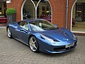 Ferrari 458 - geograph.org.uk - 4973340.jpg 1,600 × 1,200; 675 KB
-
 Ferrari 488 at Meridien Modena - geograph.org.uk - 4973332.jpg 1,600 × 1,200; 713 KB
-
 Ferrari 488 GTB, taken 2Feb2020 arp.jpg 4,509 × 3,372; 2.39 MB
-
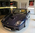 Ferrari 575M - geograph.org.uk - 5005557.jpg 1,600 × 1,493; 460 KB
-
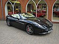 Ferrari California T - geograph.org.uk - 4973355.jpg 1,600 × 1,200; 721 KB
-
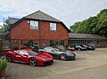 Ferrari dealership, Lyndhurst - geograph.org.uk - 5883511.jpg 1,600 × 1,188; 331 KB
-
 Ferrari Enzo - geograph.org.uk - 4973347.jpg 1,600 × 1,118; 396 KB
-
 Ferrari Enzo - geograph.org.uk - 4973349.jpg 1,600 × 1,267; 476 KB
-
 Ferrari F12 at Meridien Modena - geograph.org.uk - 5005465.jpg 1,600 × 1,200; 623 KB
-
 Ferrari F355 Spider - geograph.org.uk - 5005569.jpg 1,600 × 1,200; 425 KB
-
 Ferrari F430 Spider - geograph.org.uk - 5005543.jpg 1,600 × 1,200; 603 KB
-
 Ferraris and a Lamborghini - geograph.org.uk - 5882191.jpg 1,600 × 1,034; 321 KB
-

-
 Fields west of Pinkney Lane - geograph.org.uk - 6084216.jpg 1,024 × 683; 268 KB
-
 First steps - geograph.org.uk - 763396.jpg 640 × 480; 88 KB
-
 Foldsgate Inclosure, embankment ^ ditch - geograph.org.uk - 4305600.jpg 1,024 × 768; 287 KB
-

-
 Ford at Warwick Slade - geograph.org.uk - 5113877.jpg 1,440 × 960; 2.56 MB
-
 Forest Cottage, Lyndhurst - geograph.org.uk - 2991846.jpg 1,024 × 712; 835 KB
-
 Forest cycleway - geograph.org.uk - 5811035.jpg 1,600 × 1,200; 768 KB
-
 Forest keeper's cottage - geograph.org.uk - 4374221.jpg 640 × 427; 94 KB
-
 Forest lawn - geograph.org.uk - 3722653.jpg 1,600 × 1,200; 583 KB
-
 Forest lawn at Clayhill Heath - geograph.org.uk - 5815321.jpg 1,024 × 683; 263 KB
-
 Forest Lodge Hotel. Lyndhurst - geograph.org.uk - 1299853.jpg 640 × 480; 91 KB
-
 Forest track at Park Hill - geograph.org.uk - 4722518.jpg 640 × 427; 131 KB
-
 Former Hotel - geograph.org.uk - 6269043.jpg 5,184 × 3,456; 987 KB
-
 Former Hotel - geograph.org.uk - 6269044.jpg 5,184 × 3,456; 929 KB
-
 Former Lyndhurst Park Hotel - geograph.org.uk - 5882204.jpg 1,600 × 1,132; 261 KB
-
 Former Lyndhurst Park Hotel - geograph.org.uk - 6217949.jpg 1,600 × 1,067; 262 KB
-
 Former sand pit on Parkhill - geograph.org.uk - 3467366.jpg 1,500 × 1,000; 222 KB
-
 Foxlease turning at Goose Green - geograph.org.uk - 3429563.jpg 640 × 476; 94 KB
-
 Frost in the Forest - geograph.org.uk - 3298156.jpg 1,600 × 1,200; 610 KB
-
 Frosty morning in the New Forest - geograph.org.uk - 3298165.jpg 1,600 × 1,202; 474 KB
-
 Garden by Romsey Road, Lyndhurst - geograph.org.uk - 6288647.jpg 1,888 × 1,230; 1.53 MB
-

-
 Gosport Lane - High Street - geograph.org.uk - 4925176.jpg 640 × 480; 70 KB
-
 Gosport Lane at car park entrance - geograph.org.uk - 3429552.jpg 640 × 443; 82 KB
-
 Gosport Lane before the road divides - geograph.org.uk - 3429556.jpg 640 × 424; 75 KB
-
 Grass corridor, Lyndhurst - geograph.org.uk - 5584714.jpg 640 × 480; 191 KB
-
 Grave of Mrs Reginald Hargreaves - geograph.org.uk - 2202120.jpg 413 × 640; 209 KB
-
 Green by Gosport Lane - geograph.org.uk - 1063573.jpg 640 × 480; 78 KB
-
 Green on Pinkney Lane, Bank - geograph.org.uk - 6289528.jpg 1,892 × 1,236; 1.46 MB
-
 Green on Pinkney Lane, Bank - geograph.org.uk - 6289530.jpg 1,920 × 1,280; 1.96 MB
-

-
 Gritnam, cycle trail - geograph.org.uk - 2686501.jpg 1,024 × 768; 206 KB
-
 Gritnam, ditch - geograph.org.uk - 2686469.jpg 1,024 × 768; 420 KB
-
 Gritnam, gate - geograph.org.uk - 2686457.jpg 1,024 × 768; 392 KB
-
 Gritnam, roadbridge - geograph.org.uk - 2625412.jpg 1,024 × 768; 358 KB
-
 Heather House Guest House - geograph.org.uk - 2602039.jpg 640 × 478; 63 KB
-
 Heavy frost in The New Forest - geograph.org.uk - 3298146.jpg 1,600 × 1,177; 531 KB
-
 High St, Lyndhurst - geograph.org.uk - 2202318.jpg 3,296 × 2,472; 1.79 MB
-
 High St, Lyndhurst, Hampshire, England.jpg 3,734 × 2,717; 3.01 MB
-
 High Street - geograph.org.uk - 6269027.jpg 3,456 × 3,456; 833 KB
-
 High Street - geograph.org.uk - 6269028.jpg 5,184 × 3,456; 1.01 MB
-
 High Street - geograph.org.uk - 6269032.jpg 5,184 × 3,456; 1.07 MB
-
 High Street at entrance to Car Park - geograph.org.uk - 3429549.jpg 640 × 417; 74 KB
-
 High Street Funeral Directors - geograph.org.uk - 5828859.jpg 1,600 × 1,599; 558 KB
-
 High Street, Lyndhurst - geograph.org.uk - 4234413.jpg 640 × 480; 68 KB
-
 High Street, Lyndhurst - geograph.org.uk - 4974958.jpg 1,600 × 1,200; 523 KB
-
 High Street, Lyndhurst - geograph.org.uk - 5005476.jpg 1,600 × 1,200; 616 KB
-
 High Street, Lyndhurst - geograph.org.uk - 5809217.jpg 1,024 × 683; 1.07 MB

_a_classic_car_in_Empress_Road_-_geograph.org.uk_-_2621844.jpg)


_-_geograph.org.uk_-_6191626.jpg)


.jpg)


