Category:Mörsbachgut Donnersbachwald
Jump to navigation
Jump to search
| Object location | | View all coordinates using: OpenStreetMap |
|---|
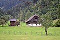
| This category shows the protected monument with the number 27601 in Austria. (Commons, de, Wikidata) |
 | |||||
| Upload media | |||||
| Instance of | |||||
|---|---|---|---|---|---|
| Location | Irdning-Donnersbachtal, Liezen District, Styria, Austria | ||||
| Street address |
| ||||
| Heritage designation | |||||
 | |||||
Media in category "Mörsbachgut Donnersbachwald"
The following 3 files are in this category, out of 3 total.
-
 Mörsbachgut N.jpg 1,920 × 1,440; 769 KB
-
 Mörsbachgut Scheune.jpg 1,920 × 1,440; 939 KB
-
 Mörsbachgut.jpg 1,920 × 1,280; 871 KB

