Category:Müngerstock
Jump to navigation
Jump to search
| Object location | | View all coordinates using: OpenStreetMap |
|---|
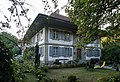
residential building in Schüpfen in the canton of Bern, Switzerland .jpg) | |||||
| Upload media | |||||
| Instance of | |||||
|---|---|---|---|---|---|
| Part of | |||||
| Location | Schüpfen, Seeland administrative district, Seeland administrative region, Bern, Switzerland | ||||
| Street address |
| ||||
| Commissioned by |
| ||||
| Heritage designation | |||||
| Inception |
| ||||
 | |||||
Media in category "Müngerstock"
The following 4 files are in this category, out of 4 total.
-
 Müngerstock (1).jpg 5,710 × 3,901; 13.98 MB
-
 Müngerstock (2).jpg 6,000 × 4,000; 13.33 MB
-
 Müngerstock (3).jpg 6,000 × 4,000; 13.23 MB
-
 Müngerstock (4).jpg 6,000 × 4,000; 10.64 MB
.jpg)
.jpg)
.jpg)