Category:M A Reinaldaweg 19, Linschoten
Jump to navigation
Jump to search
| Object location | | View all coordinates using: OpenStreetMap |
|---|
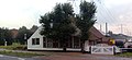
farmhouse in Montfoort, Netherlands  | |||||
| Upload media | |||||
| Instance of | |||||
|---|---|---|---|---|---|
| Location | Linschoten, Utrecht, Netherlands | ||||
| Street address |
| ||||
| Located on street |
| ||||
| Heritage designation |
| ||||
 | |||||
|
This is a category about rijksmonument number 25987
|
| Address |
|
Media in category "M A Reinaldaweg 19, Linschoten"
The following 4 files are in this category, out of 4 total.
-
 25987-MAR19-0117.jpg 2,044 × 947; 1.27 MB
-
 25987-MAR19-0118.jpg 1,803 × 819; 1.01 MB
-
 25987-MAR19-0119.jpg 2,042 × 1,003; 473 KB
-
 Aanzicht - Linschoten - 20140671 - RCE.jpg 1,200 × 800; 231 KB


