Category:Macosquin
Jump to navigation
Jump to search
village in United Kingdom  | |||||
| Upload media | |||||
| Instance of | |||||
|---|---|---|---|---|---|
| Location | Northern Ireland | ||||
 | |||||
English: Macosquin is a small village in County Londonderry, Northern Ireland, 4 kilometres (2.5 miles) south-west of Coleraine, on the road to Limavady. In the 2001 Census it had a population of 596 people. It lies within the Coleraine Borough Council area. The area is known for its underground caves and springs.
Media in category "Macosquin"
The following 31 files are in this category, out of 31 total.
-
 Ballinrees Reservoir - geograph.org.uk - 812552.jpg 640 × 480; 118 KB
-
 Ballinrees reservoir - geograph.org.uk - 812558.jpg 640 × 480; 88 KB
-
 Farm Building near Ringsend - geograph.org.uk - 767200.jpg 640 × 479; 97 KB
-

-
 Macosquin, the post office - geograph.org.uk - 5075350.jpg 640 × 480; 65 KB
-
 Near Mascosquin - geograph.org.uk - 529700.jpg 640 × 479; 51 KB
-

-
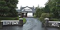 The Bushtown Hotel. - geograph.org.uk - 496425.jpg 640 × 319; 97 KB
-
 Ballinrees Orange Hall - geograph.org.uk - 528907.jpg 640 × 281; 27 KB
-
 Ballycanon Townland - geograph.org.uk - 802289.jpg 640 × 479; 81 KB
-
 Ballynacanon Townland - geograph.org.uk - 802236.jpg 640 × 479; 58 KB
-
 Ballynacanon Townland - geograph.org.uk - 802241.jpg 640 × 479; 60 KB
-
 Ballynacanon Townland - geograph.org.uk - 802243.jpg 640 × 479; 50 KB
-
 Ballynacanon Townland - geograph.org.uk - 802256.jpg 640 × 478; 68 KB
-
 Ballynacanon Townland - geograph.org.uk - 802264.jpg 640 × 479; 73 KB
-
 Ballynacanon Townland - geograph.org.uk - 802297.jpg 640 × 479; 65 KB
-
 Ballystrone Townland - geograph.org.uk - 802096.jpg 640 × 479; 71 KB
-
 Ballystrone Townland - geograph.org.uk - 802207.jpg 640 × 479; 58 KB
-
 Ballyvennox Townland - geograph.org.uk - 802174.jpg 640 × 479; 78 KB
-
 Ballyvennox Townland - geograph.org.uk - 802175.jpg 640 × 479; 67 KB
-
 Cashel Road - geograph.org.uk - 767182.jpg 640 × 479; 72 KB
-
 Cashel Road - geograph.org.uk - 767191.jpg 640 × 479; 60 KB
-
 Cashel Townland - geograph.org.uk - 767194.jpg 640 × 479; 77 KB
-
 Craignashinny Townland - geograph.org.uk - 767172.jpg 640 × 479; 68 KB
-
 Croghan Townland - geograph.org.uk - 767081.jpg 640 × 479; 51 KB
-
 Lane at Letterloan - geograph.org.uk - 767154.jpg 640 × 479; 69 KB
-
 Letterloan Townland - geograph.org.uk - 767152.jpg 640 × 479; 47 KB
-
 Lismurphy Townland - geograph.org.uk - 529616.jpg 640 × 479; 68 KB
-
 Near Dunderg - geograph.org.uk - 550262.jpg 640 × 479; 69 KB
-

-
 Road at Lismurphy - geograph.org.uk - 529619.jpg 640 × 479; 58 KB


