Category:Madison County, North Carolina
Jump to navigation
Jump to search
English: This page contains media related to Madison County, North Carolina.
Counties of North Carolina: Alamance · Alexander · Alleghany · Anson · Ashe · Avery · Beaufort · Bertie · Bladen · Brunswick · Buncombe · Burke · Cabarrus · Caldwell · Camden · Carteret · Caswell · Catawba · Chatham · Cherokee · Chowan · Clay · Cleveland · Columbus · Craven · Cumberland · Currituck · Dare · Davidson · Davie · Duplin · Durham · Edgecombe · Forsyth · Franklin · Gaston · Gates · Graham · Granville · Greene · Guilford · Halifax · Harnett · Haywood · Henderson · Hertford · Hoke · Hyde · Iredell · Jackson · Johnston · Jones · Lee · Lenoir · Lincoln · Macon · Madison · Martin · McDowell · Mecklenburg · Mitchell · Montgomery · Moore · Nash · New Hanover · Northampton · Onslow · Orange · Pamlico · Pasquotank · Pender · Perquimans · Person · Pitt · Polk · Randolph · Richmond · Robeson · Rockingham · Rowan · Rutherford · Sampson · Scotland · Stanly · Stokes · Surry · Swain · Transylvania · Tyrrell · Union · Vance · Wake · Warren · Washington · Watauga · Wayne · Wilkes · Wilson · Yadkin · Yancey
county in North Carolina, United States   | |||||
| Upload media | |||||
| Instance of | |||||
|---|---|---|---|---|---|
| Named after | |||||
| Location | North Carolina | ||||
| Capital | |||||
| Inception |
| ||||
| Population |
| ||||
| Area |
| ||||
| Different from | |||||
| official website | |||||
 | |||||
Subcategories
This category has the following 16 subcategories, out of 16 total.
B
- Bull Creek, North Carolina (8 F)
C
H
- Hot Springs, North Carolina (161 F)
L
- Little Pine Garnet Mine (3 F)
M
N
P
S
- Spring Creek, North Carolina (79 F)
Media in category "Madison County, North Carolina"
The following 200 files are in this category, out of 261 total.
(previous page) (next page)-

-
 Almandine garnet (Madison County, North Carolina, USA) 1.jpg 2,465 × 2,318; 3.63 MB
-
 Almandine garnet (Madison County, North Carolina, USA) 2.jpg 2,387 × 2,589; 4.26 MB
-
 Barnard Bridge, Barnard, NC (50527932198).jpg 4,032 × 3,024; 6.27 MB
-
 Barnard Bridge, Barnard, NC (50527932648).jpg 3,024 × 4,032; 5.81 MB
-
 Barnard Bridge, Barnard, NC (50527957183).jpg 4,032 × 3,024; 5.78 MB
-
 Barnard Road Crossing, Barnard, NC (50527941638).jpg 4,032 × 3,024; 9.5 MB
-
 Barnard Road Crossing, Barnard, NC (50527943873).jpg 3,024 × 4,032; 6.84 MB
-
 Barnard Road Crossing, Barnard, NC (50528658521).jpg 4,032 × 3,024; 8.1 MB
-
 Barnard Road Crossing, Barnard, NC (50528660701).jpg 4,032 × 3,024; 5.85 MB
-
 Barnard Road Crossing, Barnard, NC (50528661981).jpg 4,032 × 3,024; 6.96 MB
-
 Barnard Road Crossing, Barnard, NC (50528666881).jpg 4,032 × 3,024; 7.73 MB
-
 Barnard Road Crossing, Barnard, NC (50528667546).jpg 3,024 × 4,032; 8.75 MB
-
 Barnard Road Crossing, Barnard, NC (50528817507).jpg 4,032 × 3,024; 7.37 MB
-
 Barnard Road Crossing, Barnard, NC (50528821622).jpg 3,024 × 4,032; 8.29 MB
-
 Barnard Road Crossing, Barnard, NC (50528822122).jpg 3,024 × 4,032; 7.57 MB
-
 Barnard Road Crossing, Barnard, NC (50528825112).jpg 3,024 × 4,032; 7.84 MB
-
 Barnard Road Crossing, Barnard, NC (50528826927).jpg 4,032 × 3,024; 7.22 MB
-
 Barnard Road, Walnut, NC (50527924358).jpg 3,024 × 4,032; 4.15 MB
-
 Barnard Road, Walnut, NC (50527924653).jpg 4,464 × 3,348; 4.73 MB
-
 Barnard Road, Walnut, NC (50527925313).jpg 4,048 × 5,398; 7.77 MB
-
 Barnard Road, Walnut, NC (50527926123).jpg 3,221 × 2,416; 5 MB
-
 Barnard Road, Walnut, NC (50527926603).jpg 3,024 × 4,032; 5.82 MB
-
 Barnard Road, Walnut, NC (50527928728).jpg 2,396 × 3,194; 4.39 MB
-
 Barnard Road, Walnut, NC (50527929113).jpg 3,221 × 2,416; 5.5 MB
-
 Barnard Road, Walnut, NC (50527929763).jpg 3,024 × 4,032; 5.67 MB
-
 Barnard Road, Walnut, NC (50527930923).jpg 4,032 × 3,024; 7.29 MB
-
 Barnard Road, Walnut, NC (50527957623).jpg 2,606 × 3,475; 4.91 MB
-
 Barnard Road, Walnut, NC (50527964533).jpg 4,032 × 3,024; 6.7 MB
-
 Barnard Road, Walnut, NC (50528650071).jpg 3,824 × 2,868; 6.29 MB
-
 Barnard Road, Walnut, NC (50528650446).jpg 3,024 × 4,032; 5.28 MB
-
 Barnard Road, Walnut, NC (50528651141).jpg 3,588 × 4,784; 5.86 MB
-
 Barnard Road, Walnut, NC (50528691516).jpg 3,363 × 4,481; 6.33 MB
-
 Barnard Road, Walnut, NC (50528806827).jpg 3,632 × 2,724; 4.36 MB
-
 Barnard Road, Walnut, NC (50528808637).jpg 3,701 × 2,776; 3.72 MB
-
 Barnard Road, Walnut, NC (50528808812).jpg 2,685 × 3,580; 3.07 MB
-
 Barnard Road, Walnut, NC (50528809892).jpg 3,024 × 4,032; 5.94 MB
-
 Barnard Road, Walnut, NC (50528810442).jpg 3,233 × 4,311; 7.6 MB
-
 Barnard Road, Walnut, NC (50528811167).jpg 4,032 × 3,024; 9.27 MB
-
 Barnard Road, Walnut, NC (50528812907).jpg 4,032 × 3,024; 4.66 MB
-
 Barnard Road, Walnut, NC (50528841357).jpg 4,032 × 3,024; 8.11 MB
-
 Barnard Road, Walnut, NC (50528842247).jpg 3,067 × 2,300; 3.54 MB
-
 Barnard Road, Walnut, NC (50528844602).jpg 4,032 × 3,024; 4.47 MB
-
 Barnard Road, Walnut, NC (50528848402).jpg 4,032 × 3,024; 5.97 MB
-
 Black Well Road, Barnard, NC (50527947893).jpg 4,803 × 3,597; 6.67 MB
-
 Black Well Road, Barnard, NC (50528672921).jpg 3,024 × 4,032; 4.83 MB
-
 Black Well Road, Barnard, NC (50528674931).jpg 2,580 × 3,440; 5.45 MB
-
 Black Well Road, Barnard, NC (50528677361).jpg 3,024 × 4,032; 5.66 MB
-
 Black Well Road, Barnard, NC (50528677916).jpg 3,716 × 2,788; 5.16 MB
-
 Black Well Road, Barnard, NC (50528828397).jpg 4,032 × 3,024; 6.63 MB
-
 Black Well Road, Barnard, NC (50528830707).jpg 3,175 × 2,381; 4.12 MB
-
 Black Well Road, Barnard, NC (50528831077).jpg 2,826 × 3,775; 3.63 MB
-
 Black Well Road, Barnard, NC (50528831362).jpg 3,772 × 2,832; 4.18 MB
-
 Blue folds (Unsplash).jpg 4,608 × 3,072; 1.08 MB
-
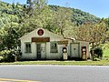
 Dave’s 209 Cafe Sign, Old Spring Creek School, Spring Creek, NC (50550815388).jpg 3,024 × 4,032; 5.06 MB
-

-
 Dave’s 209 Cafe Sign, Old Spring Creek School, Spring Creek, NC (50550818948).jpg 3,024 × 4,032; 3.66 MB
-
 Dave’s 209 Cafe Sign, Old Spring Creek School, Spring Creek, NC (50551549006).jpg 4,032 × 3,024; 5.27 MB
-

-

-
 Fall Sunsets.jpg 3,264 × 2,448; 2.66 MB
-

-

-
 Flats of Spring Creek Missionary Baptist Church, Spring Creek, NC (50550832013).jpg 3,024 × 4,032; 4.36 MB
-
 Flats of Spring Creek Missionary Baptist Church, Spring Creek, NC (50550834513).jpg 3,050 × 2,285; 2.54 MB
-
 Flats of Spring Creek Missionary Baptist Church, Spring Creek, NC (50551568371).jpg 2,655 × 3,540; 3.03 MB
-
 Flats of Spring Creek Missionary Baptist Church, Spring Creek, NC (50551693827).jpg 4,032 × 3,024; 5.02 MB
-
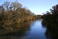 French broad river 9228.JPG 1,997 × 1,331; 1.2 MB
-
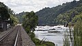 French Broad River at Marshall, North Carolina 1.jpg 5,472 × 3,078; 11.03 MB
-
 French Broad River at Marshall, North Carolina 2.jpg 5,213 × 3,475; 11.97 MB
-

-
 Hiking man in green field (Unsplash).jpg 2,500 × 1,667; 4.04 MB
-
 Historical Marker, Jewell Hill Cemetery, Walnut, NC (50528741711).jpg 3,024 × 4,032; 7.81 MB
-
 Interior of Mountain Farmhouse.jpg 1,024 × 748; 248 KB
-
 Irwin's-chapel-log-church-tn-nc1.jpg 2,041 × 1,529; 1.14 MB
-
 Jewell Hill Cemetery, Walnut, NC (50527998038).jpg 4,032 × 3,024; 6.62 MB
-
 Jewell Hill Cemetery, Walnut, NC (50527999898).jpg 4,032 × 3,024; 7.39 MB
-
 Jewell Hill Cemetery, Walnut, NC (50528725796).jpg 4,032 × 3,024; 8.09 MB
-
 Jewell Hill Cemetery, Walnut, NC (50528731561).jpg 4,032 × 3,024; 6.6 MB
-
 Jewell Hill Cemetery, Walnut, NC (50528896532).jpg 4,032 × 3,024; 7.05 MB
-
 Lemon-gap-appalachian-trail-tnnc1.jpg 2,048 × 1,536; 1.81 MB
-
 Madison County Board of Commissioners meeting, January 2018.jpg 754 × 320; 42 KB
-
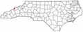
 Map of North Carolina highlighting Madison County.svg 8,061 × 3,056; 236 KB
-
 Mary Sands c. 1920.jpg 1,487 × 1,879; 986 KB
-
 Max Patch Mountain, Del Rio (Unsplash).jpg 2,500 × 1,667; 3.51 MB
-
 Max Patch Mountain, Del Rio, United States (Unsplash).jpg 4,608 × 3,072; 1.24 MB
-
 Max Patch, United States (Unsplash qBX6EMdy0a4).jpg 5,760 × 3,840; 9.35 MB
-
 Meadow Fork Bridge on North Carolina State Highway 209, Bluff, NC (50528023678).jpg 4,032 × 3,024; 7.06 MB
-
 Meadow Fork Bridge on North Carolina State Highway 209, Bluff, NC (50528747676).jpg 4,028 × 5,366; 9.32 MB
-
 Meadow Fork Bridge on North Carolina State Highway 209, Bluff, NC (50528748421).jpg 4,032 × 3,024; 6.58 MB
-
 Meadow Fork Bridge on North Carolina State Highway 209, Bluff, NC (50528751106).jpg 3,024 × 4,032; 6.95 MB
-
 Meadow Fork Bridge on North Carolina State Highway 209, Bluff, NC (50528900247).jpg 4,032 × 3,024; 6.47 MB
-
 Meadow Fork Road and North Carolina State Highway 209, Bluff, NC (50528036333).jpg 3,024 × 4,032; 8.72 MB
-
 Meadow Fork Road and North Carolina State Highway 209, Bluff, NC (50528041843).jpg 4,032 × 3,024; 9.85 MB
-
 Meadow Fork Road and North Carolina State Highway 209, Bluff, NC (50528042453).jpg 4,032 × 3,024; 6.49 MB
-
 Meadow Fork Road and North Carolina State Highway 209, Bluff, NC (50528043758).jpg 3,024 × 4,032; 6.04 MB
-
 Meadow Fork Road and North Carolina State Highway 209, Bluff, NC (50528753551).jpg 4,032 × 3,024; 10.44 MB
-
 Meadow Fork Road and North Carolina State Highway 209, Bluff, NC (50528754641).jpg 3,621 × 4,828; 11.27 MB
-
 Meadow Fork Road and North Carolina State Highway 209, Bluff, NC (50528754946).jpg 3,024 × 4,032; 6.68 MB
-
 Meadow Fork Road and North Carolina State Highway 209, Bluff, NC (50528761161).jpg 4,032 × 3,024; 9.8 MB
-
 Meadow Fork Road and North Carolina State Highway 209, Bluff, NC (50528767866).jpg 3,146 × 4,196; 7.63 MB
-
 Meadow Fork Road and North Carolina State Highway 209, Bluff, NC (50528911237).jpg 4,032 × 3,024; 7.57 MB
-
 Meadow Fork Road and North Carolina State Highway 209, Bluff, NC (50528927132).jpg 4,032 × 3,024; 7.03 MB
-

-

-

-

-

-

-

-

-

-

-

-

-

-

-
 NCMap-doton-HotSprings.PNG 300 × 117; 9 KB
-

-
 North Carolina State Highway 209, Luck, NC (50550849503).jpg 4,032 × 3,024; 6.56 MB
-
 North Carolina State Highway 209, Luck, NC (50550851718).jpg 4,032 × 3,024; 7.66 MB
-
 North Carolina State Highway 209, Luck, NC (50550852403).jpg 4,032 × 3,024; 6.21 MB
-
 North Carolina State Highway 209, Luck, NC (50551584406).jpg 3,691 × 2,768; 5.82 MB
-
 North Carolina State Highway 209, Luck, NC (50551710377).jpg 4,032 × 3,024; 8.04 MB
-
 North Carolina State Highway 209, Luck, NC (50551710957).jpg 4,032 × 3,024; 6.49 MB
-
 North Carolina State Highway 209, Luck, NC (50551711982).jpg 3,140 × 4,186; 7.62 MB
-
 North Carolina State Highway 209, Luck, NC (50551712882).jpg 3,024 × 4,032; 7.04 MB
-
 North Carolina State Highway 209, Luck, NC (50551713797).jpg 3,024 × 4,032; 6.61 MB
-
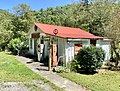
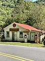
 Old Caldwell Store, Meadow Fork Road, Bluff, NC (50528029658).jpg 3,024 × 4,032; 4.27 MB
-
 Old Caldwell Store, Meadow Fork Road, Bluff, NC (50528029913).jpg 3,024 × 4,032; 4.25 MB
-
 Old Caldwell Store, Meadow Fork Road, Bluff, NC (50528030948).jpg 5,470 × 4,106; 7.44 MB
-
 Old Caldwell Store, Meadow Fork Road, Bluff, NC (50528752281).jpg 3,464 × 4,615; 7.93 MB
-
 Old Caldwell Store, Meadow Fork Road, Bluff, NC (50528755791).jpg 3,024 × 4,032; 6.35 MB
-
 Old Caldwell Store, Meadow Fork Road, Bluff, NC (50528756086).jpg 4,273 × 3,205; 3.31 MB
-
 Old Caldwell Store, Meadow Fork Road, Bluff, NC (50528757261).jpg 4,032 × 3,024; 6.32 MB
-
 Old Caldwell Store, Meadow Fork Road, Bluff, NC (50528759466).jpg 3,024 × 4,032; 5.28 MB
-
 Old Caldwell Store, Meadow Fork Road, Bluff, NC (50528766811).jpg 3,024 × 4,032; 7.43 MB
-
 Old Caldwell Store, Meadow Fork Road, Bluff, NC (50528767296).jpg 4,032 × 3,024; 7.83 MB
-
 Old Caldwell Store, Meadow Fork Road, Bluff, NC (50528771516).jpg 3,556 × 2,666; 5.51 MB
-
 Old Caldwell Store, Meadow Fork Road, Bluff, NC (50528908567).jpg 4,032 × 3,024; 5.49 MB
-
 Old Caldwell Store, Meadow Fork Road, Bluff, NC (50528920752).jpg 4,032 × 3,024; 8.21 MB
-
 Old Caldwell Store, Meadow Fork Road, Bluff, NC (50528921882).jpg 4,808 × 3,606; 9.12 MB
-
 Old Caldwell Store, Meadow Fork Road, Bluff, NC (50528925917).jpg 3,024 × 4,032; 8.14 MB
-
-
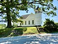
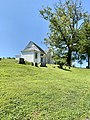
 Old Walnut Methodist Church, Jewell Hill Cemetery, Walnut, NC (50527997528).jpg 2,852 × 3,803; 4.1 MB
-
 Old Walnut Methodist Church, Jewell Hill Cemetery, Walnut, NC (50527998908).jpg 3,024 × 4,032; 5.2 MB
-
 Old Walnut Methodist Church, Jewell Hill Cemetery, Walnut, NC (50528000358).jpg 3,190 × 2,392; 2.76 MB
-
 Old Walnut Methodist Church, Jewell Hill Cemetery, Walnut, NC (50528003973).jpg 4,032 × 3,024; 5.32 MB
-
 Old Walnut Methodist Church, Jewell Hill Cemetery, Walnut, NC (50528006888).jpg 3,024 × 4,032; 3.37 MB
-
 Old Walnut Methodist Church, Jewell Hill Cemetery, Walnut, NC (50528008968).jpg 3,024 × 4,032; 6.17 MB
-
 Old Walnut Methodist Church, Jewell Hill Cemetery, Walnut, NC (50528009333).jpg 4,032 × 3,024; 4.54 MB
-
 Old Walnut Methodist Church, Jewell Hill Cemetery, Walnut, NC (50528010373).jpg 4,032 × 3,024; 7.45 MB
-
 Old Walnut Methodist Church, Jewell Hill Cemetery, Walnut, NC (50528015048).jpg 3,419 × 4,559; 4.99 MB
-
 Old Walnut Methodist Church, Jewell Hill Cemetery, Walnut, NC (50528015373).jpg 3,816 × 2,858; 3.14 MB
-
 Old Walnut Methodist Church, Jewell Hill Cemetery, Walnut, NC (50528727286).jpg 2,371 × 3,161; 2.81 MB
-
 Old Walnut Methodist Church, Jewell Hill Cemetery, Walnut, NC (50528730551).jpg 2,858 × 3,816; 5.39 MB
-
 Old Walnut Methodist Church, Jewell Hill Cemetery, Walnut, NC (50528732756).jpg 3,197 × 4,263; 3.52 MB
-
 Old Walnut Methodist Church, Jewell Hill Cemetery, Walnut, NC (50528735456).jpg 3,416 × 4,557; 5.17 MB
-
 Old Walnut Methodist Church, Jewell Hill Cemetery, Walnut, NC (50528736856).jpg 3,024 × 4,032; 6.28 MB
-
 Old Walnut Methodist Church, Jewell Hill Cemetery, Walnut, NC (50528882052).jpg 4,032 × 3,024; 4.45 MB
-
 Old Walnut Methodist Church, Jewell Hill Cemetery, Walnut, NC (50528888787).jpg 3,222 × 4,296; 2.88 MB
-
 Old Walnut Methodist Church, Jewell Hill Cemetery, Walnut, NC (50528889742).jpg 4,159 × 3,119; 3.23 MB
-
 Old Walnut Methodist Church, Jewell Hill Cemetery, Walnut, NC (50528890417).jpg 3,024 × 4,032; 3.04 MB
-
 Old Walnut Methodist Church, Jewell Hill Cemetery, Walnut, NC (50528890752).jpg 4,794 × 3,596; 4.99 MB
-

-

-

-

-

-

-
-

-

-
-

-

-

-

-

-

-

-

-

-
-
 Playground, Old Spring Creek School, Spring Creek, NC (50551687912).jpg 3,744 × 2,808; 6.11 MB
-
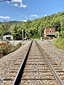
 Railroad Tracks, Barnard, NC (50527946953).jpg 3,024 × 4,032; 6.01 MB
-
 Railroad Tracks, Barnard, NC (50527950368).jpg 4,032 × 3,024; 6.9 MB
-
 Railroad Tracks, Barnard, NC (50528676386).jpg 3,024 × 4,032; 5.5 MB
-
 Railroad Tracks, Barnard, NC (50528829607).jpg 4,032 × 3,024; 6.69 MB
-

-
 School Road, Walnut, NC (50527980328).jpg 3,024 × 4,032; 7.15 MB
-
 School Road, Walnut, NC (50527981538).jpg 4,032 × 3,024; 6.79 MB
-
 School Road, Walnut, NC (50527982258).jpg 3,547 × 2,660; 5.25 MB
-
 School Road, Walnut, NC (50527982823).jpg 3,024 × 4,032; 6.87 MB
-
 School Road, Walnut, NC (50528707501).jpg 3,024 × 4,032; 6.58 MB
-
 School Road, Walnut, NC (50528709986).jpg 4,007 × 5,344; 9.53 MB
-
 School Road, Walnut, NC (50528710536).jpg 3,436 × 4,582; 7.46 MB
-
 School Road, Walnut, NC (50528710981).jpg 4,032 × 3,024; 6.68 MB
-
 School Road, Walnut, NC (50528713771).jpg 3,024 × 4,032; 8.02 MB
-
 School Road, Walnut, NC (50528721896).jpg 4,032 × 3,024; 6.82 MB

_1.jpg)
_2.jpg)
.jpg)
.jpg)
.jpg)
.jpg)
.jpg)
.jpg)
.jpg)
.jpg)
.jpg)
.jpg)
.jpg)
.jpg)
.jpg)
.jpg)
.jpg)
.jpg)
.jpg)
.jpg)
.jpg)
.jpg)
.jpg)
.jpg)
.jpg)
.jpg)
.jpg)
.jpg)
.jpg)
.jpg)
.jpg)
.jpg)
.jpg)
.jpg)
.jpg)
.jpg)
.jpg)
.jpg)
.jpg)
.jpg)
.jpg)
.jpg)
.jpg)
.jpg)
.jpg)
.jpg)
.jpg)
.jpg)
.jpg)
.jpg)
.jpg)
.jpg)
.jpg)
.jpg)
.jpg)
.jpg)
.jpg)

.jpg)
.jpg)
.jpg)
.jpg)


.jpg)
.jpg)


.jpg)
.jpg)
.jpg)
.jpg)
.jpg)


.jpg)
.jpg)
.jpg)
.jpg)
.jpg)
.jpg)
.jpg)
.jpg)
.jpg)
.jpg)
.jpg)
.jpg)
.jpg)
.jpg)
.jpg)
.jpg)
.jpg)
.jpg)
.jpg)
,_Barnard_Road,_Barnard,_NC_(50527933593).jpg)
,_Barnard_Road,_Barnard,_NC_(50527937503).jpg)
,_Barnard_Road,_Barnard,_NC_(50527942138).jpg)
,_Barnard_Road,_Barnard,_NC_(50528659741).jpg)
,_Barnard_Road,_Barnard,_NC_(50528660021).jpg)
,_Barnard_Road,_Barnard,_NC_(50528662311).jpg)
,_Barnard_Road,_Barnard,_NC_(50528662631).jpg)
,_Barnard_Road,_Barnard,_NC_(50528663806).jpg)
,_Barnard_Road,_Barnard,_NC_(50528664866).jpg)
,_Barnard_Road,_Barnard,_NC_(50528817097).jpg)
,_Barnard_Road,_Barnard,_NC_(50528819402).jpg)
,_Barnard_Road,_Barnard,_NC_(50528821157).jpg)
,_Barnard_Road,_Barnard,_NC_(50528825952).jpg)
.jpg)
.jpg)
.jpg)
.jpg)
.jpg)
.jpg)
.jpg)
.jpg)
.jpg)
.jpg)
.jpg)
.jpg)
.jpg)
.jpg)
.jpg)
.jpg)
.jpg)
.jpg)
.jpg)
.jpg)
.jpg)
.jpg)
.jpg)
.jpg)
,_School_Drive,_Walnut,_NC_(50527968528).jpg)
.jpg)
.jpg)
.jpg)
.jpg)
.jpg)
.jpg)
.jpg)
.jpg)
.jpg)
.jpg)
.jpg)
.jpg)
.jpg)
.jpg)
.jpg)
.jpg)
.jpg)
.jpg)
.jpg)
.jpg)
.jpg)
.jpg)
.jpg)
.jpg)
.jpg)
.jpg)
.jpg)
.jpg)
.jpg)
.jpg)
.jpg)
.jpg)
.jpg)
.jpg)
.jpg)
.jpg)
.jpg)
.jpg)
.jpg)
.jpg)
.jpg)
.jpg)
.jpg)
.jpg)
.jpg)
,_School_Road,_Walnut,_NC_(50527993473).jpg)
.jpg)
.jpg)
.jpg)
.jpg)
.jpg)
.jpg)
.jpg)
.jpg)
.jpg)
.jpg)