Category:Magor, Monmouthshire
Jump to navigation
Jump to search
large village in Monmouthshire, south east Wales, UK  | |||||
| Upload media | |||||
| Instance of | |||||
|---|---|---|---|---|---|
| Location | Monmouthshire, Wales | ||||
| Population |
| ||||
 | |||||
Cymraeg: Pentref yn Sir Fynwy rhwng Cil-y-Coed a Chasnewydd yw Magwyr (Saesneg: Magor). Lleolir Gwarchodfa Natur Cors Magwyr gerllaw.
English: Magor - meaning 'a wall' - is a large village in Monmouthshire, south east Wales, between Chepstow and the city of Newport, and adjoining the Caldicot Levels beside the Severn estuary. Magor lies close to the M4 motorway, which has a nearby motorway service area sharing its name. It is within the commuter belts of Newport, Bristol and Cardiff.
Subcategories
This category has the following 3 subcategories, out of 3 total.
M
- Magor railway station (13 F)
- Magor services (34 F)
Media in category "Magor, Monmouthshire"
The following 72 files are in this category, out of 72 total.
-
 150 239 with a 156 in tow heads through Magor.jpg 4,153 × 2,437; 1.72 MB
-
 43191 at Magor - no sign of electrification, yet!.jpg 5,472 × 3,648; 2.92 MB
-
 60 017 leads a Theale-Robeston discharged Murco tanks train through Magor.jpg 1,597 × 1,167; 337 KB
-

-
 66 161 passes Magor with the Moreton-on-Lugg to Hayes & Harlington stone empties.jpg 2,656 × 2,656; 1.35 MB
-
 66 171 leading Heathcote siding to Moreton on Lugg Tarmac hoppers at Magor.jpg 1,271 × 887; 209 KB
-
 66 523 Magor.jpg 4,921 × 2,791; 2.8 MB
-
 6V05 Round Oak-Margam bogie steel carriers passes Magor 13th June 2012.jpg 1,924 × 1,333; 2.12 MB
-
 Blind young Blue tit and Adult bird.jpg 2,108 × 1,539; 1.47 MB
-
 Bristol-Cardiff services passing Magor - 7189034123.jpg 2,155 × 1,395; 3.03 MB
-
 Bristol-Cardiff services passing Magor.jpg 2,634 × 1,768; 3.75 MB
-
 Cardiff-Portsmouth Class 158 905 THREE power cars.jpg 2,733 × 1,705; 635 KB
-
 Country lane near Llandevenny - geograph.org.uk - 806406.jpg 640 × 426; 84 KB
-

-

-
 DRS 66 303 leads 4V38 Tesco Express from Daventry to Wentloog through Magor.jpg 2,114 × 1,054; 530 KB
-
 Ebenezer Baptist Church, Magor - geograph.org.uk - 2034007.jpg 640 × 480; 68 KB
-
 Ebenezer Baptist Church, Magor - geograph.org.uk - 4862797.jpg 640 × 480; 74 KB
-
 Empty FHH coal hoppers from Uskmouth power station passing Magor - 7374206756.jpg 2,863 × 1,290; 856 KB
-
 Empty FHH coal hoppers from Uskmouth power station passing Magor - 7374207488.jpg 2,760 × 1,545; 1.12 MB
-
 Empty FHH coal hoppers from Uskmouth power station passing Magor.jpg 1,362 × 924; 350 KB
-

-
 Frozen Pond Magor Marsh.jpg 2,560 × 1,920; 1.66 MB
-
 Grade II listed Magor Post Office - geograph.org.uk - 5691093.jpg 800 × 786; 126 KB
-
 Grade II listed Magor War Memorial - geograph.org.uk - 5673097.jpg 800 × 646; 104 KB
-
 House construction, West End, Magor - geograph.org.uk - 2035161.jpg 640 × 530; 77 KB
-
 House in Magor - panoramio.jpg 2,004 × 1,508; 228 KB
-
 Llanwern - Margam empty steel bogie flats passes Magor with 66 047 in charge.jpg 1,541 × 1,729; 609 KB
-
 Llanwern - Margam empty steel bogie flats passes Magor.jpg 1,829 × 1,377; 587 KB
-
 Looking over the fields - panoramio.jpg 2,560 × 1,920; 1.96 MB
-
 M 4 Motorway near Magor - geograph.org.uk - 418845.jpg 640 × 480; 106 KB
-
 Magor Barbers, The Square, Magor - geograph.org.uk - 2034918.jpg 480 × 640; 56 KB
-
 Magor Church.jpg 640 × 481; 52 KB
-
 Magor footbridge with FGW Class 158 units.jpg 2,812 × 1,808; 1.08 MB
-
 Magor footbridge with FGW HST.jpg 3,132 × 1,832; 1.32 MB
-
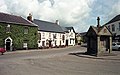
 Magor House, War Memorial, Golden Lion.jpg 2,098 × 1,306; 3.34 MB
-
 Magor Motors - geograph.org.uk - 2033960.jpg 640 × 426; 57 KB
-
 Magor Old School.jpg 1,799 × 1,131; 1.5 MB
-
 Magor Post Office - geograph.org.uk - 2034809.jpg 640 × 483; 71 KB
-
 Magor Post Office 1995.jpg 2,048 × 1,265; 2.93 MB
-
 Magor Square in 1985.jpg 2,098 × 1,306; 1.06 MB
-
 Magor War Memorial - geograph.org.uk - 2034018.jpg 635 × 640; 105 KB
-
 Magor War Memorial.jpg 1,306 × 2,099; 3.12 MB
-
 Magor, postbox No. NP26 917 - geograph.org.uk - 1177546.jpg 480 × 640; 49 KB
-
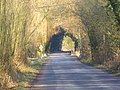 Natural Tunnel - panoramio.jpg 2,560 × 1,920; 3.14 MB
-
 Over the fields - panoramio.jpg 2,560 × 1,920; 2.11 MB
-
 Path from Magor to Llandavenny - panoramio.jpg 600 × 450; 137 KB
-
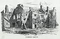 Pencoed Castle (1131015).jpg 1,000 × 647; 145 KB
-
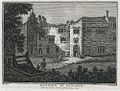 Penhow Castle and Church & Mansion of Pencoed (1129239).jpg 1,000 × 756; 255 KB
-
 Pointing the way to the Meadow in the snow.jpg 2,452 × 1,839; 2.68 MB
-
 Procurator's House, Magor - geograph.org.uk - 2021985.jpg 640 × 480; 88 KB
-
 Procurator's House, Magor.jpg 3,697 × 2,669; 1.14 MB
-
 Reen across Magor Marsh.jpg 4,928 × 3,264; 3.25 MB
-

-
 Scarlet Elf cups.jpg 2,560 × 1,920; 1.72 MB
-
 Snowy fence at Magor.jpg 2,560 × 1,920; 995 KB
-
 Stickleback Sculptures in Winter.jpg 1,801 × 2,316; 2.43 MB
-
 Stickleback sculptures.jpg 3,264 × 4,048; 3.43 MB
-
 The Binker willow sculpture.jpg 2,537 × 4,448; 3.44 MB
-
 The Castle and Old Mansion of Pencoed.jpeg 750 × 568; 204 KB
-
 The Golden Lion, Magor - geograph.org.uk - 2027918.jpg 1,496 × 1,122; 536 KB
-
 The Golden Lion, Magor - geograph.org.uk - 5670961.jpg 800 × 748; 127 KB
-
 The Wheatsheaf Inn, Magor - geograph.org.uk - 2033984.jpg 640 × 579; 79 KB
-
Water Voles at Cynrig-Llygod Dwr yn Cynrig.webm 3 min 37 s, 640 × 360; 21.55 MB
-
 Wheatsheaf Inn, Magor - geograph.org.uk - 2027908.jpg 1,496 × 1,122; 494 KB
-
 Wheatsheaf Inn, The Square, Magor - geograph.org.uk - 5670614.jpg 800 × 529; 97 KB
-
 Wrong-line working at Magor (geograph 6013075).jpg 2,844 × 3,793; 3.22 MB
-
 After the Rain - geograph.org.uk - 350466.jpg 640 × 480; 148 KB
-
 Come Dancing...^ - geograph.org.uk - 418832.jpg 640 × 446; 76 KB
-
 Looking North from the B4245 - geograph.org.uk - 156649.jpg 640 × 481; 33 KB
-
 Magor - geograph.org.uk - 375295.jpg 640 × 480; 90 KB
-
 Road Junction at Knollbury - geograph.org.uk - 418861.jpg 640 × 480; 70 KB


.jpg)
.jpg)


.jpg)


