Category:Maiernigg-Turm
Jump to navigation
Jump to search
Deutsch: Schwarzer Felsen, Mauerreste des ehem. Maiernigg-Turms von anno 1928. Der Holzturm ist im Jahr 1960 niedergebrannt.
| Camera location | | View all coordinates using: OpenStreetMap |
|---|
Media in category "Maiernigg-Turm"
The following 5 files are in this category, out of 5 total.
-
 Der Weiße Turm.jpg 1,800 × 1,200; 740 KB
-
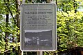
 Infotafel ehem. Maiernigg-Turm und Schwarzer Felsen.jpg 1,512 × 2,016; 2.11 MB
-
 Mauerreste ehem. Maiernigg-Turm, Klagenfurt.jpg 2,016 × 1,512; 2.27 MB
-
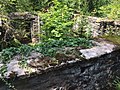 Mauerreste vom ehem. Maiernigg-Turm erbaut 1928.jpg 2,016 × 1,512; 2.22 MB
-
 Reste Maiernigg-Turm am Schwarzen Felsen.jpg 2,016 × 1,512; 2.05 MB


