Category:Maliebaan 12, Utrecht
Jump to navigation
Jump to search
| Object location | | View all coordinates using: OpenStreetMap |
|---|
 | |||||
| Upload media | |||||
| Instance of |
| ||||
|---|---|---|---|---|---|
| Location | Utrecht, Netherlands | ||||
| Street address |
| ||||
| Heritage designation |
| ||||
 | |||||
|
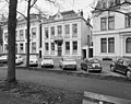
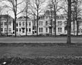
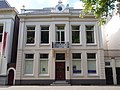
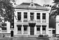
This is a category about rijksmonument number 36326
|
| Address |
|
Media in category "Maliebaan 12, Utrecht"
The following 5 files are in this category, out of 5 total.
-
 Gevel - Utrecht - 20235933 - RCE.jpg 1,200 × 953; 301 KB
-
 Overzicht - Utrecht - 20235934 - RCE.jpg 1,200 × 959; 368 KB
-
 Overzicht - Utrecht - 20235935 - RCE.jpg 1,200 × 966; 335 KB
-
 Rijksmonument-36326.jpg 2,560 × 1,920; 1,021 KB
-
 Voorgevel - Utrecht - 20235932 - RCE.jpg 1,200 × 820; 197 KB


