Category:Maliebaan 26, Utrecht
Jump to navigation
Jump to search
| Object location | | View all coordinates using: OpenStreetMap |
|---|
 | |||||
| Upload media | |||||
| Instance of |
| ||||
|---|---|---|---|---|---|
| Location | Utrecht, Netherlands | ||||
| Street address |
| ||||
| Heritage designation |
| ||||
 | |||||
|
This is a category about rijksmonument number 36332
|
| Address |
|
Media in category "Maliebaan 26, Utrecht"
The following 5 files are in this category, out of 5 total.
-
 Exterieur OVERZICHT VOORGEVELS - Utrecht - 20265617 - RCE.jpg 1,200 × 780; 208 KB
-
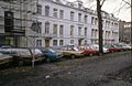
 Overzicht - Utrecht - 20235949 - RCE.jpg 1,200 × 961; 339 KB
-
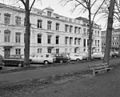 Overzicht - Utrecht - 20235950 - RCE.jpg 1,200 × 967; 299 KB
-
 Overzicht voorzijde huizenblok - Utrecht - 20235948 - RCE.jpg 1,200 × 823; 308 KB
-
 Rijksmonument-36332.jpg 1,920 × 2,560; 963 KB


