Category:Maliebaan 62, Utrecht
Jump to navigation
Jump to search
| Object location | | View all coordinates using: OpenStreetMap |
|---|
 | |||||
| Upload media | |||||
| Instance of |
| ||||
|---|---|---|---|---|---|
| Location | Utrecht, Netherlands | ||||
| Street address |
| ||||
| Heritage designation |
| ||||
 | |||||
|
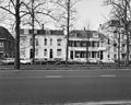
This is a category about rijksmonument number 36338
|
| Address |
|
Media in category "Maliebaan 62, Utrecht"
The following 4 files are in this category, out of 4 total.
-
 Overzicht - Utrecht - 20235959 - RCE.jpg 1,200 × 959; 296 KB
-
 Rijksmonument-36338-b.jpg 2,560 × 1,920; 1,008 KB
-
 Rijksmonument-36338.jpg 1,920 × 2,560; 948 KB
-
 Voorgevels - Utrecht - 20235962 - RCE.jpg 1,200 × 851; 238 KB


