Category:Manordeifi
Jump to navigation
Jump to search
village and community in Pembrokeshire, Wales, UK  L'église Saint-David.  | |||||
| Upload media | |||||
| Pronunciation audio | |||||
|---|---|---|---|---|---|
| Instance of | |||||
| Location | Pembrokeshire, Wales | ||||
| Population |
| ||||
| Area |
| ||||
| official website | |||||
 | |||||
Cymraeg: Pentref bychan yng ngogledd Sir Benfro yw Manordeifi. Saif ar lan ddeheuol Afon Teifi tua hanner ffordd rhwng Castell Newydd Emlyn i'r dwyrain ac Aberteifi i'r gorllewin.
Subcategories
This category has the following 5 subcategories, out of 5 total.
Media in category "Manordeifi"
The following 63 files are in this category, out of 63 total.
-
 2010 Wales Pembrokeshire Community Manordeifi map.svg 512 × 393; 1,018 KB
-
 2024 Wales Pembrokeshire Community Manordeifi map.svg 512 × 393; 1.19 MB
-
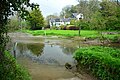
 Abercych - geograph.org.uk - 5723394.jpg 640 × 480; 71 KB
-
 Abercych Ford - geograph.org.uk - 6135441.jpg 3,000 × 2,000; 1.58 MB
-
 Abercych, postbox № SA37 83 - geograph.org.uk - 2029169.jpg 640 × 480; 102 KB
-
 Abercych, the post office - geograph.org.uk - 2029160.jpg 640 × 480; 68 KB
-

-
 Allt Cil-Frychan - geograph.org.uk - 5723408.jpg 640 × 480; 147 KB
-
 B4332 crosses Afon Cych - geograph.org.uk - 2646424.jpg 3,561 × 2,676; 1.41 MB
-
 B4332 leaves Penrhiw - geograph.org.uk - 2646434.jpg 3,283 × 2,483; 1.12 MB
-
 Bridge over Afon Dulais - geograph.org.uk - 3017677.jpg 3,264 × 2,448; 1.48 MB
-
 Bridge over old canal - geograph.org.uk - 1928309.jpg 800 × 600; 186 KB
-
 Car park near the entrance to Ffynone Wood - geograph.org.uk - 1851551.jpg 1,024 × 768; 140 KB
-
 Chapel at Capel Newydd - Newchapel - geograph.org.uk - 3447445.jpg 640 × 480; 64 KB
-
 Chapel at Newchapel - Capel Newydd - geograph.org.uk - 3447456.jpg 640 × 480; 72 KB
-
 Coracle, Manordeifi Old Church - geograph.org.uk - 3831709.jpg 1,920 × 2,560; 1.62 MB
-
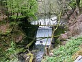 Dam in Ffynone Wood - geograph.org.uk - 1849814.jpg 1,536 × 1,152; 191 KB
-
 Disused quarry near Cwm Morgenau - geograph.org.uk - 1929507.jpg 800 × 600; 145 KB
-
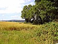 Edge of Gallt Cynhercyn wood, Manordeifi - geograph.org.uk - 898285.jpg 640 × 480; 127 KB
-
 Eisteddfod security - geograph.org.uk - 3817346.jpg 3,264 × 2,448; 2.97 MB
-
 Eisteddfod yr Urdd - geograph.org.uk - 3817357.jpg 3,264 × 2,448; 3.41 MB
-
 Entrance through trees to Glandulais - geograph.org.uk - 3017664.jpg 3,264 × 2,448; 2.49 MB
-
 Entrance to Castell Malgwyn Hotel - geograph.org.uk - 3560214.jpg 640 × 426; 80 KB
-
 Field Edge View at Cefn Uchaf Triangulation Pillar - geograph.org.uk - 4750404.jpg 4,000 × 3,000; 4.05 MB
-
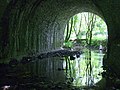
 Flood arch under Hammet Bridge - geograph.org.uk - 1931085.jpg 800 × 600; 148 KB
-
 Garnon's Mill Road, Cilgerran - geograph.org.uk - 1929522.jpg 800 × 600; 152 KB
-
 Gatehouse at hotel entrance - geograph.org.uk - 3560215.jpg 640 × 426; 65 KB
-
 Gelli-deg - geograph.org.uk - 5723493.jpg 640 × 480; 148 KB
-
 Ger Gelli-deg - Near Gelli-deg - geograph.org.uk - 5723405.jpg 640 × 480; 128 KB
-

-
 Ger y Castell across the field - geograph.org.uk - 3560219.jpg 640 × 426; 64 KB
-
 Gower family crest and motto - geograph.org.uk - 1926419.jpg 800 × 600; 159 KB
-
 Lay-by on the B4332 - geograph.org.uk - 4444158.jpg 3,264 × 2,448; 2.43 MB
-
 Llwybr Gelli-deg - Gelli-deg Path - geograph.org.uk - 5723486.jpg 640 × 480; 149 KB
-

-
 Manordeifi old church - geograph.org.uk - 6041750.jpg 800 × 630; 70 KB
-
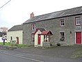
 Nag's Head Inn - geograph.org.uk - 3815109.jpg 3,264 × 2,448; 3.97 MB
-
 Nags Head Brewery - geograph.org.uk - 3017691.jpg 3,264 × 2,448; 3.79 MB
-
 New Years Day celebrations outside The Nag's Head Abercych - geograph.org.uk - 2757026.jpg 3,264 × 2,448; 4.47 MB
-
 Open day Ffynone - geograph.org.uk - 1281749.jpg 640 × 480; 92 KB
-
 Ordnance Survey Cut Mark - geograph.org.uk - 6403532.jpg 1,024 × 757; 299 KB
-
 Ordnance Survey Cut Mark - geograph.org.uk - 6403533.jpg 1,024 × 686; 179 KB
-
 Ordnance Survey Cut Mark - geograph.org.uk - 6403534.jpg 1,024 × 733; 299 KB
-
 Ordnance Survey Cut Mark - geograph.org.uk - 6403536.jpg 1,024 × 793; 268 KB
-
 Ordnance Survey Cut Mark - geograph.org.uk - 6403537.jpg 1,024 × 821; 282 KB
-
 Ordnance Survey Cut Mark - geograph.org.uk - 6403538.jpg 1,024 × 725; 213 KB
-
 Path in Ffynone Wood - geograph.org.uk - 6305964.jpg 5,184 × 3,888; 7.53 MB
-
 Pen-yr-allt-wen - geograph.org.uk - 5723416.jpg 640 × 480; 157 KB
-
 Plaque on Hammet Bridge - geograph.org.uk - 1929684.jpg 800 × 600; 153 KB
-
 Pont Newydd - geograph.org.uk - 5723431.jpg 640 × 480; 107 KB
-
 Pontrhydyceirt - geograph.org.uk - 1931214.jpg 800 × 600; 136 KB
-
 Reflections in the Afon Teifi - geograph.org.uk - 3560191.jpg 640 × 426; 59 KB
-
 Rhyd Afon Dulais - Afon Dulais ford - geograph.org.uk - 5723442.jpg 640 × 480; 131 KB
-
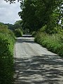 Road to Manordeifi - geograph.org.uk - 1926135.jpg 600 × 800; 133 KB
-

-
 The B4332 in Penrhiw - geograph.org.uk - 6283712.jpg 2,592 × 1,944; 1.51 MB
-
 The drive, Castell Malgwyn - geograph.org.uk - 1927550.jpg 800 × 600; 143 KB
-
 The Ffynnone Arms - geograph.org.uk - 2646610.jpg 3,648 × 2,736; 1.88 MB
-

-
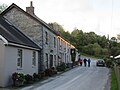 The Nag's Head and adjacent buildings - geograph.org.uk - 6305329.jpg 4,485 × 3,375; 2.32 MB
-
 Under Hammet Bridge - geograph.org.uk - 1930173.jpg 800 × 600; 171 KB
-
 Welcome to Abercych - geograph.org.uk - 3815115.jpg 3,264 × 2,448; 3.61 MB
-
 Llwyn-Grawys Farmhouse - geograph.org.uk - 572024.jpg 640 × 480; 145 KB


