Category:Manti-La Sal National Forest
Jump to navigation
Jump to search
national forest in Utah and Colorado, United States  | |||||
| Upload media | |||||
| Instance of | |||||
|---|---|---|---|---|---|
| Location | |||||
| IUCN protected areas category | |||||
| Replaces | |||||
| official website | |||||
 | |||||
English: Media related to the Manti-La Sal National Forest, a national forest of the United States located in the central and southeastern parts of Utah and the extreme western part of Colorado.
Subcategories
This category has the following 26 subcategories, out of 26 total.
A
- Abajo Peak (1 F)
B
C
D
- Dark Canyon Wilderness (13 F)
E
- Electric Lake (3 F)
F
H
- Hiawatha, Utah (16 F)
J
- Joes Valley State Park (empty)
L
M
N
S
- Scad Valley (3 F)
T
- Thompson Canyon (Grand County, Utah) (empty)
U
- Upper Joes Valley (empty)
W
Media in category "Manti-La Sal National Forest"
The following 29 files are in this category, out of 29 total.
-
-

-
-
-
-

-
 2016.04.02 09.21.17 DSC03088 - Flickr - andrey zharkikh.jpg 4,896 × 3,672; 2.25 MB
-
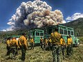 2018 06 17-16.53.05.813-CDT.jpg 1,200 × 900; 257 KB
-
 Abert’s squirrel (11740399534).jpg 1,072 × 813; 454 KB
-
 Brook near geyser pass la sal.jpg 1,944 × 2,592; 1.93 MB
-
 Bull moose in fall brush (11741304526).jpg 2,816 × 2,112; 1.38 MB
-
 Did you know? Wetlands Team with Life sign in Scad Valley, Aug 10.jpg 2,816 × 2,112; 2.55 MB
-

-
 Emerycounty ut.png 820 × 958; 43 KB
-
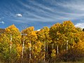
 Fall Aspen Trees in the La Sal Mountains.jpg 9,667 × 2,255; 4.21 MB
-
 Fall-apsens-La-sal.jpg 2,592 × 1,944; 2.06 MB
-
 Hiding fawn - panoramio.jpg 1,468 × 1,032; 638 KB
-
 La Sal Pass, January 2019.jpg 6,000 × 4,000; 16.56 MB
-
 Lasalfall.jpg 681 × 1,024; 408 KB
-
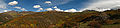
 LaSalMountains.jpg 4,500 × 1,760; 5.63 MB
-
 Mantilasalfromarches.jpg 1,024 × 681; 220 KB
-
 National Scenic Byway - Nebo Loop (Utah) - NARA - 68886696.jpg 600 × 600; 62 KB
-
 Pika (11740251783).jpg 2,066 × 1,547; 1.09 MB
-
 Rock Slide Remnants at Geyser Pass - panoramio.jpg 2,048 × 1,155; 1.85 MB
-
 Sanjuancounty ut.png 1,024 × 829; 54 KB
-
 Scenery and Landscapes - Utah - DPLA - 8d1157c4133d3dbef67277c1acceb71f.jpg 4,785 × 3,876; 2.76 MB
-
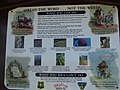 Spread the Word . . . Not the Weeds sign in Scad Valley, Aug 10.jpg 2,816 × 2,112; 2.4 MB
-
 Utah La Sal loop road in winter.jpg 4,032 × 3,024; 8.75 MB
-
 Zion 001.jpg 2,304 × 1,728; 987 KB


.jpg)

.jpg)


_-_NARA_-_68886696.jpg)
.jpg)


Categories:
- National Forests of Colorado
- National Forests of Utah
- Protected areas of Montrose County, Colorado
- Protected areas of Mesa County, Colorado
- Protected areas of Carbon County, Utah
- Protected areas of Emery County, Utah
- Protected areas of Utah County, Utah
- Protected areas of San Juan County, Utah
- Protected areas of Grand County, Utah
- Protected areas of Sanpete County, Utah
- National Forests of the United States by name
- Bears Ears National Monument
- Locations along U.S. Route 191 in San Juan County, Utah
- Locations along Utah State Route 9 (1910-1977) in San Juan County, Utah
- Locations along Utah State Route 29
- Locations along Utah State Route 31 in Emery County, Utah
- Locations along Utah State Route 31 in Sanpete County, Utah
- Locations along Utah State Route 46
- Locations along Utah State Route 264 in Carbon County, Utah
- Locations along Utah State Route 264 in Emery County, Utah
- Locations along Utah State Route 264 in Sanpete County, Utah
- Locations along The Energy Loop: Huntington/Eccles Canyons Scenic Byway
- Locations along the Skyline Drive (Wasatch Plateau) in Sanpete County, Utah
- Locations along the Skyline Drive (Wasatch Plateau) in Utah County, Utah
- Wasatch and Uinta Montane Forests Ecoregion
- Colorado Rockies Forests Ecoregion