Category:Maple Cross
Jump to navigation
Jump to search
English: Maple Cross is a village in Hertfordshire, England with a large proportion of the housing being either council owned or formerly council owned. The area is served by junction 17 of the M25 motorway, which makes up one of the boundaries of the village. It lies about 8 km west of Watford.
village in Hertfordshire, England  | |||||
| Upload media | |||||
| Instance of | |||||
|---|---|---|---|---|---|
| Location | Three Rivers, Hertfordshire, East of England, England | ||||
 | |||||
Subcategories
This category has the following 2 subcategories, out of 2 total.
H
W
Media in category "Maple Cross"
The following 14 files are in this category, out of 14 total.
-
 Business Park at Maple Cross - geograph.org.uk - 28091.jpg 640 × 480; 20 KB
-
 Business Park Maple Cross - geograph.org.uk - 28093.jpg 640 × 480; 19 KB
-
 Chalfont Road - geograph.org.uk - 1065327.jpg 640 × 480; 65 KB
-
 Footpath nearing houses - geograph.org.uk - 850173.jpg 640 × 480; 89 KB
-
 Footpath on edge of field - geograph.org.uk - 850205.jpg 640 × 480; 80 KB
-
 Maple Cross, Chalfont Lane - geograph.org.uk - 98122.jpg 640 × 480; 101 KB
-
 Maple Cross, Chalfont Road - geograph.org.uk - 98072.jpg 640 × 480; 141 KB
-
 Maple Cross, Denham Way - geograph.org.uk - 98092.jpg 640 × 480; 161 KB
-
 Maple Cross, Longcroft Road - geograph.org.uk - 98079.jpg 640 × 480; 104 KB
-
 Maple Cross, Woodoaks Farm - geograph.org.uk - 98185.jpg 640 × 480; 98 KB
-
 Old Uxbridge Road - geograph.org.uk - 850161.jpg 640 × 480; 76 KB
-

-
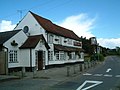
 The Cross Pub at Maple Cross - geograph.org.uk - 28089.jpg 640 × 479; 39 KB
-
 The Cross, Maple Cross - geograph.org.uk - 177035.jpg 640 × 480; 78 KB


