Category:Maps by Heinrich Bünting
Jump to navigation
Jump to search
Subcategories
This category has the following 4 subcategories, out of 4 total.
A
- Africa Tertia Pars Terrae (4 F)
B
Media in category "Maps by Heinrich Bünting"
The following 6 files are in this category, out of 6 total.
-
 1581 map of the Eastern Mediterranean by Heinrich Bünting.jpg 8,983 × 7,121; 12.07 MB
-
 1585 map of the world by Heinrich Bünting.jpg 4,569 × 3,567; 4.69 MB
-
-
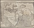
 Description of the Holy Land WDL2891.png 1,322 × 1,024; 2.54 MB
-
 Reisen der Kinder von Israel aus Egypten.jpg 8,932 × 6,711; 17.99 MB
-
 Bünting Eigentliche und Wahrhaftige Gestalt der Erden und des Meers 1581 UTA.jpg 2,937 × 2,378; 9.35 MB


