Category:Maps by Lloyd Van Derveer
Jump to navigation
Jump to search
Media in category "Maps by Lloyd Van Derveer"
The following 14 files are in this category, out of 14 total.
-
 1851 Map of Georgetown, crop from 1851 Map of the City.jpg 2,964 × 2,944; 5.57 MB
-
 1851 Map of Hunterdon County, NJ - Holcombe detail.jpg 769 × 876; 259 KB
-
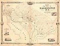
 1851 Map of the City of Washington D.jpg 12,424 × 9,409; 44.37 MB
-
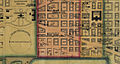 FederalTriangle 1851.jpg 1,260 × 669; 994 KB
-
 Map of Hunterdon County, New Jersey - entirely from original surveys LOC 2012592358.jpg 11,525 × 15,651; 26.53 MB
-
 Map of Hunterdon County, New Jersey - entirely from original surveys LOC 2012592358.tif 11,525 × 15,651; 516.07 MB
-
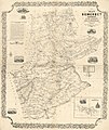 Map of Somerset County, New Jersey - entirely from original surveys LOC 2012593680.jpg 11,448 × 13,624; 22.95 MB
-
 Map of Somerset County, New Jersey - entirely from original surveys LOC 2012593680.tif 11,448 × 13,624; 446.23 MB
-
 Map of Somerset County, New Jersey - Rocky Hill detail, 1850.jpg 681 × 383; 79 KB
-

-

-
 Map of the city of Washington D.C. LOC 88694045.jpg 12,614 × 9,690; 17.36 MB
-
 Map of the city of Washington D.C. LOC 88694045.tif 12,614 × 9,690; 349.7 MB
-
 Plan of the city of Baltimore, Maryland LOC 2004629026.jpg 13,414 × 10,643; 27.75 MB


