Category:Maps by Pierre Duval
Jump to navigation
Jump to search
Subcategories
This category has only the following subcategory.
Media in category "Maps by Pierre Duval"
The following 47 files are in this category, out of 47 total.
-
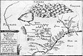
 Duval L'Afrique 1664 UTA.jpg 6,474 × 4,990; 13.74 MB
-

-
 Amérique septentrionale - par P. Du-Val... - btv1b84698238.jpg 9,372 × 6,874; 9.73 MB
-
 Ancient Armenia and vicinity by Pierre Du Val.jpg 629 × 455; 144 KB
-
 Carte de Bretagne 1689 Pierre Duval(1619-1683).jpg 3,628 × 2,352; 2.53 MB
-

-
 Carte des Indes Orientales, 1665.jpg 4,091 × 2,884; 3.96 MB
-

-

-
 Duval (1677), Imperii Romani Iuventus, detalle.jpg 839 × 629; 184 KB
-
 Floride francaise Pierre du Val.jpg 711 × 486; 107 KB
-
 ΙΑΝ 0563 du Val 1657 Epirus.jpg 5,146 × 3,527; 4.36 MB
-
 Koczuby 1703.png 938 × 500; 299 KB
-
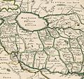
 L'Alemagne et ses confins - par P. Duval... - btv1b84698379.jpg 4,345 × 3,216; 2.83 MB
-

-
 L'Europe... - par... P. du-Val - btv1b53027452q.jpg 13,533 × 10,294; 22.48 MB
-
 L'Europe... - par... P. du-Val - btv1b53027492c.jpg 12,120 × 9,467; 21.82 MB
-
 L'Evesché d'Aire - tracé par le Sr. Pierre De Val... - btv1b5973005k.jpg 6,744 × 5,415; 4.11 MB
-

-
 Le duché d'Aiguillon - Par le Sr. Pierre du Val... - btv1b59730060.jpg 6,211 × 4,811; 3.29 MB
-
 Le Globe Terrestre - Par P. Du Val Geographe du Roy - btv1b550003804 (1 of 2).jpg 3,750 × 5,498; 1.98 MB
-
 Le globe terrestre - par P. Du Val... - btv1b8444042r (1 of 2).jpg 4,934 × 7,739; 5.03 MB
-
 Le globe terrestre - par P. Du Val... - btv1b8444042r (2 of 2).jpg 5,185 × 8,024; 5.24 MB
-

-
 Les environs de Murat, près du Cantal en Auvergne - par P. Duval - btv1b8468965n.jpg 4,825 × 3,802; 2.33 MB
-
 Les environs de Vic-le-Comte en Auvergne - par P. Duval - btv1b8469888m.jpg 4,878 × 3,648; 2.57 MB
-
 Overijssel 1849.jpg 850 × 1,000; 1.08 MB
-
 Petri Du Val, Maltha 1685.jpg 770 × 643; 505 KB
-
 Pierre Du Val - Carte Du Voyages De Perse et du Daghesthan (ca. 1665).jpg 2,253 × 3,210; 1.54 MB
-
 Pierre Du Val - Géorgie (1676).jpg 2,204 × 1,813; 1.09 MB
-

-

-
-

-

-

-
 Pierre Du Val. Expeditionis Alexandri Magni Per Europam, Asiam et Africam. 1654.jpg 1,912 × 1,300; 2.86 MB
-
 Pierre Duval, La ville de Ierusalem (FL45602972 3939264).jpg 2,710 × 2,215; 2.11 MB
-
 Pierre Duval, Planisphere ou carte generale du monde (FL13730376 2718552).jpg 9,800 × 7,156; 102.68 MB
-
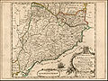 Principaute de Catalogne.jpg 1,733 × 1,300; 3.16 MB
-

-
 Tabula Geographica Locorum ubi habita sunt concilia tam Generalia quam Provincialia, Synodi, &c.jpg 13,280 × 9,370; 23.65 MB
-
 Travels of Pietro della Valle-1.png 1,752 × 1,231; 857 KB
-
 Travels of Pietro della Valle-2.png 1,577 × 1,117; 501 KB
-
 Travels of Pietro della Valle-4.png 1,591 × 1,125; 672 KB
-
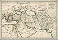
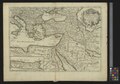 UBBasel Map 1677 Kartenslg Mappe 250-2 Empire des Turcs.tiff 11,080 × 7,712, 2 pages; 244.5 MB
-
 UBBasel Map 1677 Kartenslg Mappe 252-40 Guinée.tiff 10,995 × 7,692, 2 pages; 241.99 MB


.jpg)
.jpg)


_du_Roy._1668_-_btv1b84953768.jpg)
,_Imperii_Romani_Iuventus,_detalle.jpg)


.jpg)


.jpg)

.jpg)
.jpg)
.jpg)


.jpg)
.jpg)


.jpg)
.jpg)


