Category:Maps from Africa by Élisée Reclus, Volume 1
Jump to navigation
Jump to search
Media in category "Maps from Africa by Élisée Reclus, Volume 1"
The following 118 files are in this category, out of 118 total.
-
 AFR V1 D020 Highlands and plateaux of central Africa.jpg 1,785 × 2,203; 486 KB
-
 AFR V1 D021 Hydrography of Africa according to medieval geographers.jpg 1,887 × 896; 248 KB
-
 AFR V1 D025 Outflow of Lake Nyanza according to Speke.jpg 1,726 × 1,922; 266 KB
-
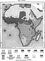
 AFR V1 D028 Isothermal lines of Africa.jpg 1,777 × 1,968; 697 KB
-
 AFR V1 D029 Distribution of the rainfall in Africa.jpg 1,825 × 2,236; 908 KB
-
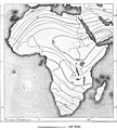
 AFR V1 D032 Vegetable zones of Africa.jpg 1,808 × 2,416; 1.1 MB
-
 AFR V1 D036 North East Africa part 1 of 2 in colour.jpg 3,970 × 2,592; 1.07 MB
-
 AFR V1 D036 North East Africa part 1 of 2.jpg 3,607 × 2,508; 950 KB
-
 AFR V1 D036-037 Map of North East Africa combined.jpg 3,624 × 4,895; 1.97 MB
-
 AFR V1 D037 North East Africa part 2 of 2 in colour.jpg 3,970 × 2,592; 1,011 KB
-
 AFR V1 D037 North East Africa part 2 of 2.jpg 3,619 × 2,368; 861 KB
-
 AFR V1 D045 Language of Africa.jpg 1,819 × 2,442; 814 KB
-
 AFR V1 D050 Religions of Africa.jpg 1,818 × 2,276; 1.04 MB
-
 AFR V1 D054 Chief routes of explorers in the interior of Africa 1883.jpg 1,817 × 2,129; 826 KB
-
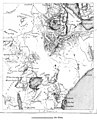
 AFR V1 D061 Sources of the Nile and Nyanza plateau.jpg 1,674 × 1,776; 363 KB
-
 AFR V1 D070 From Dufile to Lado.jpg 1,017 × 2,256; 285 KB
-
 AFR V1 D071 Region of the 'Sud'.jpg 1,257 × 2,598; 246 KB
-
 AFR V1 D076 Meshra-er-Rek in the Zariba region.jpg 1,718 × 1,521; 263 KB
-
 AFR V1 D081 Basin of the Nile affluents.jpg 1,748 × 2,553; 415 KB
-
 AFR V1 D083 Cataract of Hanneck.jpg 1,831 × 2,016; 767 KB
-
 AFR V1 D084 Kaibar cataract.jpg 1,745 × 1,657; 702 KB
-
 AFR V1 D090 The Keneh valley on the route to Kosier.jpg 1,733 × 1,445; 454 KB
-
 AFR V1 D091 Head of the Ibrahimieh canal.jpg 1,754 × 2,423; 624 KB
-
 AFR V1 D093 Entrance of the Fayum.jpg 1,748 × 1,891; 670 KB
-
 AFR V1 D094 Fayum.jpg 1,707 × 1,937; 534 KB
-
 AFR V1 D096 Rosetta mouth.jpg 1,742 × 1,658; 643 KB
-
 AFR V1 D098 Damietta mouth.jpg 1,737 × 1,890; 735 KB
-
 AFR V1 D100 Branch of the Nile flowing to Lake Menzaleh.jpg 1,760 × 1,646; 662 KB
-
 AFR V1 D114 U-Kerewe and U-Sukuma.jpg 1,694 × 1,437; 426 KB
-
 AFR V1 D116 Karagwe.jpg 1,715 × 1,728; 408 KB
-
 AFR V1 D122 South U-Ganda.jpg 1,733 × 1,090; 453 KB
-
 AFR V1 D128 U-Nyoro.jpg 1,772 × 1,050; 306 KB
-
 AFR V1 D136 Water parting between the Nile and Congo.jpg 1,798 × 749; 140 KB
-
 AFR V1 D143 Routes of the explorers east of the Bahe-el-Jebel.jpg 1,039 × 2,411; 188 KB
-
 AFR V1 D152 Chief routes of explorers in the Zariba region.jpg 1,808 × 2,112; 439 KB
-
 AFR V1 D158 Inhabitants of the Zariba region.jpg 1,769 × 2,072; 354 KB
-
 AFR V1 D162 Confluence of the Sobat and Yal.jpg 1,805 × 1,698; 153 KB
-
 AFR V1 D171 Chief Routes of Abyssinian Explorers.jpg 1,798 × 2,865; 479 KB
-
 AFR V1 D173 Northern Abyssinia (Ethiopia).jpg 2,123 × 3,215; 896 KB
-
 AFR V1 D178 Northern spurs of the Abyssinian highlands.jpg 1,699 × 1,515; 354 KB
-
 AFR V1 D179 The Simen Highlands.jpg 1,804 × 1,445; 356 KB
-
 AFR V1 D180 Lakes of East Abyssinia.jpg 928 × 2,467; 417 KB
-
 AFR V1 D186 Lake of Alalbed.jpg 1,767 × 1,278; 362 KB
-
 AFR V1 D188 Intermediate Abyssinian plateaux and valleys.jpg 1,770 × 2,641; 1.15 MB
-
 AFR V1 D201 Inhabitants of Abyssinia.jpg 1,759 × 2,520; 635 KB
-
 AFR V1 D212 Gondar.jpg 1,593 × 2,141; 579 KB
-
 AFR V1 D216 Debra-Tabor.jpg 1,754 × 992; 291 KB
-
 AFR V1 D217 Mahdera-Mariam.jpg 1,759 × 1,864; 458 KB
-
 AFR V1 D218 Koarata and southern shore of Lake Tana.jpg 1,728 × 1,620; 536 KB
-
 AFR V1 D221 Magdala.jpg 800 × 537; 106 KB
-
 AFR V1 D224 Adua and Aksum.jpg 1,728 × 1,122; 311 KB
-
 AFR V1 D227 Aksum.jpg 1,739 × 1,771; 446 KB
-
 AFR V1 D229 Kumaili Valley.jpg 1,146 × 2,282; 361 KB
-
 AFR V1 D231 Bogos Territory.jpg 1,741 × 1,134; 262 KB
-
 AFR V1 D233 Massawah.jpg 1,770 × 2,206; 494 KB
-
 AFR V1 D238 Annesley Bay.jpg 1,852 × 2,573; 832 KB
-
 AFR V1 D245 Routes of the Chief Explorers in the Lower Awash Region.jpg 1,760 × 1,865; 230 KB
-
 AFR V1 D253 Routes of the chief explorers in South Abyssinia.jpg 1,801 × 1,541; 280 KB
-
 AFR V1 D257 Populations of South Abyssinia.jpg 1,757 × 1,421; 424 KB
-
 AFR V1 D261 Chief towns of Shoa.jpg 1,781 × 992; 224 KB
-
 AFR V1 D264 Harrar.jpg 1,737 × 1,517; 497 KB
-
 AFR V1 D265 Zeila.jpg 1,858 × 1,787; 394 KB
-
 AFR V1 D266 Course of the lower Awash.jpg 1,748 × 1,974; 544 KB
-
 AFR V1 D267 Tajurah Bay and Lake Assal.jpg 1,789 × 1,622; 394 KB
-
 AFR V1 D268 Obok.jpg 1,831 × 1,533; 476 KB
-
 AFR V1 D271 Assab.jpg 1,793 × 2,255; 544 KB
-
 AFR V1 D279 Routes of the chief explorers in Taka and neighbouring districts.jpg 1,792 × 1,164; 225 KB
-
 AFR V1 D287 The Lega country.jpg 1,771 × 1,969; 533 KB
-
 AFR V1 D290 Inhabitants of the Blue Nile.jpg 511 × 599; 84 KB
-
 AFR V1 D296 Inhabitants of Taka and neighbouring districts.jpg 1,807 × 1,574; 318 KB
-
 AFR V1 D306 Fazogl gold mines.jpg 1,724 × 1,283; 388 KB
-
 AFR V1 D308 Senar.jpg 1,744 × 2,106; 318 KB
-
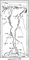
 AFR V1 D309 Confluence of the two Niles.jpg 1,810 × 2,071; 406 KB
-
 AFR V1 D311 Khartum.jpg 1,720 × 1,181; 247 KB
-
 AFR V1 D313 Pyramids of Meroe.jpg 1,719 × 1,929; 308 KB
-
 AFR V1 D319 Kassala.jpg 1,793 × 2,181; 471 KB
-
 AFR V1 D321 Berber.jpg 1,061 × 2,302; 408 KB
-
 AFR V1 D322 Suakin in 1882.jpg 1,698 × 1,779; 492 KB
-
 AFR V1 D325 Suakin uplands.jpg 1,757 × 1,540; 428 KB
-
 AFR V1 D332 Central Kordofan.jpg 1,749 × 1,778; 182 KB
-
 AFR V1 D337 El-Obeid.jpg 1,879 × 2,452; 382 KB
-
 AFR V1 D343 Central region of Dar-For.jpg 1,748 × 1,660; 313 KB
-
 AFR V1 D357 Mineral region of the Ethai uplands.jpg 1,857 × 1,378; 287 KB
-
 AFR V1 D359 Nubian gold mines.jpg 1,687 × 1,459; 413 KB
-
 AFR V1 D360 Korosko desert.jpg 1,015 × 2,505; 352 KB
-
 AFR V1 D364 Bayuda steppe.jpg 1,768 × 2,323; 344 KB
-
 AFR V1 D377 Dongola and the third cataract.jpg 1,311 × 2,639; 395 KB
-
 AFR V1 D393 Density of the population of Egypt.jpg 1,473 × 2,621; 795 KB
-
 AFR V1 D404 Chain of Oases west of Egypt.jpg 1,822 × 1,591; 221 KB
-
 AFR V1 D407 The Natron lakes.jpg 1,763 × 1,366; 405 KB
-
 AFR V1 D415 Isothermal lines and rainfall of Egypt.jpg 1,682 × 2,546; 709 KB
-
 AFR V1 D430 Arab tribes in Egypt.jpg 1,830 × 2,487; 468 KB
-
 AFR V1 D436 Religions of Egypt.jpg 1,644 × 2,351; 290 KB
-
 AFR V1 D440 Domains of the Dairah in the delta.jpg 1,878 × 1,664; 342 KB
-
 AFR V1 D449 Trajan's canal.jpg 1,823 × 1,235; 435 KB
-
 AFR V1 D450 Suez in the year 1800.jpg 1,769 × 2,462; 904 KB
-
 AFR V1 D452 Proposed freshwater canal from Suez to Alexandria.jpg 1,860 × 1,514; 320 KB
-
 AFR V1 D456 Lake Timsah.jpg 1,715 × 1,371; 518 KB
-
 AFR V1 D457 Great international routes of the old world.jpg 1,784 × 1,363; 359 KB
-
 AFR V1 D461 Assuan and the first cataract before the opening of the railway.jpg 1,781 × 1,912; 675 KB
-
 AFR V1 D463 The Egyptian Sudan.jpg 2,574 × 3,682; 1.02 MB
-
 AFR V1 D468 Ruins of Thebes.jpg 1,731 × 1,600; 713 KB
-
 AFR V1 D476 Kosseir.jpg 1,809 × 1,923; 565 KB
-
 AFR V1 D482 Oasis of Khargeh and Dakhel.jpg 1,839 × 1,051; 170 KB
-
 AFR V1 D484 The Siwah Oasis.jpg 1,735 × 1,315; 451 KB
-
 AFR V1 D491 Cairo and its environs.jpg 2,103 × 3,290; 1.26 MB
-
 AFR V1 D512 Barrage of the Nile.jpg 1,753 × 1,431; 208 KB
-
 AFR V1 D513 Suez.jpg 1,745 × 2,376; 793 KB
-
 AFR V1 D515 Entrance of the Wady-Tumilat, Tel-el-Kebir.jpg 1,799 × 1,374; 404 KB
-
 AFR V1 D518 Port Said.jpg 1,743 × 2,056; 680 KB
-
 AFR V1 D520 The San Morass.jpg 1,796 × 1,019; 288 KB
-
 AFR V1 D522 Damietta.jpg 1,755 × 1,485; 607 KB
-
 AFR V1 D524 The delta and the Suez canal (left page).jpg 2,247 × 3,392; 1.11 MB
-
 AFR V1 D525 The delta and the Suez canal (right page).jpg 2,308 × 3,476; 932 KB
-
 AFR V1 D531 Abukir and Alexandria.jpg 1,894 × 2,475; 594 KB
-
 AFR V1 D533 Alexandria.jpg 1,743 × 1,678; 444 KB
-
 AFR V1 D537 Alexandria and Lake Mariut.jpg 1,788 × 2,329; 603 KB
-
 AFR V1 D545 Egyptian Railways.jpg 1,707 × 1,425; 231 KB


.jpg)


.jpg)
.jpg)


