Category:Maps from The Trolley Wayfinder (1912)
Jump to navigation
Jump to search
Media in category "Maps from The Trolley Wayfinder (1912)"
The following 6 files are in this category, out of 6 total.
-
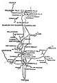 1912 map of street railway lines in the Connecticut River Valley.jpg 951 × 1,374; 216 KB
-
 1912 map of the Exeter, Hampton and Amesbury Street Railway.jpg 603 × 662; 122 KB
-
 1912 map of the Massachusetts Northeastern Street Railway.jpg 3,158 × 3,492; 2.39 MB
-
-
 1912 map of the Milford and Uxbridge Street Railway.jpg 1,887 × 1,349; 406 KB
-
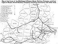
 1912 map of the Portland Railroad.jpg 946 × 1,687; 422 KB


