Category:Maps of Épinay-sur-Seine
Jump to navigation
Jump to search
Arrondissement of Bobigny: Bagnolet · Bobigny · Bondy · Les Lilas · Montreuil · Noisy-le-Sec · Pantin · Le Pré-Saint-Gervais · Romainville ·
Arrondissement of Saint-Denis, Seine-Saint-Denis: Aubervilliers · La Courneuve · Épinay-sur-Seine · L'Île-Saint-Denis · Pierrefitte-sur-Seine · Saint-Denis · Saint-Ouen-sur-Seine · Stains · Villetaneuse ·
Arrondissement of Le Raincy: Aulnay-sous-Bois · Le Blanc-Mesnil · Le Bourget · Clichy-sous-Bois · Coubron · Drancy · Dugny · Gagny · Gournay-sur-Marne · Livry-Gargan · Montfermeil · Neuilly-Plaisance · Neuilly-sur-Marne · Noisy-le-Grand · Les Pavillons-sous-Bois · Le Raincy · Rosny-sous-Bois · Sevran · Tremblay-en-France · Vaujours · Villemomble · Villepinte ·
Wikimedia category | |||||
| Upload media | |||||
| Instance of | |||||
|---|---|---|---|---|---|
| Category combines topics | |||||
| Épinay-sur-Seine | |||||
commune in Seine-Saint-Denis, France    | |||||
| Instance of | |||||
| Named after | |||||
| Location | |||||
| Located in or next to body of water | |||||
| Head of government |
| ||||
| Population |
| ||||
| Area |
| ||||
| Elevation above sea level |
| ||||
| official website | |||||
 | |||||
Media in category "Maps of Épinay-sur-Seine"
The following 13 files are in this category, out of 13 total.
-
 93031-Épinay-sur-Seine-Hydro.jpeg 5,846 × 4,133; 3.84 MB
-
 93031-Épinay-sur-Seine-Sols.png 3,270 × 2,598; 6.65 MB
-
 Carte Quartiers Épinay-sur-Seine.svg 656 × 422; 120 KB
-
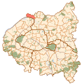
 Carte Seine-Saint-Denis Epinay-sur-Seine.png 611 × 552; 21 KB
-
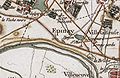 Epinay-Carte de Cassini.jpg 467 × 302; 143 KB
-
 Epinay-sur-Seine - carte de France dite d Etat-Major.jpg 908 × 543; 633 KB
-
 Epinay-sur-Seine map.svg 1,552 × 1,586; 540 KB
-
 Map commune FR insee code 93031.png 756 × 605; 75 KB
-
 Plan de tumulus et du monument d’Epinay-sur-Seine- Archives nationales- F-9-1414.jpg 6,784 × 5,280; 12.28 MB
-
 Plan du terroir de St Denis en France et des paroisses alentours.jpg 1,311 × 1,024; 590 KB
-
 Plan livreur - EPINAY SUR SEINE.JPG 2,333 × 1,717; 800 KB
-
 Terroir de Stains-Pierrefitte-Villetaneuse-Epinay.jpg 1,166 × 744; 754 KB
-


_dans_son_EPT_de_La_Plaine_Commune_au_sein_de_la_M%C3%A9tropole_du_Grand_Paris.png)