Category:Maps of 10th-century Germany
Jump to navigation
Jump to search
| Preceded by: Maps of the Carolingian territory in the 9th-century |
Maps of 10th-century Germany 901 AD-1000 AD |
Succeeded by: Maps of 11th-century Germany |
Media in category "Maps of 10th-century Germany"
The following 4 files are in this category, out of 4 total.
-
 Central Europe 919-1125.jpg 1,900 × 1,536; 843 KB
-
 Lotharingia-959 with current borders.svg 512 × 751; 416 KB
-
 Modern history; Europe (1904) (14765415832).jpg 2,028 × 3,008; 2.05 MB
-
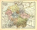
 Putz83.jpg 678 × 800; 115 KB


_(14765415832).jpg)
