Category:Maps of 16th-century France
Jump to navigation
Jump to search
| Preceded by: Maps of 15th-century France |
Maps of 16th-century France 1501 AD-1600 AD |
Succeeded by: Maps of 17th-century France |
Subcategories
This category has only the following subcategory.
*
Media in category "Maps of 16th-century France"
The following 11 files are in this category, out of 11 total.
-
 392 of 'La France Illustrée- géographie générale ... Par F. J' (11292231994).jpg 1,177 × 1,167; 375 KB
-

-
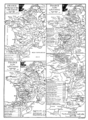
 C. 1575 France (Northern).jpg 2,206 × 1,275; 3.11 MB
-
 C. 1575 France (Southern).jpg 1,980 × 1,381; 2.99 MB
-
 France language map 1550.jpg 1,559 × 1,726; 630 KB
-
 France1911dev.png 2,046 × 2,780; 3.94 MB
-
 Le Verdunois XIIIe-XVIe siecle.jpg 1,475 × 1,023; 496 KB
-
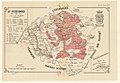
 Map of France under Francis I (1515-1547)-es.svg 723 × 809; 79 KB
-
 Map of France under Francis I (1515-1547)-fr.svg 723 × 809; 377 KB
-
 Metallurgie1500.jpg 419 × 579; 66 KB
-
 Provinces of France 1322-1789.png 2,388 × 2,452; 10.31 MB
.jpg)
%27_(11303088004).jpg)
.jpg)
.jpg)


-es.svg)
-fr.svg)

