Category:Maps of 7th-century Iberian Peninsula
Jump to navigation
Jump to search
| Preceded by: Maps of 6th-century Iberian Peninsula |
Maps of 7th-century Iberian Peninsula 601 AD-700 AD |
Succeeded by: Maps of 8th-century Iberian Peninsula |
Media in category "Maps of 7th-century Iberian Peninsula"
The following 11 files are in this category, out of 11 total.
-
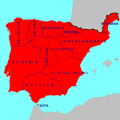
 Visigothic Kingdom 586-711 ru.svg 1,263 × 1,053; 1.39 MB
-
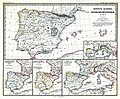 (Spruner-Menke, map 14) The Iberian peninsula 531-711.jpg 3,355 × 2,759; 2.18 MB
-
 Hispania 700 AD.PNG 2,500 × 2,500; 253 KB
-
 Hispania 700 AD.svg 604 × 534; 49 KB
-
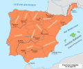 Iberia 700-es.svg 924 × 762; 710 KB
-
 Iberia 700-pt.svg 924 × 762; 160 KB
-
 Iberia 700-zh.svg 1,155 × 953; 197 KB
-
 Iberia 700.svg 924 × 762; 314 KB
-
 Visigothic Kingdom 586-711 be.svg 1,263 × 1,053; 1.39 MB
-
 Visigothic Kingdom 586-711 es.svg 1,246 × 975; 1.09 MB
-
 Visigothic Kingdom 586-711 pt.svg 1,246 × 975; 401 KB

_The_Iberian_peninsula_531-711.jpg)


