Category:Maps of Adorp
Jump to navigation
Jump to search
Wikimedia category | |||||
| Upload media | |||||
| Instance of | |||||
|---|---|---|---|---|---|
| Category combines topics |
| ||||
| Adorp | |||||
former municipality in the province of Groningen, the Netherlands  | |||||
| Instance of |
| ||||
| Location |
| ||||
| Population |
| ||||
| Replaced by | |||||
| |||||
Media in category "Maps of Adorp"
The following 3 files are in this category, out of 3 total.
-
 Map - NL - Winsum - Wijk 03 - Buurt 00 Adorp.svg 375 × 375; 27 KB
-
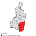 Map - NL - Winsum - Wijk 03 - Buurt 09 Verspreide huizen Adorp.svg 375 × 375; 27 KB
-
 Adorp, Gemeenteatlas van Nederland.jpg 2,188 × 2,680; 1.65 MB


