Category:Maps of Aigre
Jump to navigation
Jump to search
Wikimedia category | |||||
| Upload media | |||||
| Instance of | |||||
|---|---|---|---|---|---|
| Category combines topics | |||||
| Aigre | |||||
commune in Nouvelle-Aquitaine, France  Мэрия  | |||||
| Instance of |
| ||||
| Location |
| ||||
| Inception |
| ||||
| Population |
| ||||
| Area |
| ||||
| Replaces | |||||
| official website | |||||
 | |||||
Media in category "Maps of Aigre"
This category contains only the following file.
-
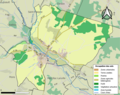 16005-Aigre-Sols.png 3,270 × 2,598; 2.2 MB
