Category:Maps of Amdo
Jump to navigation
Jump to search
Media in category "Maps of Amdo"
The following 48 files are in this category, out of 48 total.
-
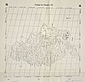 Der Jesuiten-Atlas der Kanghsi-Zeit - China und die Aussenlaender LOC 74650033-16.jpg 6,288 × 6,072; 3.87 MB
-
 Der Jesuiten-Atlas der Kanghsi-Zeit - China und die Aussenlaender LOC 74650033-16.tif 6,288 × 6,072; 109.24 MB
-
 Der Jesuiten-Atlas der Kanghsi-Zeit - China und die Aussenlaender LOC 74650033-9.jpg 9,514 × 9,444; 8.89 MB
-

-
-
-

-

-

-

-

-

-
 Anville Nouvel atlas de la Chine - Page15 Chine generale couleur.jpg 2,500 × 1,755; 2.87 MB
-
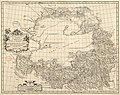
 Anville Nouvel atlas de la Chine - Page87 - thibet bhoutan generale.jpg 5,112 × 4,048; 8.6 MB
-

-
 CEM-44-La-Chine-la-Tartarie-Chinoise-et-le-Thibet-1734-2568.jpg 2,552 × 1,832; 2.5 MB
-

-

-

-
 1837 Malte-Brun Map of China and Japan - Geographicus - China-mb-1837.jpg 2,328 × 1,758; 772 KB
-
 1912 China map from National Geographic.jpg 6,980 × 5,326; 10.65 MB
-
 Map of Tibet in 1917, from- STANFORD(1917) p41-42 PLATE12. KANSU (14780689431) (cropped).jpg 2,633 × 3,139; 2.84 MB
-
 STANFORD(1917) p41-42 PLATE12. KANSU (14780689431).jpg 4,923 × 4,507; 7.5 MB
-

-

-

-
 Historic Tibet Map v češtině.png 970 × 608; 99 KB
-
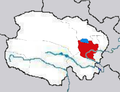
 Location of Haidong Prefecture within Qinghai (China).png 880 × 620; 89 KB
-

-
 Map of Tibet in 1798, from- Map China c1798 (cropped).jpg 348 × 255; 40 KB
-
 Map of Tibet in 1875 from China Proper map (cropped).jpg 182 × 365; 45 KB
-
 Map of Tibet in 1900, from- A map of China LOC 2007633876 (cropped).jpg 3,099 × 6,704; 3.69 MB
-

-

-
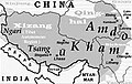 Map of Tibet Ü-Tsang Amdo and Kham.jpg 295 × 187; 25 KB
-

-

-

-
 Mongolei-SinkiangTxt.png 1,023 × 606; 1.14 MB
-
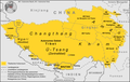
 QinghaiHainan.png 1,500 × 1,147; 491 KB
-
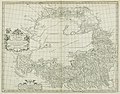
 Regni Sinae vel Sinae Propriae Mappa et Descriptio Geographica.jpg 6,416 × 7,071; 9.98 MB
-
 Simla Accord Treaty 1914 Map1.jpg 800 × 629; 151 KB
-
 Tibet ethnolinguistic 1967.png 668 × 386; 433 KB
-

-
 Tibet provinces.png 1,421 × 986; 871 KB
-
 TibetanPlateau.jpg 720 × 481; 329 KB
-
 Tibetischer Kulturraum Karte 2.png 1,500 × 951; 454 KB
-
 Tibetischer Kulturraum Karte.png 1,500 × 951; 446 KB


.jpg)

.jpg)


_p41-42_PLATE12._KANSU_(14780689431)_(cropped).jpg)
_p41-42_PLATE12._KANSU_(14780689431).jpg)

.jpg)
_north_east.jpg)

.png)

.jpg)
.jpg)
.jpg)
_about_the_year_1750_from_Regni_Sinae_vel_Sinae_Propriae_Mappa_et_Descriptio_Geographica_(cropped).jpg)
.png)

_(cropped).jpg)
.jpg)


.jpg)


