Category:Maps of Atacama Region
Jump to navigation
Jump to search
Regions of Chile: Arica y Parinacota · Tarapacá · Antofagasta · Atacama · Coquimbo · Valparaíso · Santiago · O'Higgins · Maule · Ñuble · Biobío · Araucanía · Los Ríos · Los Lagos · Aysén · Magallanes
Wikimedia category | |||||
| Upload media | |||||
| Instance of | |||||
|---|---|---|---|---|---|
| |||||
Subcategories
This category has the following 2 subcategories, out of 2 total.
M
Media in category "Maps of Atacama Region"
The following 27 files are in this category, out of 27 total.
-
 Mapa loc Atacama.svg 400 × 600; 1.13 MB
-
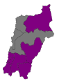 2021AtacamaGovernorElectionMap1T.svg 512 × 747; 14 KB
-
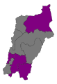 2021AtacamaGovernorElectionMap2T.svg 512 × 747; 14 KB
-
 Admiralty Chart No 1287 Maitencillo to Herradura, Published 1841, New Edition 1915.jpg 8,053 × 11,017; 27.56 MB
-
 Atacama Comunas.png 400 × 600; 37 KB
-
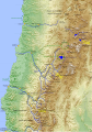
 Atacama location map.svg 220 × 280; 970 KB
-
 Carta de los Desiertos de Tarapacá y de Atacama 1879.jpg 714 × 1,024; 165 KB
-
 Chile Atacama.jpg 1,276 × 1,258; 607 KB
-
 Chile region III.png 71 × 271; 5 KB
-
 Chile.cuencas.hidrograficas.atacama.svg 2,010 × 2,870; 2.07 MB
-
 ChileRegionAtacama.png 300 × 400; 11 KB
-

-
 Desierto de Atacama y la Puna en 1830.svg 3,840 × 2,160; 906 KB
-
 Fenomeno del Desierto Florido, Gajardo 1994.jpg 3,308 × 4,679; 2 MB
-

-
 III Atacama.svg 600 × 800; 45 KB
-
 JOG-sg19-05-Taltal-Chañaral-Pan de Azucar National Park.jpg 4,918 × 1,124; 1.28 MB
-
 Map border Chile Peru fr.jpg 1,061 × 423; 147 KB
-
 Mapa Ferrocarril Caldera Copiapó.svg 1,494 × 1,207; 223 KB
-
 Pascua Lama.JPG 679 × 298; 44 KB
-
 Provincias de Atacama.svg 600 × 800; 45 KB
-
 Txu-oclc-224571178-sg19-05.jpg 3,899 × 5,240; 3.41 MB
-
 Txu-oclc-224571178-sg19-06.jpg 5,212 × 3,963; 8.29 MB
-
 Txu-oclc-224571178-sg19-13.jpg 3,972 × 5,211; 5.02 MB
-
 Txu-oclc-224571178-sh19-01 (cropped).jpg 1,573 × 1,984; 1.9 MB
-
 Txu-oclc-224571178-sh19-01.jpg 3,961 × 5,200; 8 MB
-
 Txu-pclmaps-oclc-22834566 q-26b.jpg 9,000 × 6,535; 9.95 MB


.jpg)


.jpg)

