Category:Maps of Atlantic hurricane paths
Jump to navigation
Jump to search
Subcategories
This category has the following 2 subcategories, out of 2 total.
- Maps of Atlantic hurricane seasons (1 P, 164 F)
C
- Maps of Hurricane Camille (5 F)
Media in category "Maps of Atlantic hurricane paths"
The following 50 files are in this category, out of 50 total.
-
 1-2-3 Rita and Philippe.png 500 × 400; 35 KB
-
 145531 5day cone with line and wind.png 897 × 736; 91 KB
-
 173249 5day cone with line and wind.png 897 × 736; 88 KB
-
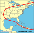 Galveston map.png 542 × 519; 11 KB
-
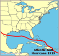 Atlantic gulf 1919 map.png 522 × 499; 10 KB
-
 Miami 1926 map.png 542 × 519; 10 KB
-
 1926 base revised 4.png 2,078 × 1,561; 508 KB
-
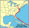 Okee 1928 map.png 542 × 519; 10 KB
-
 Labor day 1935 map.png 542 × 519; 11 KB
-
 New england 1938 map.png 522 × 499; 11 KB
-
 Atlantic 1944 map.png 522 × 499; 10 KB
-
 Carol 1954 map.png 542 × 519; 10 KB
-
 Edna 1954 map.png 542 × 519; 10 KB
-
 Hazel 1954 map.png 542 × 519; 10 KB
-
 Connie 1955 map.png 542 × 519; 10 KB
-
 Diane 1955 map.png 542 × 519; 10 KB
-
 Audrey 1957 map.png 522 × 499; 10 KB
-
 Donna 1960 map.png 542 × 519; 11 KB
-
 Agnes 1972 map.png 542 × 519; 10 KB
-
 Claudette 1979 map.png 542 × 519; 11 KB
-
 Alicia 1983 map.png 542 × 519; 10 KB
-
 Gilbert 1988 map.png 542 × 519; 10 KB
-
 Hugo 1989 map.png 542 × 519; 11 KB
-
 Andrew 1992 map.png 542 × 519; 10 KB
-
 Alberto 1994 map.png 542 × 519; 10 KB
-
 Opal 1995 map.png 542 × 519; 10 KB
-
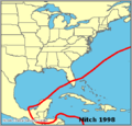 Mitch map.png 542 × 519; 11 KB
-
 Floyd map.png 542 × 519; 10 KB
-
 Keith map.png 542 × 519; 10 KB
-
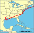 Allison 2001 map.png 542 × 519; 10 KB
-
 Iris map.png 542 × 519; 10 KB
-
 Isabel 2003 map.png 542 × 519; 11 KB
-
 Isabel.png 2,296 × 1,608; 1.52 MB
-
 Charley 2004 map.png 480 × 460; 9 KB
-
 Frances 2004 map.png 480 × 460; 9 KB
-
 Ivan 2004 map.png 480 × 460; 9 KB
-
 Jeanne 2004 map.png 480 × 460; 17 KB
-
 205453 5day cone no line and wind.png 897 × 736; 99 KB
-
 Augsep1848hurricanetrack.jpg 1,082 × 950; 231 KB
-
 Dolly 2038 track (hypothetical).png 542 × 473; 235 KB
-

-
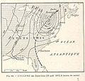 FMIB 36816 Cyclone des Etats-Unis (29 Aout 1893, 8 Heures du Matin).jpeg 766 × 727; 166 KB
-
 Hurricane Charley wind field.png 553 × 930; 146 KB
-
 Hurricane Donna path map MM00031010 (4934989715).jpg 3,254 × 6,071; 4.92 MB
-
 Hurricane Sandy cumulative wind history 211847P sm.gif 896 × 716; 36 KB
-
 Ivan2004track.png 673 × 486; 253 KB
-
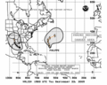
 Prelim08.gif 886 × 758; 32 KB
-
 Racer's hurricane approximate track.jpg 222 × 185; 16 KB
-
 Tracks of Storm Centres for October 1872.png 669 × 430; 519 KB
-
 Tropical Depression 14 1987 track.png 437 × 584; 32 KB


.png)

.jpeg)

.jpg)


