Category:Maps of Auckland volcanic field
Jump to navigation
Jump to search
Subcategories
This category has the following 2 subcategories, out of 2 total.
Media in category "Maps of Auckland volcanic field"
The following 7 files are in this category, out of 7 total.
-
 125 of 'Neu-Seeland ... Mit 2 Karten, 6 Farbenstahlstichen, etc' (11064233556).jpg 1,708 × 2,525; 491 KB
-
 Admiralty Chart No 1896. Entrances to Auckland Harbour nautical chart 55767, Published 1857.jpg 16,329 × 11,791; 41.69 MB
-
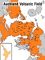 Auckland Volcanic Field.jpg 1,536 × 2,048; 585 KB
-
 Auckland20061016222837 (cropped).jpg 2,151 × 1,526; 1.43 MB
-
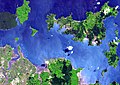
 Auckland20061016222837.jpg 5,599 × 4,983; 10.15 MB
-
 Mount Wellington, or Maunga Rei, near Auckland (circa 1860).jpg 778 × 609; 187 KB
-
 NZ-OneTreeHill.png 589 × 701; 104 KB
.jpg)


.jpg)

.jpg)
