Category:Maps of Ayeyarwady Region
Jump to navigation
Jump to search
Subcategories
This category has the following 8 subcategories, out of 8 total.
L
M
- Maps of Hinthada District (17 F)
- Maps of Kyonpyaw District (5 F)
- Maps of Labutta District (3 F)
- Maps of Maubin District (6 F)
- Maps of Myaungmya District (5 F)
- Maps of Pathein District (18 F)
- Maps of Pyapon District (7 F)
Media in category "Maps of Ayeyarwady Region"
The following 7 files are in this category, out of 7 total.
-
 Admiralty Chart No 3771 Andrew Bay to Calventuras, Published 1912.jpg 11,204 × 19,558; 43.86 MB
-
 Aya Region District Map.svg 852 × 1,184; 238 KB
-
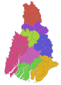
 Ayeyarwady region districts map 2022.svg 522 × 616; 377 KB
-
 Ayeyarwady Region in Myanmar 2010.svg 1,228 × 2,003; 985 KB
-
 Ayeyarwady Region in Myanmar.svg 1,200 × 2,520; 1.2 MB
-
 Myanmar Regions Ayeyarwady Region.png 129 × 250; 30 KB
-
 MyanmarAyeyarwady.png 200 × 379; 10 KB


