Category:Maps of Back Bay, Boston
Jump to navigation
Jump to search
Subcategories
This category has only the following subcategory.
Media in category "Maps of Back Bay, Boston"
The following 22 files are in this category, out of 22 total.
-

-

-
 1870 BackBay July4 map byFFuchs JohnWeik detail.png 935 × 555; 990 KB
-

-
 1883 ColumbusAve Walker map Boston.png 800 × 709; 1.22 MB
-
 1883 HuntingtonAve Walker map Boston.png 806 × 715; 1.13 MB
-
 Boston 1888 SampsonMap BackBay detail.jpg 1,284 × 835; 677 KB
-
 1895 Ward 11 map detail of Atlas of the City of Boston by Bromley p9.jpg 11,442 × 7,452; 13.86 MB
-
 1921 Embankment map Boston bySampson Murdock BPL 12593 detail.png 1,058 × 739; 1.65 MB
-
 2012 District 8 Boston City Council electoral districts map.jpg 607 × 698; 566 KB
-
 Atlas of the city of Boston, Boston proper and Roxbury - plate 12 (19265082824).jpg 2,000 × 1,375; 3.04 MB
-
 Copley Square map 1874.png 1,658 × 1,185; 2.76 MB
-
 Grundmann Studio in Bromley Atlas 1917.png 998 × 752; 1.2 MB
-
 Plan of Back Bay and vicinity (3719855239).jpg 1,024 × 798; 628 KB
-
 Plan of Boston comprising a part of Charlestown and Cambridge (2675276692).jpg 1,556 × 2,000; 3.05 MB
-
-

-
 Plan of lots on Falmouth Street, Boston (3120134275).jpg 2,000 × 1,554; 2.7 MB
-

-

-
 Street map of Back Bay.jpg 422 × 359; 27 KB
-


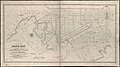
.jpg)


.jpg)


.jpg)
.jpg)
,_showing_the_system_of_streets,_grades_and_sewers_as_laid_out_and_recommended_by_the_Back_Bay_Commissioners_(3886417341).jpg)
.jpg)
.jpg)


.jpg)
.jpg)