Category:Maps of Barbezieux-Saint-Hilaire
Jump to navigation
Jump to search
Wikimedia category | |||||
| Upload media | |||||
| Instance of | |||||
|---|---|---|---|---|---|
| Category combines topics | |||||
| Barbezieux-Saint-Hilaire | |||||
commune in Charente, France  .svg)  | |||||
| Instance of | |||||
| Location |
| ||||
| Population |
| ||||
| Area |
| ||||
| Elevation above sea level |
| ||||
| Replaces |
| ||||
| official website | |||||
 | |||||
Media in category "Maps of Barbezieux-Saint-Hilaire"
The following 9 files are in this category, out of 9 total.
-
 16-AAV2020-373.png 3,519 × 2,930; 2.16 MB
-
 16-Barbezieux-Saint-Hilaire-AAV2020.png 3,519 × 2,930; 1.4 MB
-
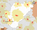
 16028-Barbezieux-Saint-Hilaire-argile.jpg 3,057 × 2,480; 788 KB
-
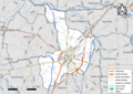 16028-Barbezieux-Saint-Hilaire-Routes-Hydro.png 3,507 × 2,480; 3.35 MB
-
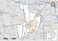 16028-Barbezieux-Saint-Hilaire-Routes-Hydro.svg 1,056 × 744; 5.41 MB
-
 16028-Barbezieux-Saint-Hilaire-Sols.png 3,270 × 2,598; 3.45 MB
-
 16028-Barbezieux-Saint-Hilaire-ZNIEFF1.png 5,866 × 4,133; 10.34 MB
-
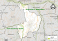 16028-Barbezieux-Saint-Hilaire-ZNIEFF2.png 5,866 × 4,133; 10.61 MB
-
 Map commune FR insee code 16028.png 756 × 605; 84 KB


