Category:Maps of Barneveld
Jump to navigation
Jump to search
Wikimedia category | |||||
| Upload media | |||||
| Instance of | |||||
|---|---|---|---|---|---|
| Category combines topics | |||||
| Barneveld | |||||
municipality in the Netherlands    .svg) | |||||
| Pronunciation audio | |||||
| Instance of |
| ||||
| Location | Gelderland, Netherlands | ||||
| Capital | |||||
| Head of government |
| ||||
| Population |
| ||||
| Area |
| ||||
| Elevation above sea level |
| ||||
| Different from | |||||
| official website | |||||
 | |||||
Subcategories
This category has the following 2 subcategories, out of 2 total.
- Maps of De Glind (2 F)
Media in category "Maps of Barneveld"
The following 19 files are in this category, out of 19 total.
-
 Barneveld1.png 1,599 × 1,134; 297 KB
-
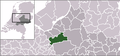 LocatieBarneveld.png 280 × 130; 8 KB
-
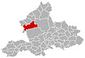
 Map - NL - Municipality code 0203 (2009).svg 300 × 160; 530 KB
-
 2013-Barneveld.jpg 3,990 × 2,897; 6.38 MB
-
 BAG woonplaatsen - Gemeente Barneveld.png 2,419 × 2,419; 1.02 MB
-
 Barneveld en Voorthuizen, Gemeenteatlas van Nederland.jpg 2,244 × 1,580; 4.82 MB
-
 Barneveld-plaats-OpenTopo.jpg 1,627 × 1,681; 1.37 MB
-
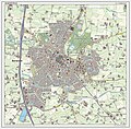 Barneveld-stad-2014Q1.jpg 1,644 × 1,619; 1.29 MB
-
 Barneveld-topografie.jpg 1,230 × 1,642; 1.36 MB
-
 Driedorp12cat.tif 628 × 628; 1.13 MB
-
 Garderen, Gemeenteatlas van Nederland.jpg 2,126 × 1,651; 3.9 MB
-
 Gem-Barneveld-2014Q1.jpg 7,947 × 5,744; 18.43 MB
-
 Gem-Barneveld-OpenTopo.jpg 9,872 × 6,924; 11.44 MB
-
 Kallenbroek Het Paradijs.jpg 960 × 736; 171 KB
-
 Karte gelderland barneveld.jpg 300 × 208; 29 KB
-
 Locatie dorp Barneveld binnen de gemeente.png 376 × 176; 17 KB
-
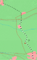 LocationKippenlijn.gif 329 × 533; 11 KB
-
 Map - NL - Barneveld (2009).svg 625 × 575; 2.14 MB
-
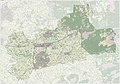
 NL - locator map municipality code GM0203 (2016).png 2,125 × 1,417; 629 KB


.svg)
.png)