<nowiki>Category:Maps of Basra; زمرہ:بصرہ کے نفشے; categoría de Wikimedia; kategoria ti Wikimedia; κατηγορία εγχειρημάτων Wikimedia; 維基媒體分類; kategori Wikimedia; ویکیمیڈیا زمرہ; Wikimedia:Klassys; Kategoriya ning Wikimedia; kategori Wikimedia; 維基媒體分類; Wikimedia-categorie; pajenn rummata eus Wikimedia; Wikimedia category; د ويکيمېډيا وېشنيزه; категория на Уикимедия; kategoria w projekcie Wikimedia; categorie în cadrul unui proiect Wikimedia; categurìa 'e nu pruggette Wikimedia; หน้าหมวดหมู่วิกิมีเดีย; categoria de Wikimedia; kategória projektov Wikimedia; Wikimédia-kategória; категорія проєкту Вікімедіа; kawan Wikimèdia; гурӯҳи Викимедиа; 维基媒体分类; Wikimedia-Kategorie; 위키미디어 분류; Wikimedia-bólkur; kategorio en Vikimedio; kategorie na projektech Wikimedia; Wikimedia-Kategorie; categoría de Wikimedia; উইকিমিডিয়া বিষয়শ্রেণী; page de catégorie de Wikimedia; kategori Wikimedia; kategorija na Wikimediji; Wikimedia proyektındağı törkem; 维基媒体分类; Wikimedia:Kategorija; Vikimedya kategorisi; विकिपीडिया वर्ग; kategorija w projektach Wikimedije; thể loại Wikimedia; ردهٔ ویکیپدیا; Wikimedia projekta kategorija; Wikimedia-kategorie; категорија на Викимедији; катэгорыя ў праекце Вікімедыя; Wikimedia:Ronnaghys; categoria de um projeto da Wikimedia; Wikimedia category; Wikimedia-Kategorie; Wikimedia-kategori; Wikimedia-kategori; kategori Wikimédia; kategori Wikimedia; Wikimedia-Kategorie; Викимедиина категорија; پۆلی ویکیمیدیا; Wikimedia category; تصنيف ويكيميديا; Vikimédia ñemohenda; Wikimedia-Kategorie; Wikimedia:ကဏ္ဍခွဲခြင်း; 維基媒體分類; Wikimedia категориясы; વિકિપીડિયા શ્રેણી; विकिमिडिया श्रेणी; Wikimediako kategoria; 维基媒体分类; categoría de Wikimedia; категория в проекте Викимедиа; Викимедиа категорияһы; tudalen categori Wikimedia; Vikipidiya:Shopni; kategori e Wikimedias; Վիքիմեդիայի նախագծի կատեգորիա; Wikimedia-kategorie; Wikimedia-kategori; विकिमिडिया श्रेणी; ウィキメディアのカテゴリ; categoria Wikimedia; 维基媒体分类; تصنيف بتاع ويكيميديا; 維基媒體分類; විකිමීඩියා ප්රභේද පිටුව; Викимедиа проектындагы төркем; Wikimedia-Kategorie; विकिमीडिया श्रेणी; categoria Vicimediorum; Wikimedia-kategoriija; гурӯҳ дар лоиҳаи Викимедиа; Wikimedia-categorie; विकिपीडिया:श्रेणी; விக்கிமீடியப் பகுப்பு; categoria di un progetto Wikimedia; gurühi Vikimedia; Wikimedia category; Wikimedia-luokka; катэгорыя ў праекце Вікімэдыя; Wikimedia kategooria; Викимедиа проектындагы төркем; Wîkîmediya:Kategorî; דף קטגוריה; ẹ̀ka Wikimedia; catigurìa di nu pruggettu Wikimedia; categoria de um projeto da Wikimedia; ვიკიპედია:კატეგორიზაცია; Wikimedia-kategory; tumbung Wikimedia; Viciméid catagóir; kategorija Wikimedie; kategorya ng Wikimedia; Wikimedia-Kategorie; Wikimedia-categorie; kategori Wikimedia; jamii ya Wikimedia; വിക്കിമീഡിയ വർഗ്ഗം; 維基媒體分類; kategori Wikimedia; категорияд Ангилал; زمرو:وڪيپيڊيا زمرا بندي; Wikimedia-Kategorie; categoría de Wikimedia; Wikimedia-kategori; 维基媒体分类; kategorija na Wikimediji</nowiki>


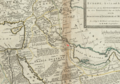
 Delineation Regionis - Bassora - cum - Pagis... (BM 1898,0725.8.1475).jpg 2,500 × 2,011; 1.36 MB
 1752 Bassora detail map Turkish Empire by Moll BPL 17082.png 1,065 × 745; 1.47 MB
 1764 Bassora detail map Petit Atlas Maritime by Bellin.png 391 × 489; 283 KB
 AMH-5342-NA View of Basra and 'Gordelaan' castle (cropped).jpg 2,305 × 857; 237 KB
 AMH-5342-NA View of Basra and 'Gordelaan' castle.jpg 2,400 × 1,652; 546 KB
 AMH-6173-NA Map of part of the Persian Gulf from Mascate to Bassora.jpg 2,400 × 1,740; 591 KB
 Basra in WW2 He.png 648 × 436; 71 KB
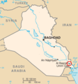 Basra location.PNG 328 × 351; 8 KB
 Basra, Galérie agréable du Monde.jpg 1,700 × 2,172; 3.69 MB
 Basra-ar.jpg 521 × 560; 150 KB
 Basrah 2003.jpg 3,929 × 2,742; 2 MB
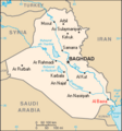 Iraq map basra.png 330 × 353; 14 KB
 Map of the Siege of UK bases in Basra.svg 3,141 × 1,968; 5.42 MB
 Medieval Basra Map.svg 589 × 435; 1.42 MB
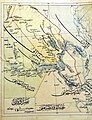 Saif in Basras.jpg 692 × 900; 172 KB

.jpg)


.jpg)