Category:Maps of Belarus during World War II
Jump to navigation
Jump to search
Media in category "Maps of Belarus during World War II"
The following 9 files are in this category, out of 9 total.
-
 Belarus today & Belorussian SSR in 1940.png 1,196 × 882; 529 KB
-
 EastPrussiaMap1944.png 3,000 × 4,110; 1.84 MB
-
 Gebietskommissariat Slonim.jpg 1,548 × 2,139; 1.17 MB
-
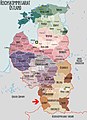
 Gen Okrug Belarus Administrative.png 660 × 980; 165 KB
-
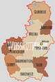
 Location map of Weissruthenien-fr.svg 1,414 × 2,248; 134 KB
-
 Reichskommissariat Ostland (1942).svg 450 × 456; 506 KB
-
 Reichskommissariat Ostland Administrative.png 2,856 × 4,120; 1.89 MB
-
 Reichskommissariat Ostland Infobox.png 500 × 747; 114 KB
-
 Reichskommissariat Ostland.png 442 × 448; 41 KB


.svg)


