Category:Maps of Bergen County, New Jersey
Jump to navigation
Jump to search
Wikimedia category | |||||
| Upload media | |||||
| Instance of | |||||
|---|---|---|---|---|---|
| Category combines topics | |||||
| Bergen County | |||||
county in New Jersey, United States    | |||||
| Instance of | |||||
| Named after |
| ||||
| Location | New Jersey | ||||
| Capital | |||||
| Inception |
| ||||
| Population |
| ||||
| Area |
| ||||
| Different from | |||||
| official website | |||||
 | |||||
Subcategories
This category has only the following subcategory.
L
Media in category "Maps of Bergen County, New Jersey"
The following 28 files are in this category, out of 28 total.
-

-

-

-

-
 Bcslamerican.jpg 736 × 540; 125 KB
-
 Bergen County New Jersey.png 167 × 300; 8 KB
-
 Bergen County, New Jersey LOC 87694285.jpg 4,645 × 6,070; 3.01 MB
-
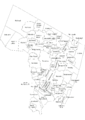 Bergen County, NJ municipalities labeled.png 2,048 × 2,896; 252 KB
-
 Bergen County, NJ municipalities labeled.svg 750 × 1,052; 369 KB
-
 Bergen County1896.jpg 2,700 × 3,718; 1.51 MB
-
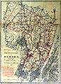
 Bergen Passaic 1872.jpg 3,491 × 2,325; 1.48 MB
-
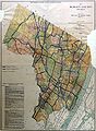
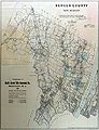 BergenCounty 1909.jpg 3,000 × 3,906; 1.1 MB
-
 BergenCounty 1918.jpg 2,400 × 3,282; 784 KB
-
 Census Bureau map of Fort Lee, New Jersey (2).gif 1,181 × 942; 751 KB
-
 Census Bureau map of New Jersey's 37th Legislative District.png 575 × 425; 76 KB
-
 Coytesville NJ (1876 map).png 2,554 × 1,202; 4.55 MB
-
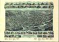 Hackensack 1896.jpg 2,508 × 1,788; 1.32 MB
-
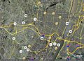
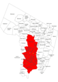 HackensackUniversityMedicalCenter coverage.png 2,048 × 2,896; 788 KB
-
 KingsPondPark Map.png 2,821 × 3,999; 746 KB
-
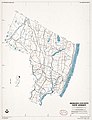
 Location map of Bergen County, New Jersey.svg 896 × 768; 874 KB
-
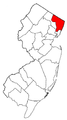
 Map of New Jersey highlighting Bergen County.svg 570 × 1,080; 42 KB
-
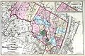
 Map of the counties of Bergen and Passaic, New Jersey - from actual surveys LOC 2011588009.jpg 13,947 × 17,224; 33.85 MB
-
 MapofMerritt.jpg 1,664 × 2,544; 533 KB
-
 N. NJ skyscrapers.png 450 × 613; 122 KB
-
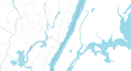
 North Manhattan Area Blank Map.png 2,150 × 1,164; 40 KB
-
 North Manhattan Area Primary Level Division Map.png 2,150 × 1,164; 43 KB
-
 North Manhattan Area Second Level Division Map.png 2,150 × 1,164; 50 KB
-
 North Manhattan Area Third Level Division Map.png 2,150 × 1,164; 84 KB
_-_Bergen_County_-_Bergenfield_-_ED_2-5_to_21_-_NARA_-_23853025.jpg)
_-_Bergen_County_-_Maywood_-_ED_2-369_to_374_-_NARA_-_23853069.jpg)
_-_Bergen_County_-_Tenafly_-_ED_2-571_to_582_-_NARA_-_23853091.jpg)
_-_Burlington_County_-_Bordentown_-_ED_3-6_to_11_-_NARA_-_23853101.jpg)


.gif)

.png)


