Category:Maps of Best, North Brabant
Jump to navigation
Jump to search
Subcategories
This category has only the following subcategory.
Media in category "Maps of Best, North Brabant"
The following 13 files are in this category, out of 13 total.
-
 1865 Best.png 1,316 × 1,634; 268 KB
-
 Map - NL - Municipality code 0753 (2009).svg 300 × 160; 530 KB
-
 2013-Best.jpg 1,560 × 1,743; 1.62 MB
-
 BAG woonplaatsen - Gemeente Best.png 2,419 × 2,419; 604 KB
-
 Best-plaats-OpenTopo.jpg 1,690 × 1,623; 1.62 MB
-
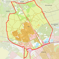
 Best-stad-2014Q1.jpg 1,690 × 1,575; 1.47 MB
-
 Best-topografie.jpg 1,364 × 1,428; 1.35 MB
-
 Gem-Best-2014Q1.jpg 3,050 × 3,466; 4.48 MB
-
 Gem-Best-OpenTopo.jpg 3,310 × 3,458; 2.29 MB
-
 Gem-Best2-OpenTopo.jpg 3,448 × 4,056; 4.73 MB
-
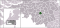 LocatieBest.png 280 × 130; 10 KB
-
 Map - NL - Best (2009).svg 625 × 575; 1.8 MB
-
 NL - locator map municipality code GM0753 (2016).png 2,125 × 1,417; 480 KB

.svg)


.svg)
.png)