Category:Maps of Bou (Loiret)
Jump to navigation
Jump to search
Subcategories
This category has the following 3 subcategories, out of 3 total.
E
G
H
Media in category "Maps of Bou (Loiret)"
The following 8 files are in this category, out of 8 total.
-
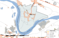 45-Bou-Routes.png 5,457 × 3,543; 2.16 MB
-
 45-Digues-Bou.png 5,457 × 3,543; 2.16 MB
-
 45043-Bou-argile.png 3,057 × 2,480; 1.75 MB
-
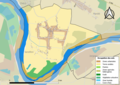
 45043-Bou-Hydro.jpeg 5,846 × 4,133; 1.32 MB
-
 45043-Bou-Orthophoto.jpeg 10,559 × 7,440; 9.45 MB
-
 45043-Bou-Sols.png 3,519 × 2,480; 1.5 MB
-
 Bou-Interco.png 3,507 × 2,480; 1.14 MB
-
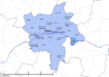
 Map commune FR insee code 45043.png 756 × 605; 35 KB


